
Skip to routes
RunFromHere
Get the app
English
White line illustration of Austin and its riverfront parks.

Austin

Lady Bird Lake puts a shared running trail beside downtown hotels. Pease Park follows Shoal Creek beneath trees, while Mueller’s lake paths offer a shorter neighborhood outing. These routes avoid the current I-35 construction and the closed Shoal Creek sections north of 24th Street.

Get running directions on your phone

Find a route near your hotel

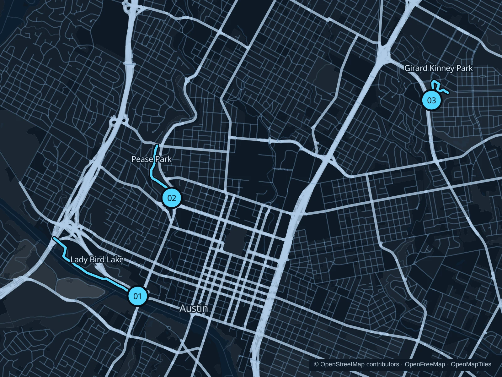
The numbers mark each start. Distances exclude the journey from your accommodation.

Map data: © OpenStreetMap contributors · OpenFreeMap · OpenMapTiles

Where to run in Austin

Butler Trail west from Pfluger Bridge

A lakeside out-and-back gives you open water, rowing boats and views toward Zilker without committing to the full lake circuit.
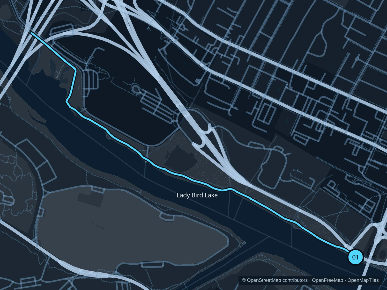
Map of the 3.6 km Butler Trail west from Pfluger Bridge run, with start and finish marked 01.
01 Out & backOpen full-size map
Approx. distance3.6 km
Underfoot

Fine gravel with paved sections; shared with bicycles

01

Start here

At the north-bank Butler Trail junction beside Pfluger Pedestrian Bridge.

Keep Lady Bird Lake on your left and follow the north-shore trail west to the north end of Roberta Crenshaw Pedestrian Walkway under MoPac. Turn before crossing the lake and return.

Getting there

Walk south on the downtown side of Lamar Boulevard to the pedestrian bridge approach, then join the north-bank trail.

Before you go

Go early in hot weather, bring water and keep right for other trail users. This section is west of the I-35 construction, but check current trail notices.

Park / route information Park / route information

Get running directions on your phone
Pease Park beside Shoal Creek

Tree cover and a creekside path make this a useful shorter choice near West Campus.

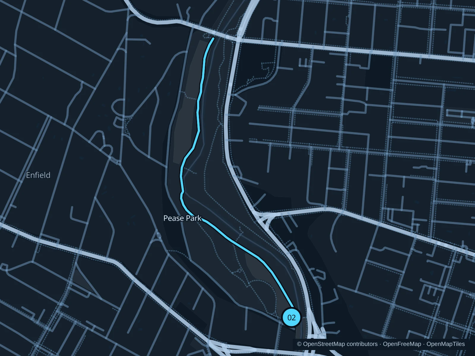
Map of the 2.1 km Pease Park beside Shoal Creek run, with start and finish marked 02.
02 Out & backOpen full-size map
Approx. distance2.1 km
Underfoot

Paved and gravel shared paths

02

Start here

On the main trail at the southern end of Kingsbury Commons, near Kingsbury Street.

Follow the main shared path north through Pease Park, staying on the west side of the creek. Turn at the trail junction just south of 24th Street and retrace your path.

Getting there

Walk from the Kingsbury Street entrance at 1100 Kingsbury Street to the main creekside trail.

Before you go

Do not extend into the landslide closure north of 24th Street or the separate maintenance closure near Janet Fish Bridge. Avoid stepping-stone creek shortcuts after rain.

Park / route information Park / route information

Get running directions on your phone
Mueller Lake paths

A short waterside outing suits stays around Mueller and visits to the Aldrich Street district.

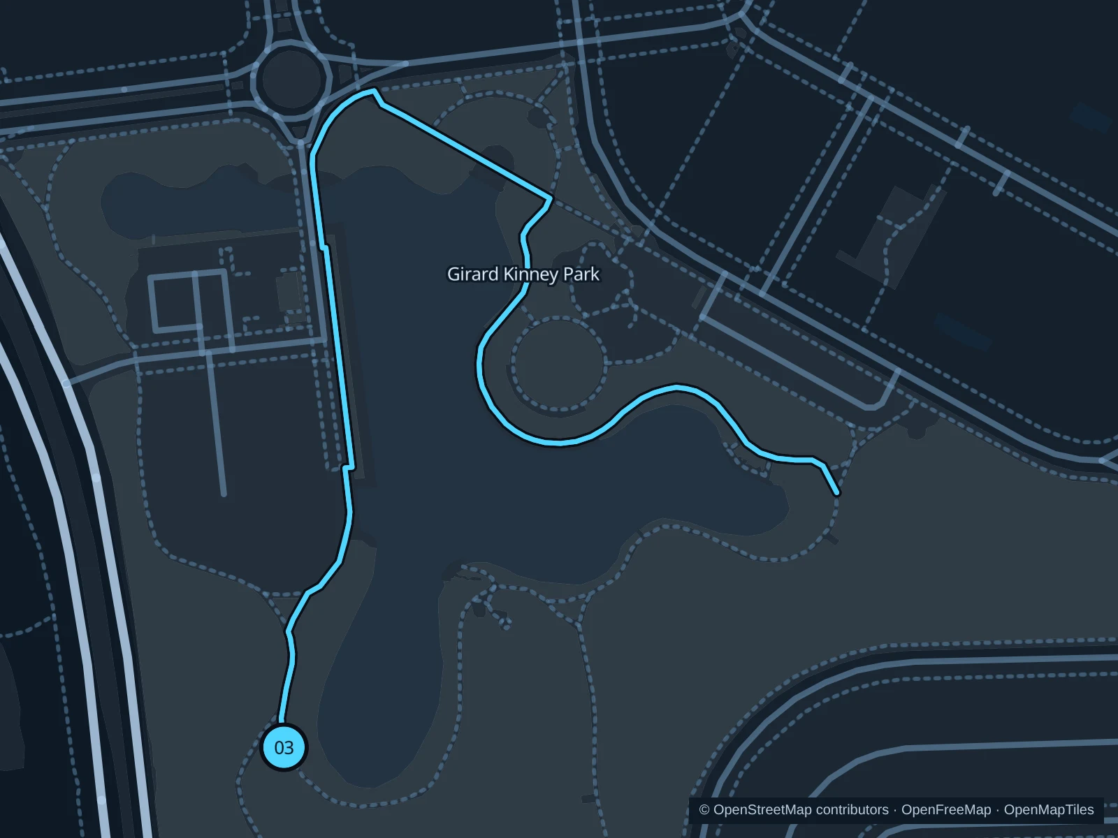
Map of the 1.5 km Mueller Lake paths run, with start and finish marked 03.
03 Out & backOpen full-size map
Approx. distance1.5 km
Underfoot

Concrete and fine-gravel paths

03

Start here

At the southwest lakeside trail junction in Girard Kinney Park, northeast of Browning Hangar.

Head north along the west side of the lake, cross the small path bridge and follow the northern shore past the amphitheater. Continue around the east side to the southeast path junction, then return the same way.

Getting there

Approach from Mueller Boulevard and the public paths by Browning Hangar; the lake is just north of the hangar.

Before you go

The park was formerly called Mueller Lake Park. Stay on the main shared paths, away from the gated playground, and slow down around families and events.

Park / route information

Get running directions on your phone

Get running directions on your phone

Choose a distance and start at your hotel. RunFromHere plans a loop back to your door and guides you along it. Download the area’s map before you leave to use it offline.

The app generates its own routes from your chosen start; it doesn’t open the routes in this guide.

More places to run

Southern Walnut Creek Trail

From Govalle Park, a broad concrete shared trail heads into East Austin greenery. It’s a better option for adding distance, but you’ll need a separate trip from central hotels.

Park / route information

Barton Creek Greenbelt

Choose this for rough limestone and natural trails rather than an easy paved run. Check rain, creek levels and closure notices; do not assume a creek crossing is passable.

Park / route information

Sources & route notes

Researched using the official visitor and park sources below; not checked on foot. Maps and GPX files use the same saved OpenStreetMap pedestrian paths. Distances are approximate. Check local notices for access, gate hours and diversions.

Researched