Skip to routes
RunFromHere
Get the app
English
Illustrated panorama of Washington, DC in white linework.

Washington, DC

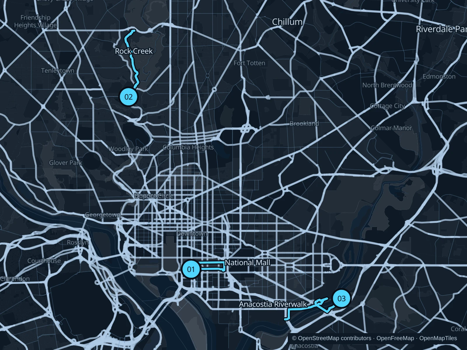
The central National Mall gives you a short museum-side circuit, Rock Creek adds a longer woodland run, and Anacostia Park offers a paved riverbank outing. Our Mall route stays east of the Washington Monument and avoids the Reflecting Pool work zone.

Get running directions on your phone

Find a route near your hotel

The numbers mark each start. Distances exclude the journey from your accommodation.

Map data: © OpenStreetMap contributors · OpenFreeMap · OpenMapTiles

Where to run in Washington, DC

National Mall

A short circuit follows the open museum-side paths of the central Mall, east of the Washington Monument.
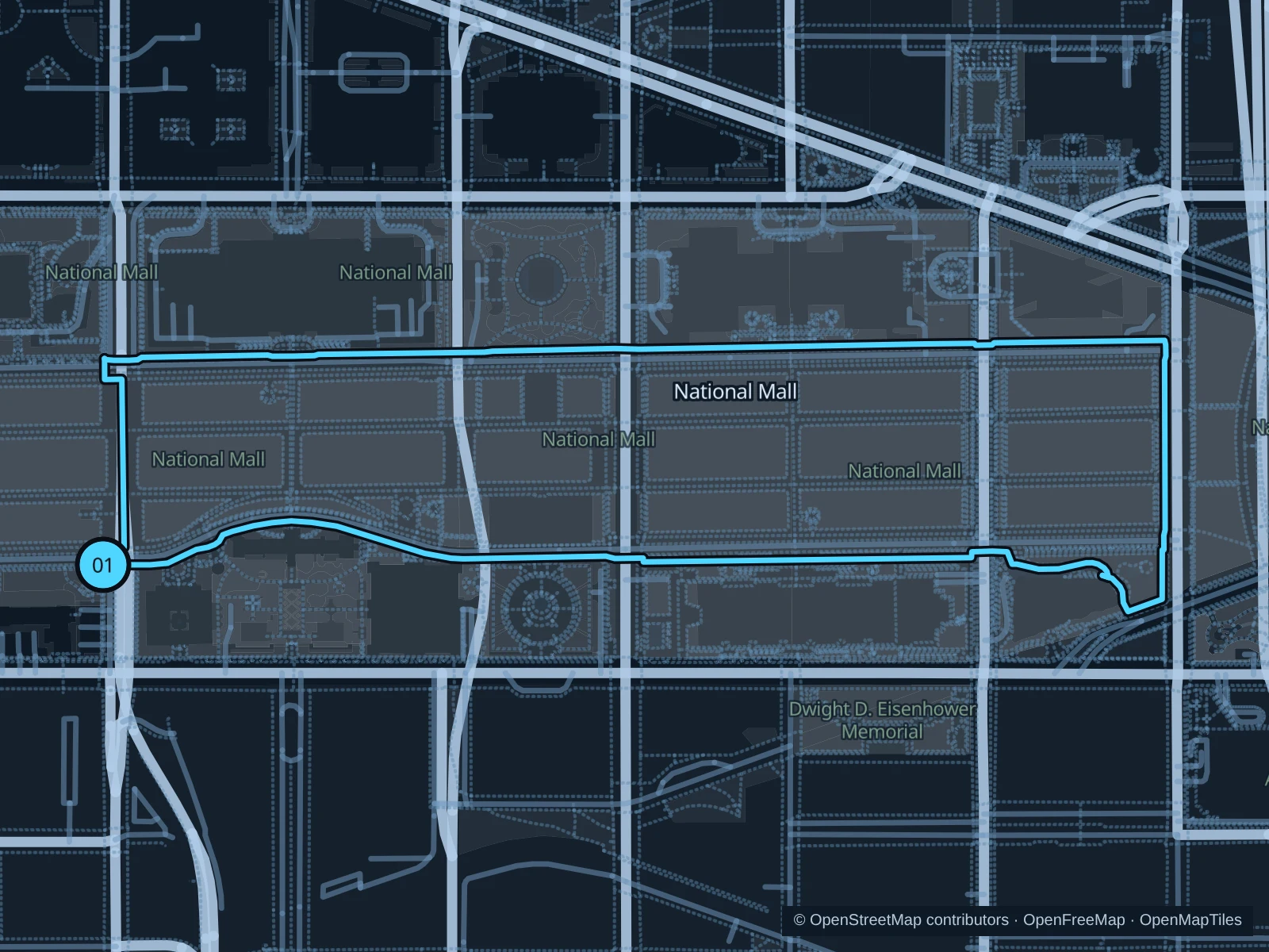
Map of the 2.9 km National Mall run, with start and finish marked 01.
01 LoopOpen full-size map
Approx. distance2.9 km
Underfoot

Paved paths and compacted natural surfaces

01

Start here

At the public Mall path beside the Smithsonian Metro exit at 12th Street.

Use the public paths along the north and south sides of the central Mall, crossing roads only at marked crossings, and return to the Smithsonian Metro side.

Getting there

Take Metro to Smithsonian, then walk to the start.

Before you go

Stop at road crossings and follow event or security barriers. This route excludes the closed Reflecting Pool walkways.

Park / route information

Get running directions on your phone
Rock Creek Western Ridge

A longer out-and-back climbs onto Rock Creek Park’s wooded western ridge.

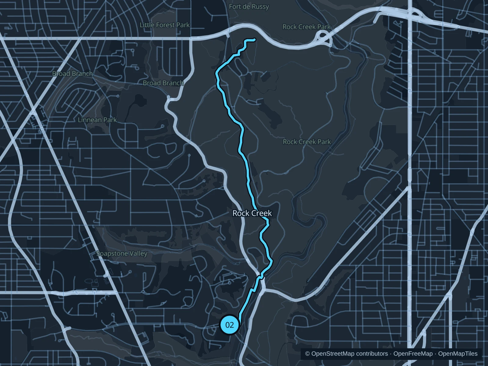
Map of the 5.7 km Rock Creek Western Ridge run, with start and finish marked 02.
02 Out & backOpen full-size map
Approx. distance5.7 km
Underfoot

Park paths and dirt trails with stones and roots

02

Start here

At the public trail junction beside Peirce Mill.

From Peirce Mill, use the public connector paths to the Western Ridge Trail, continue north to the mapped turnaround near Military Road, then retrace the same paths.

Getting there

Take Metro to Cleveland Park, then walk to the start.

Before you go

Expect roots, stones and mud. Carry a map, run in daylight and yield on narrow trails.

Park / route information

Get running directions on your phone

Anacostia Riverwalk

The eastern riverbank provides open water views and a paved park corridor.

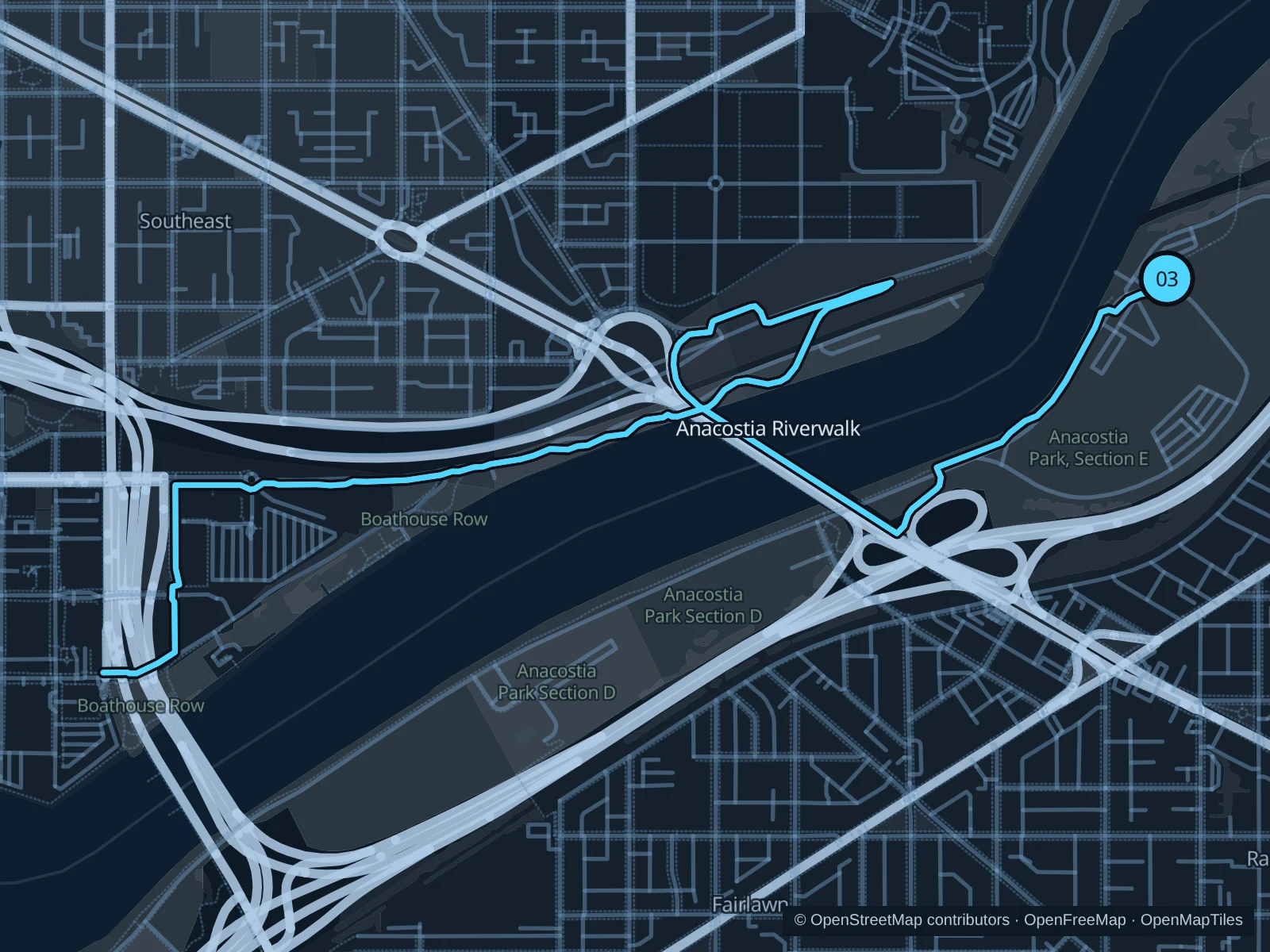
Map of the 7.2 km Anacostia Riverwalk run, with start and finish marked 03.
03 Out & backOpen full-size map
Approx. distance7.2 km
Underfoot

Paved paths shared with walkers and cyclists

03

Start here

On the riverfront path beside the Anacostia Park Skating Pavilion.

Follow the Riverwalk south, cross the river on the 11th Street Bridge pedestrian path, and turn around at the public path junction beside O Street SE on the western bank. Retrace the same route to the skating pavilion.

Getting there

Take Metro to Anacostia, then walk to the start.

Before you go

Share the path with cyclists and check flood or construction notices. Stay out of the river and off boat ramps.

Park / route information

Get running directions on your phone

Get running directions on your phone

Choose a distance and start at your hotel. RunFromHere plans a loop back to your door and guides you along it. Download the area’s map before you leave to use it offline.

The app generates its own routes from your chosen start; it doesn’t open the routes in this guide.

More places to run

C&O Canal towpath

Georgetown’s towpath is another option, but current wall repairs require signed street detours between miles 0.4 and 1.

Park / route information

Tidal Basin

The waterfront paths beside the restored seawalls reopened in April 2026. Check current local signs and slow to a walk on crowded memorial approaches.

Park / route information

Sources & route notes

Researched using the official visitor and park sources below; not checked on foot. Maps and GPX files use the same saved OpenStreetMap pedestrian paths. Distances are approximate. Check local notices for access, gate hours and diversions.

Researched