Skip to routes
RunFromHere
Get the app
English
Illustrated panorama of San Diego in white linework.

San Diego

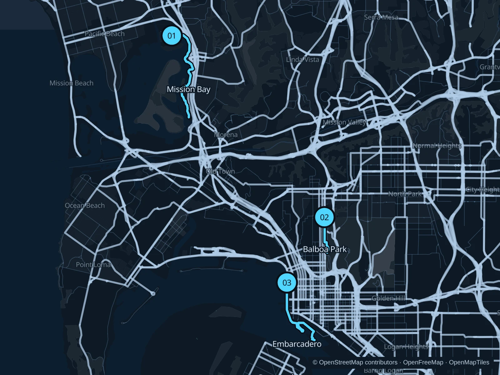
Mission Bay offers a long, mostly flat run beside sheltered water. Downtown’s Embarcadero runs past ships and marinas and is easy to reach from many hotels, while Balboa Park’s West Mesa adds trees and some ups and downs. The ocean cliffs are a separate outing, not an extension of these maps.

Get running directions on your phone

Find a route near your hotel

The numbers mark each start. Distances exclude the journey from your accommodation.

Map data: © OpenStreetMap contributors · OpenFreeMap · OpenMapTiles

Where to run in San Diego

Mission Bay · De Anza Cove to Tecolote Shores

A longer bay-edge run through waterfront lawns and recreation areas, with fewer intersections than the downtown streets.
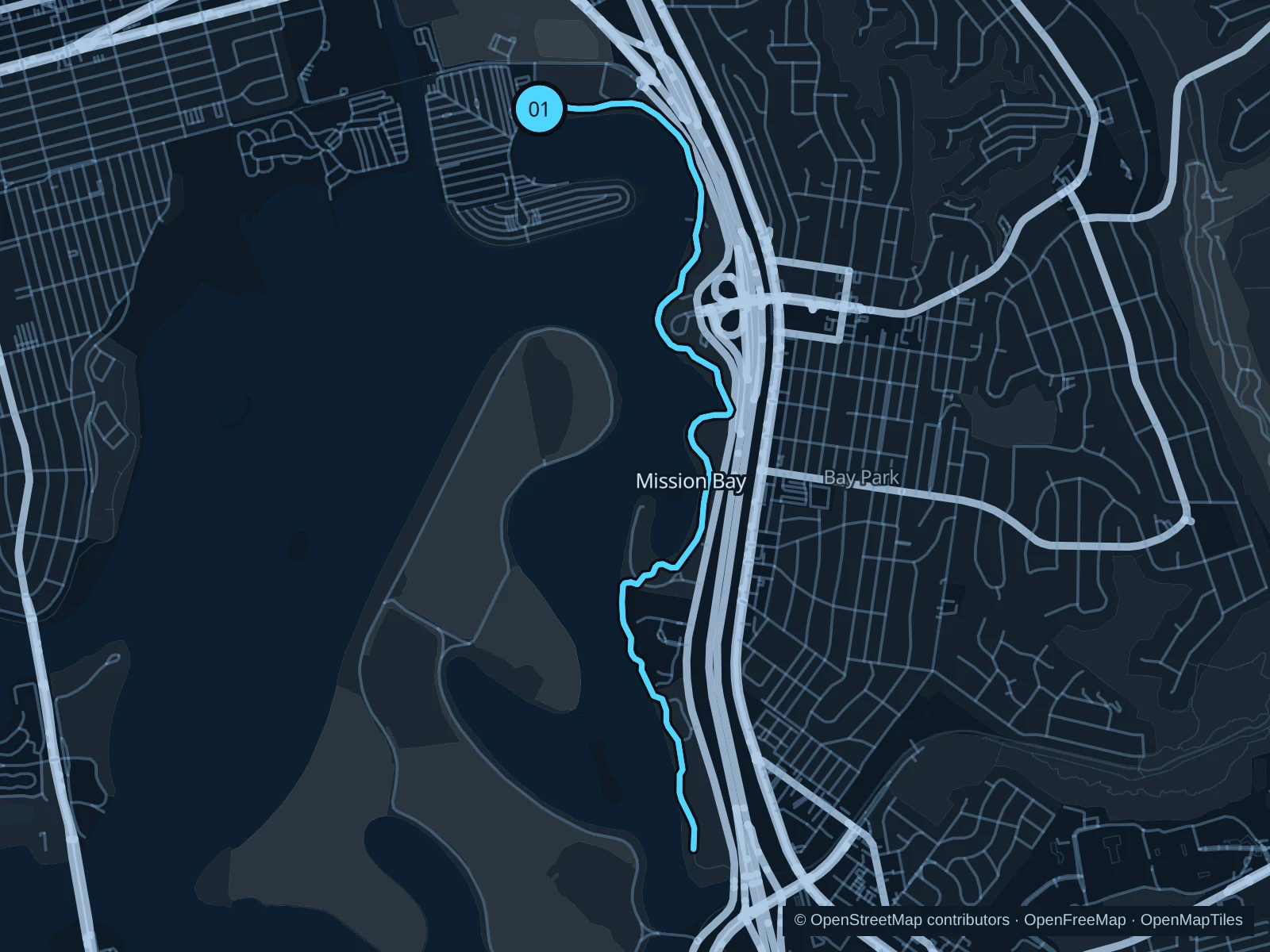
Map of the 7.9 km Mission Bay · De Anza Cove to Tecolote Shores run, with start and finish marked 01.
01 Out & backOpen full-size map
Approx. distance7.9 km
Underfoot

Paved shared bay paths

01

Start here

On the public bay path near De Anza Cove’s boat-launch area.

Follow the eastern shore south through Playa Pacifica and Tecolote Shores, then retrace the same bayside path.

Getting there

Take a local bus along Mission Bay Drive, then walk to the cove through the signed public park entrance.

Before you go

Keep clear of boat ramps and give cyclists space. Event fencing can interrupt park paths; follow the signed detours instead of cutting across parking lots with maneuvering cars.

Park / route information

Get running directions on your phone
Balboa Park · West Mesa

Tree-lined paths on the park’s western side suit a shorter run near Bankers Hill, with some slopes and changing views along the canyon edges.

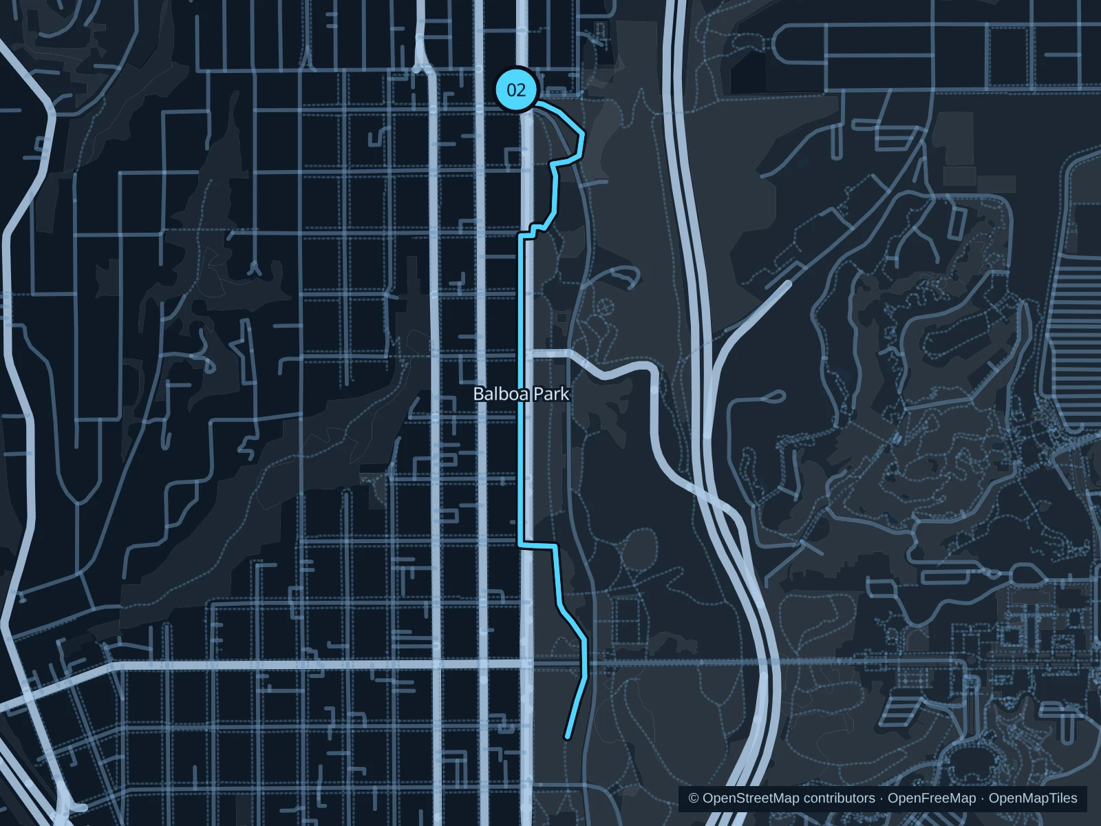
Map of the 3.0 km Balboa Park · West Mesa run, with start and finish marked 02.
02 Out & backOpen full-size map
Approx. distance3.0 km
Underfoot

Paved paths and unpaved park trails

02

Start here

At the Sixth and Upas Trails Gateway, where Sixth Avenue meets Upas Street.

Follow the West Mesa park paths south toward Marston Point, then return along the saved path.

Getting there

Walk from Hillcrest, or take a bus on Fifth Avenue and walk in along Upas Street.

Before you go

This route stays on the western park paths. Watch street crossings and uneven dirt sections; it does not enter the zoo or museum buildings.

Park / route information

Get running directions on your phone

Embarcadero · Waterfront Park to Marina Park

A bayfront run past historic ships and marina basins, handy before a conference or sightseeing in Downtown.

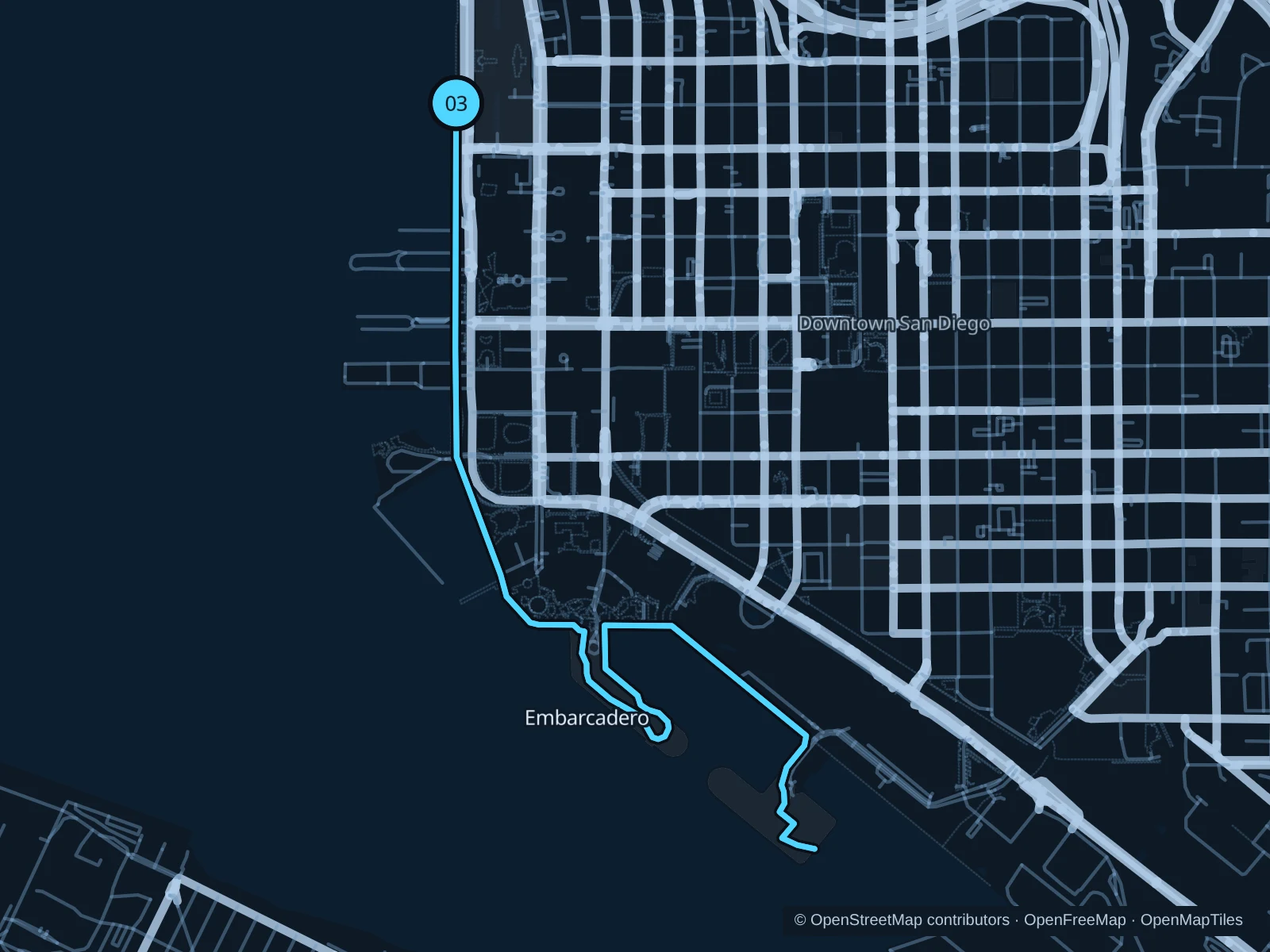
Map of the 6.8 km Embarcadero · Waterfront Park to Marina Park run, with start and finish marked 03.
03 Out & backOpen full-size map
Approx. distance6.8 km
Underfoot

Paved waterfront promenades

03

Start here

On the bayfront path opposite Waterfront Park, near Ash Street.

Follow the public waterfront south past the ships and Seaport Village, then around the marina to Embarcadero Marina Park South and back.

Getting there

Walk west from Santa Fe Depot or the County Center / Little Italy trolley stop.

Before you go

Stay off ticketed piers and private docks. Cruise arrivals, restaurant lines and events can slow you down; follow the public promenade signs.

Park / route information

Get running directions on your phone

Get running directions on your phone

Choose a distance and start at your hotel. RunFromHere plans a loop back to your door and guides you along it. Download the area’s map before you leave to use it offline.

The app generates its own routes from your chosen start; it doesn’t open the routes in this guide.

More places to run

Sunset Cliffs Natural Park

Ocean-facing paths on Point Loma make a change of scenery from the bay. Keep well back from cliff edges and follow closures; the rough bluff paths are less forgiving than the bay promenades.

Park / route information

Torrey Pines State Natural Reserve

Farther north, bluff trails add dirt surfaces and climbs. Check reserve hours, parking fees and weather-related closures before you go.

Park / route information

Sources & route notes

Researched using the official visitor and park sources below; not checked on foot. Maps and GPX files use the same saved OpenStreetMap pedestrian paths. Distances are approximate. Check local notices for access, gate hours and detours.

Researched