Skip to routes
RunFromHere
Get the app
English
Illustrated panorama of Kyoto in white linework.

Kyoto

Kyoto’s riverbanks and public gardens give you practical places to run between sightseeing and meetings. Choose the Kamo for a longer outing, Kyoto Gyoen for a garden circuit or Takaragaike for a short waterside run in the north. Plan around heat, river conditions and the trip to your start.

Get running directions on your phone

Find a route near your hotel

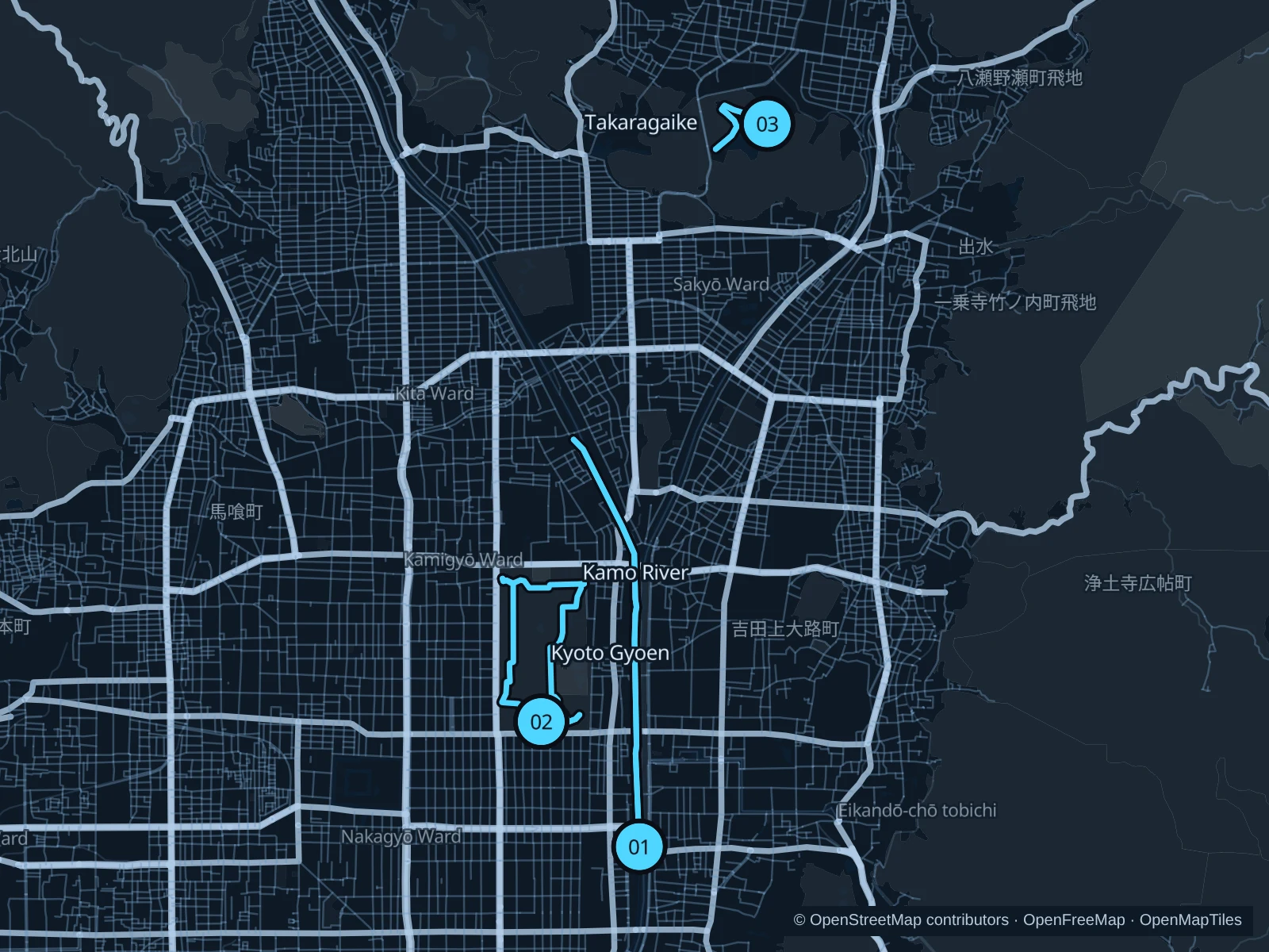
The numbers mark each start. Distances exclude the journey from your accommodation.

Map data: © OpenStreetMap contributors · OpenFreeMap · OpenMapTiles

Where to run in Kyoto

Kamo River · west bank

A longer run along the western riverbank, linking central Kyoto with the greener paths north of the river confluence.
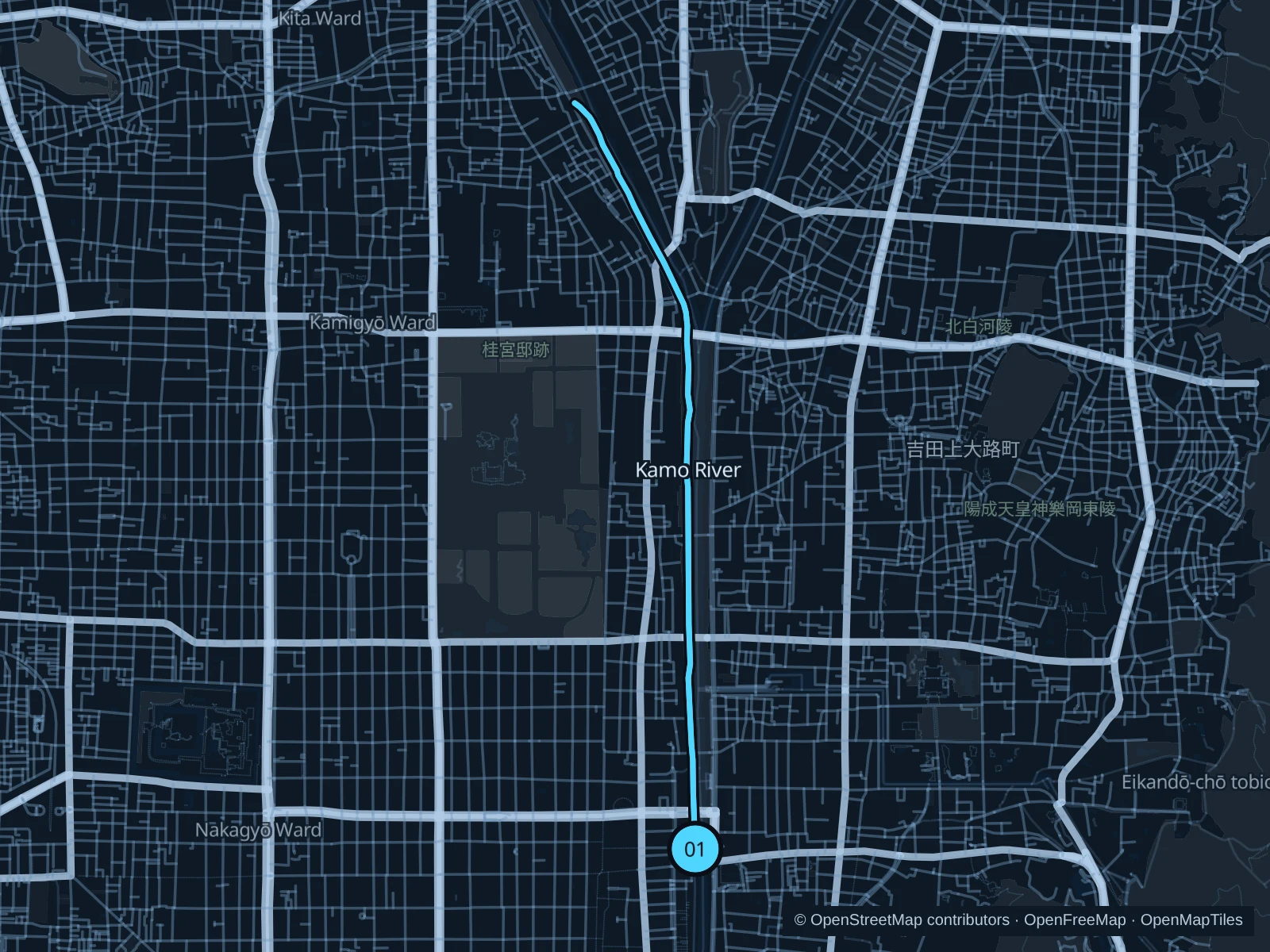
Map of the 6.5 km Kamo River · west bank run, with start and finish marked 01.
01 Out & backOpen full-size map
Approx. distance6.5 km
Underfoot

Paved paths and compacted natural surfaces

01

Start here

On the lower public path near the western end of Sanjo Bridge.

Follow the public west-bank path north past Marutamachi and Kamo Ohashi. Continue up the western Kamo branch at Demachi and turn at the marked point near Izumojibashi, then return along the same bank.

Getting there

From Sanjo or Sanjo Keihan stations, cross Sanjo Bridge on foot to its western end and use the public riverbank access. The station approach is outside the run.

Before you go

Check rain and flood warnings before using the lower banks. Keep clear of rising water, give walkers and cyclists space and return by the same bank shown on the map.

Park / route information

Get running directions on your phone
Kyoto Gyoen

A public garden circuit on broad gravel avenues around the palace grounds.

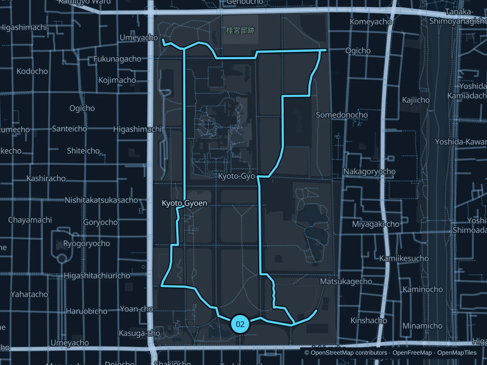
Map of the 3.9 km Kyoto Gyoen run, with start and finish marked 02.
02 LoopOpen full-size map
Approx. distance3.9 km
Underfoot

Compacted gravel paths

02

Start here

On the public garden path just inside Sakaimachi Gate on Marutamachi Street.

From Sakaimachi Gate, follow the public garden paths west and north, continue through the northern garden, then return south on the public paths between and outside the palace compounds to the southern garden. Finish back at the path just inside Sakaimachi Gate.

Getting there

From Marutamachi subway station, walk east along Marutamachi Street to Sakaimachi Gate and enter the public garden.

Before you go

Use the public garden paths outside the palace and State Guest House compounds. Run quietly, slow to a walk near visitors and gates, and follow current event or maintenance instructions.

Park / route information Park / route information Park / route information Park / route information

Get running directions on your phone

Takaragaike · pondside paths

A shorter out-and-back on the northern and western shore paths, with trees and pond views.

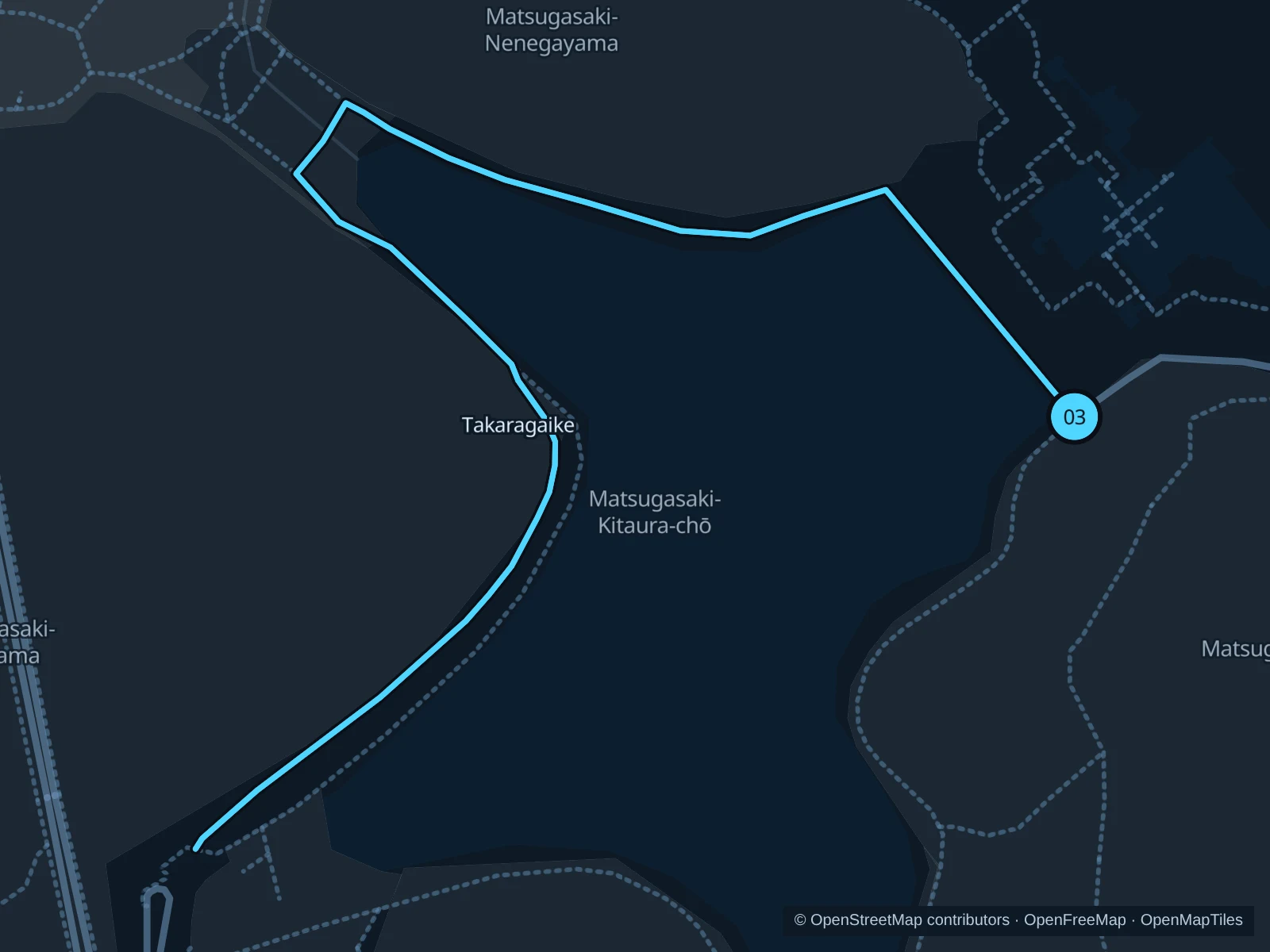
Map of the 1.7 km Takaragaike · pondside paths run, with start and finish marked 03.
03 Out & backOpen full-size map
Approx. distance1.7 km
Underfoot

Unpaved park paths

03

Start here

At the public path junction on Takaragaike’s northeastern shore, south of Kyoto International Conference Center.

Follow the public path around the northern shore and down the western side. Turn at the marked southwestern path junction and retrace the same shore paths to the northeastern start.

Getting there

From Kokusaikaikan subway station, use the public pedestrian approaches southwest toward the pond, then follow the signs to the northeastern shore. This walk is outside the run.

Before you go

Use daylight for the shaded, uneven paths and carry water in summer. Give walkers and wildlife space, and check park signs before extending onto other trails.

Park / route information Park / route information Park / route information Park / route information

Get running directions on your phone

Get running directions on your phone

Choose a distance and start at your hotel. RunFromHere plans a loop back to your door and guides you along it. Download the area’s map before you leave to use it offline.

The app generates its own routes from your chosen start; it doesn’t open the routes in this guide.

More places to run

Takano River

The eastern branch at Demachi offers another riverside outing toward Matsugasaki. Use the public bank paths and check river levels before leaving.

Park / route information

Umekoji Park

The public park west of Kyoto Station is another convenient area for a short run. Slow to a walk near family crowds and keep outside the separately ticketed aquarium and railway museum.

Park / route information

Sources & route notes

Researched using the official visitor and park sources below; not checked on foot. Maps and GPX files use the same saved OpenStreetMap pedestrian paths. Distances are approximate. Check local notices for access, gate hours and diversions.

Researched