Skip to routes
RunFromHere
Get the app
English
Illustrated panorama of Helsinki in white linework.

Helsinki

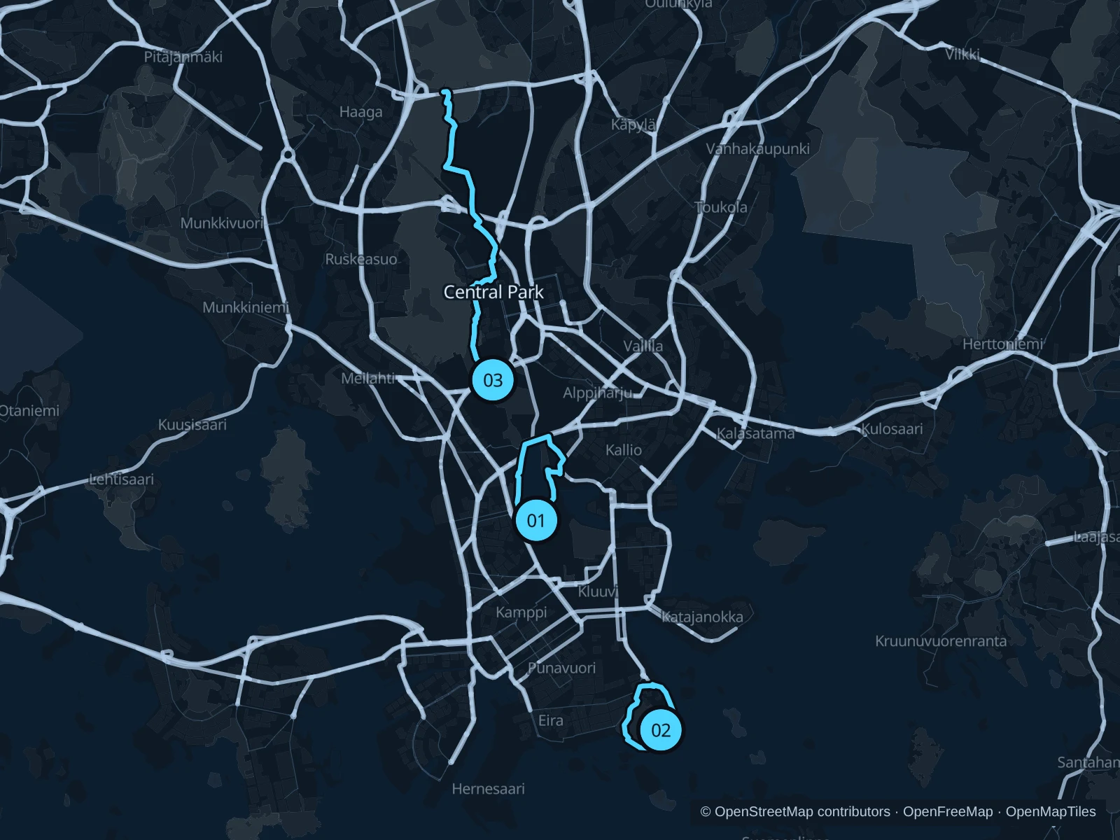
A stay in Helsinki gives you three very different settings: Töölönlahti’s bay paths, Kaivopuisto’s seaside park and a longer forest outing in Central Park (Keskuspuisto). The saved routes include public path connections, so don’t expect uninterrupted waterfront. Check winter ice, daylight and which forest paths stay open for walking when ski tracks are in use.

Get running directions on your phone

Find a route near your hotel

The numbers mark each start. Distances exclude the journey from your accommodation.

Map data: © OpenStreetMap contributors · OpenFreeMap · OpenMapTiles

Where to run in Helsinki

Töölönlahti · bay and park circuit

A central bay circuit using the waterside parks and the rising paths on the Linnunlaulu side.
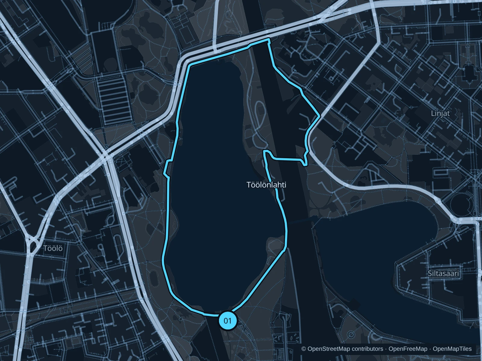
Map of the 2.6 km Töölönlahti · bay and park circuit run, with start and finish marked 01.
01 LoopOpen full-size map
Approx. distance2.6 km
Underfoot

Paved and gravel park paths with sidewalk links

01

Start here

On the public park path at the southern end of Töölönlahti.

Follow the saved east-side paths toward Linnunlaulu, cross the northern public links and return along the west-side bay paths.

Getting there

Walk north from Helsinki Central Station through the public Töölönlahti park paths.

Before you go

The eastern side rises away from the immediate waterline. Use marked crossings at connecting roads, give cyclists room on shared sections and check icy footing in winter.

Park / route information

Get running directions on your phone
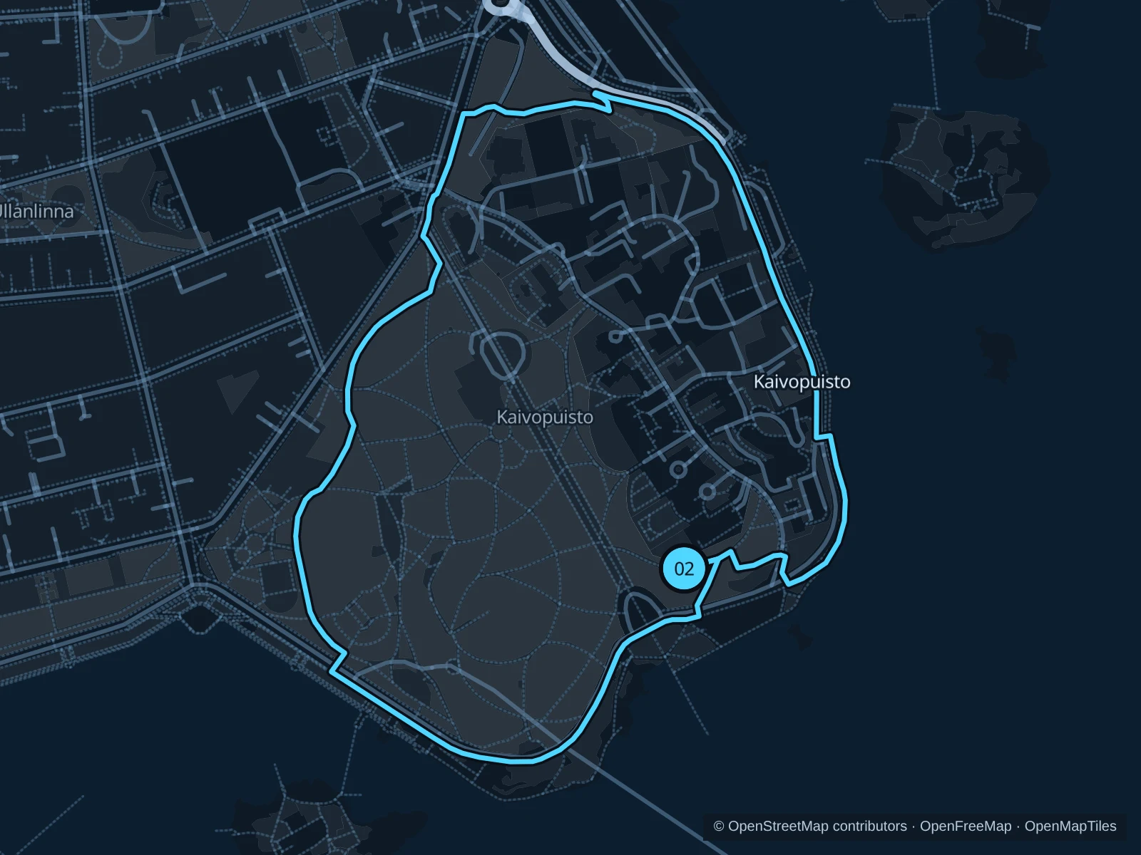
Kaivopuisto · park and shore circuit

A rolling park circuit with sea views, lawns and the public paths around Helsinki’s southern park.

Map of the 2.3 km Kaivopuisto · park and shore circuit run, with start and finish marked 02.
02 LoopOpen full-size map
Approx. distance2.3 km
Underfoot

Paved and gravel paths with public sidewalk connections

02

Start here

On the public eastern park path near the Kaivohuone area.

Follow the saved paths north and west through the park, descend south toward the shore, then follow the southern shore paths east and turn north back to the Kaivohuone starting area.

Getting there

Take a tram or bus to the Kaivopuisto area, then walk on public sidewalks into the park.

Before you go

Keep out of embassy gardens and ferry boarding areas. The park has hills, busy event lawns and road-edge connections; slow down near families and use crossings.

Park / route information

Get running directions on your phone

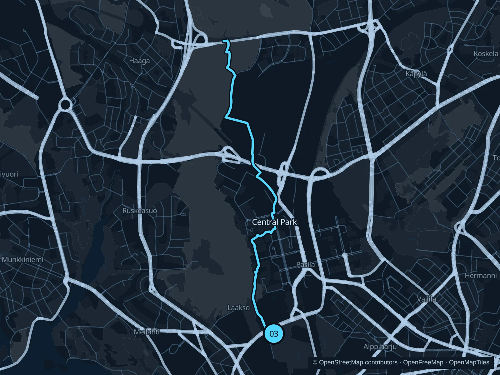
Central Park · southern forest paths

The longest saved outing heads north through the forest path network from the city’s edge.

Map of the 8.3 km Central Park · southern forest paths run, with start and finish marked 03.
03 Out & backOpen full-size map
Approx. distance8.3 km
Underfoot

Mixed forest paths, gravel and paved connections

03

Start here

On the public forest path north of the Laakso approach and Auroransilta bridge area.

Follow the recorded public forest paths north through the southern Central Park, then retrace the saved route from the northern turnaround.

Getting there

Take public transit toward Nordenskiöldinkatu and walk through the signed Laakso park approach.

Before you go

This is a seasonal forest run. Follow current walking-route signs and closures, keep off groomed ski tracks and use a shorter open alternative if snow or ice changes access.

Park / route information

Get running directions on your phone

Get running directions on your phone

Choose a distance and start at your hotel. RunFromHere plans a loop back to your door and guides you along it. Download the area’s map before you leave to use it offline.

The app generates its own routes from your chosen start; it doesn’t open the routes in this guide.

More places to run

Seurasaari

A wooded island reached by a public bridge, with separate open-air museum visitor areas. Respect seasonal bird-protection signs, keep to open recreation paths and check the bridge approach in winter.

Park / route information

Lauttasaari

The island offers another coastal running area reached by metro. Choose a signed public shore section, check street crossings and leave beach and nature-protection areas undisturbed.

Park / route information

Sources & route notes

Researched using the official visitor and park sources below; not checked on foot. Maps and GPX files use the same saved OpenStreetMap pedestrian paths. Distances are approximate. Check local notices for access, gate hours and diversions.

Researched