
Skip to routes
RunFromHere
Get the app
English
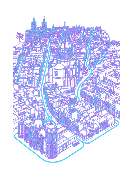
White line illustration of Zaragoza and its riverfront parks.

Zaragoza

Run opposite the Pilar basilica on the Ebro’s north bank, take a short circuit among Parque Grande’s fountains and avenues, or head to Parque del Agua for a longer outing by the canals. Summer heat and river levels matter more than the distances suggest.

Get running directions on your phone

Find a route near your hotel

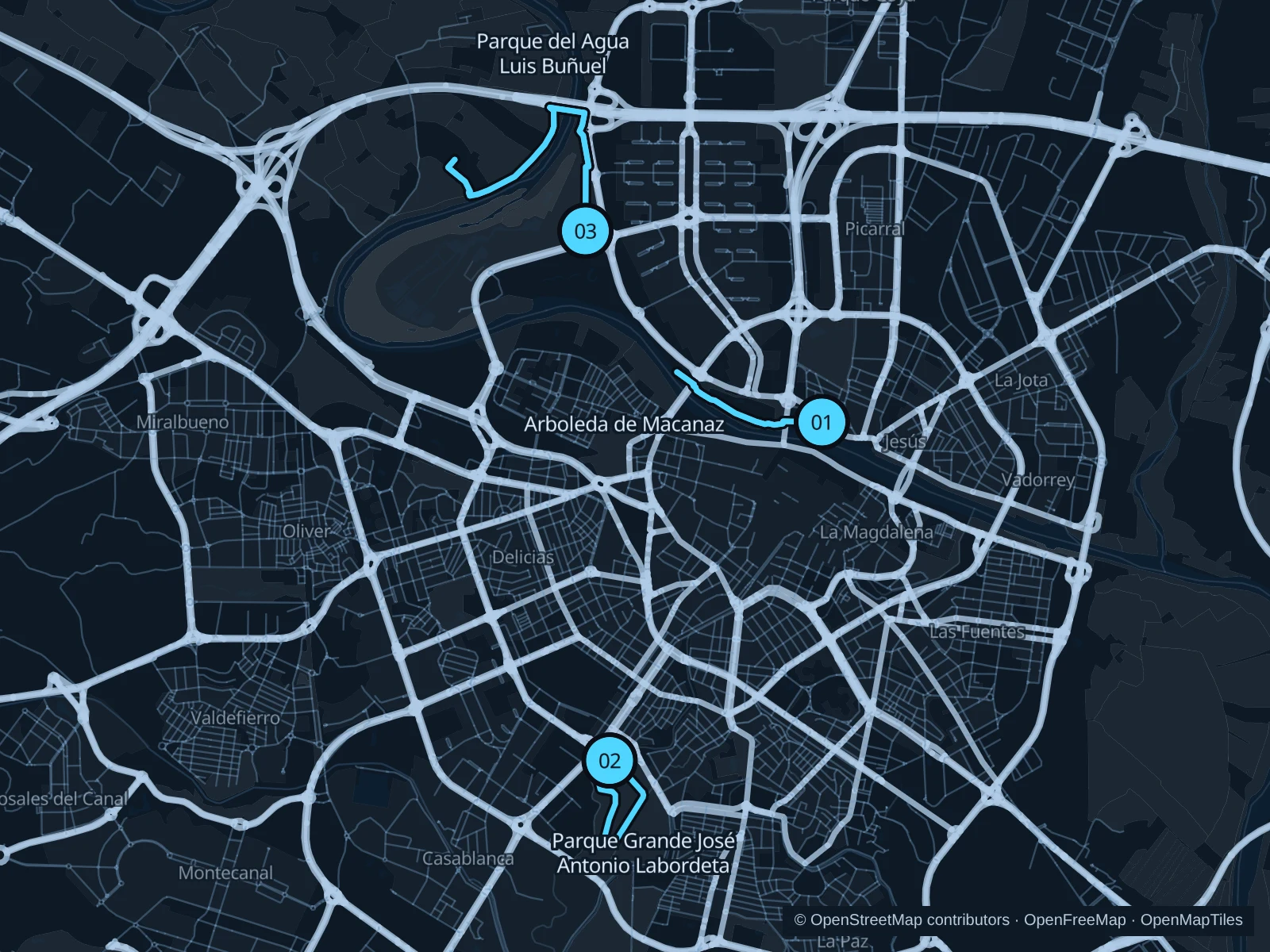
The numbers mark each start. Distances exclude the journey from your accommodation.

Map data: © OpenStreetMap contributors · OpenFreeMap · OpenMapTiles

Where to run in Zaragoza

Ebro north-bank promenade

Views across the water to the Pilar basilica make this an easy-to-reach choice from the historic center.
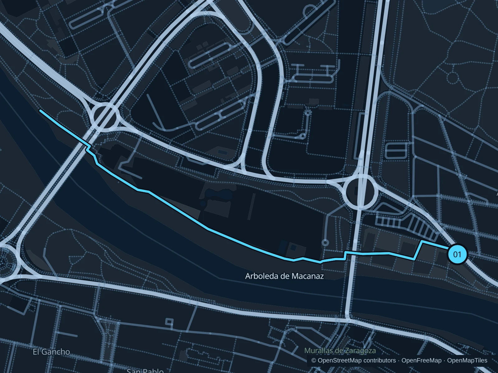
Map of the 2.5 km Ebro north-bank promenade run, with start and finish marked 01.
01 Out & backOpen full-size map
Approx. distance2.5 km
Underfoot

Paved riverside paths, with bicycles on some sections

01

Start here

At the riverside path junction in Arboleda de Macanaz, just west of the north end of Puente de Piedra.

Follow the north-bank park paths upstream through Macanaz and beneath Puente de Santiago. Continue to the north-bank path near Puente de la Almozara, then turn and retrace the same bank.

Getting there

Walk across Puente de Piedra from the Pilar district, cross Paseo de la Ribera at its marked crossing and join the riverside park path.

Before you go

Keep out of cycle-only lanes. Avoid riverside paths during flood warnings and turn back at barriers, water or mud; a GPX line is no guarantee of access.

Park / route information Park / route information

Get running directions on your phone
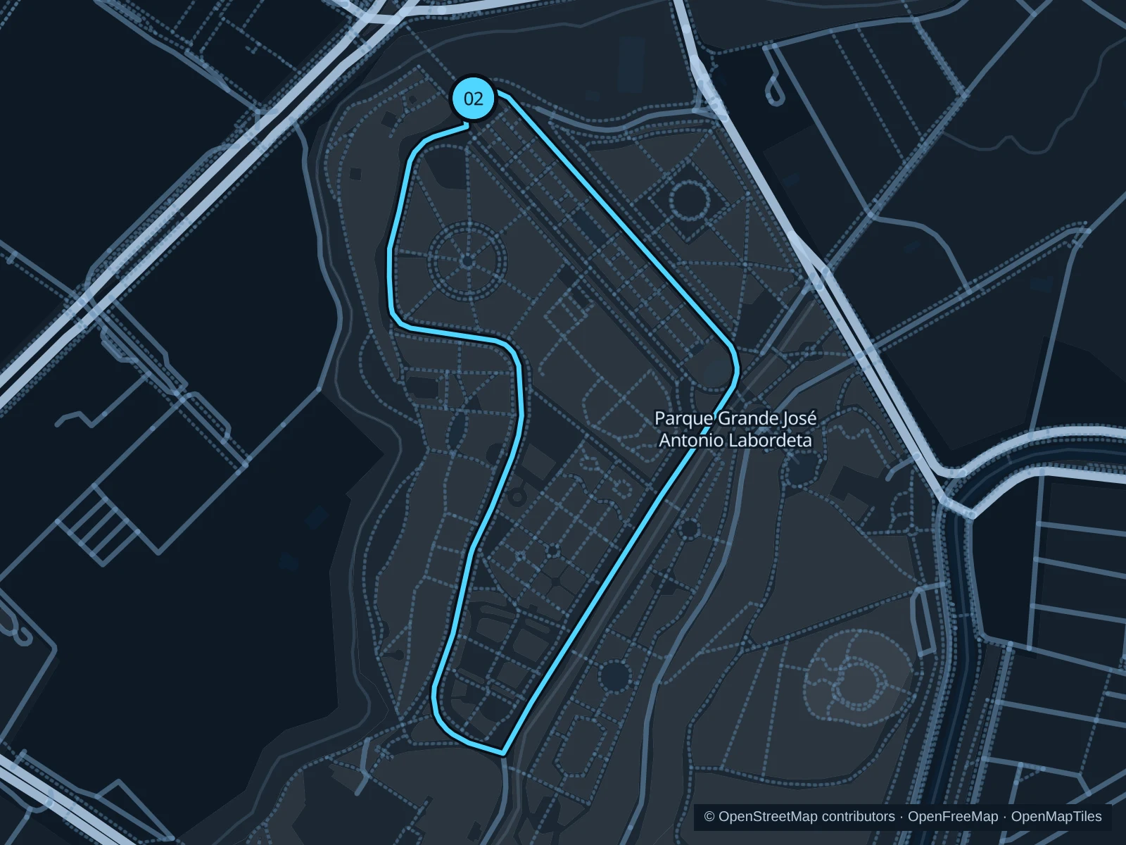
Parque Grande avenues

A compact run through the park’s lower avenues works well when you want greenery without a long trip beyond the city.

Map of the 1.6 km Parque Grande avenues run, with start and finish marked 02.
02 LoopOpen full-size map
Approx. distance1.6 km
Underfoot

Mostly asphalt park promenades

02

Start here

On Paseo de San Sebastián just inside the main entrance beyond Puente de los Cantautores.

Follow Paseo de San Sebastián southeast toward the fountains, turn onto Avenida de los Bearneses and return north via Paseo de Manuel Azaña. Finish at the main entrance without climbing the Batallador staircase.

Getting there

Walk from the Plaza de San Francisco tram stop to the main park entrance and cross Puente de los Cantautores.

Before you go

This measured route follows the main avenues; it doesn’t reproduce any of the official marked circuits. Slow down around fountains, cafés and families.

Park / route information

Get running directions on your phone
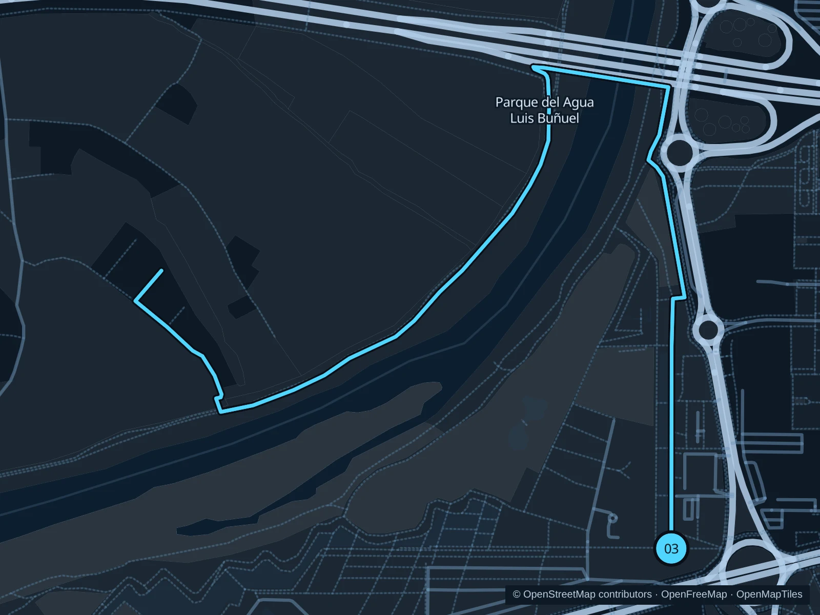
Parque del Agua canal and meadow paths

The longest option follows the park’s canal and open paths around the outside of the golf area.

Map of the 5.1 km Parque del Agua canal and meadow paths run, with start and finish marked 03.
03 Out & backOpen full-size map
Approx. distance5.1 km
Underfoot

Compacted earth, gravel and paved sections

03

Start here

At the southern end of Paseo del Gran Canal José Antonio Samaranch, by the park’s canal entrance off Avenida de las Ranillas.

Follow the Gran Canal north, then take the public paths west around the outside of the golf course. Turn at the western meadow path junction before the Ebro’s wooded riverbank and return by the same route.

Getting there

Approach from Avenida de las Ranillas near Torre del Agua, then walk northeast on the public paths to the southern end of the Gran Canal.

Before you go

Stay outside the golf course and the separate activity enclosures. Bring water for the exposed sections and obey flood or maintenance closures; do not rely on a kiosk being open.

Park / route information Park / route information Park / route information

Get running directions on your phone

Get running directions on your phone

Choose a distance and start at your hotel. RunFromHere plans a loop back to your door and guides you along it. Download the area’s map before you leave to use it offline.

The app generates its own routes from your chosen start; it doesn’t open the routes in this guide.

More places to run

Canal Imperial de Aragón

The marked canal corridor offers a straighter alternative south of the center. Choose a public access point and check road crossings before extending your run.

Park / route information

Galacho de Juslibol

For a separate nature outing, approach from Juslibol and stay on designated visitor paths. Check current flood access and seasonal visitor-center hours, and give wildlife priority.

Park / route information

Sources & route notes

Researched using the official visitor and park sources below; not checked on foot. Maps and GPX files use the same saved OpenStreetMap pedestrian paths. Distances are approximate. Check local notices for access, gate hours and diversions.

Researched