Skip to routes
RunFromHere
Get the app
English
Illustrated panorama of Warsaw in white linework.

Warsaw

Warsaw pairs a longer river outing with leafy park circuits. The Vistula Boulevards suit hotels near the center and Copernicus Science Centre; Pole Mokotowskie and Skaryszewski offer separate green settings on opposite sides of the river. Use public transport between areas, check flood notices on the quays and allow for winter ice or summer heat.

Get running directions on your phone

Find a route near your hotel

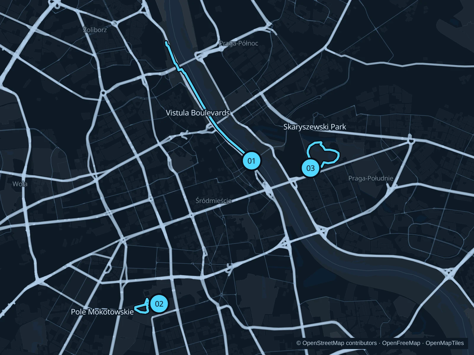
The numbers mark each start. Distances exclude the journey from your accommodation.

Map data: © OpenStreetMap contributors · OpenFreeMap · OpenMapTiles

Where to run in Warsaw

Vistula Boulevards · northern quays

The longest saved run follows the city-side quays, with river views and the changing spaces beneath Warsaw’s bridges.
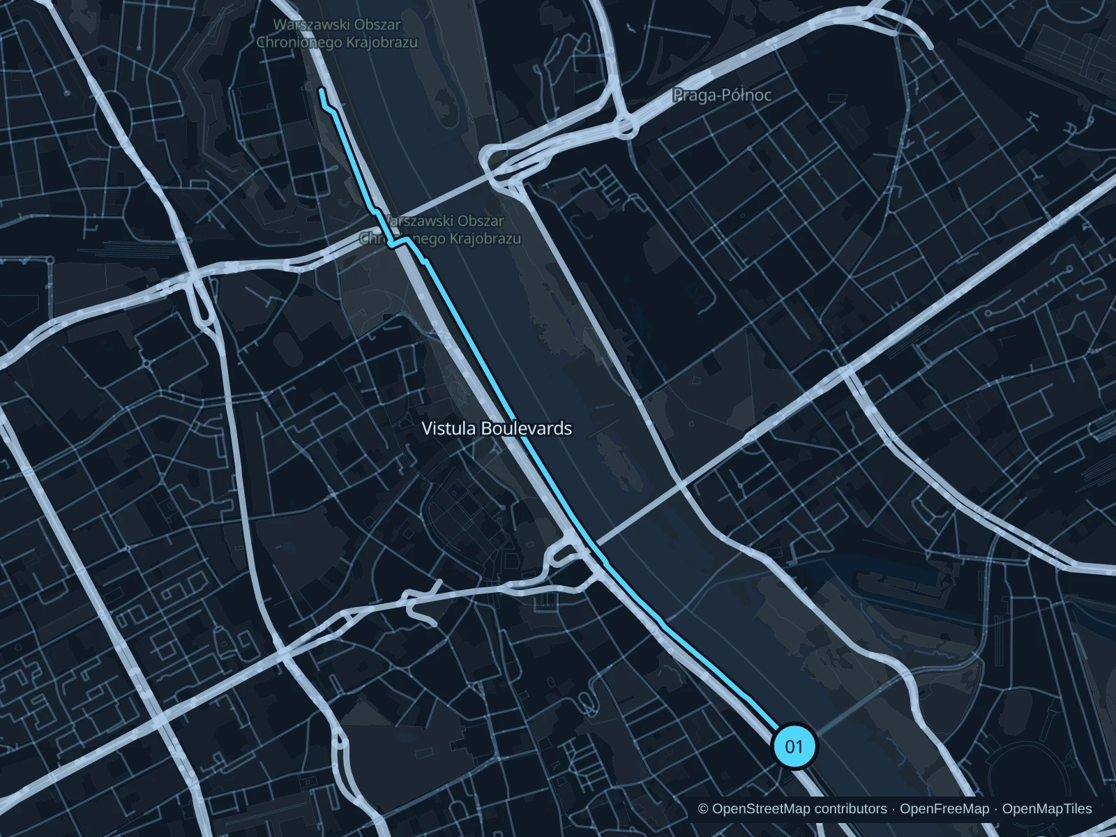
Map of the 6.9 km Vistula Boulevards · northern quays run, with start and finish marked 01.
01 Out & backOpen full-size map
Approx. distance6.9 km
Underfoot

Paved public quays and pedestrian connections

01

Start here

On the public left-bank promenade near the Mermaid statue and Świętokrzyski Bridge.

Follow the saved quay paths north, passing the bridges and public connections toward the Gdański Bridge area, then return by the same route.

Getting there

Take the metro to Centrum Nauki Kopernik and walk toward the Mermaid statue using the public crossings and promenade approaches.

Before you go

High water can close lower quays and underpasses. Respect flood barriers and event fencing, stick to pedestrian sections and slow down near cafés and at bike-lane crossings.

Park / route information

Get running directions on your phone
Pole Mokotowskie · two park circuits

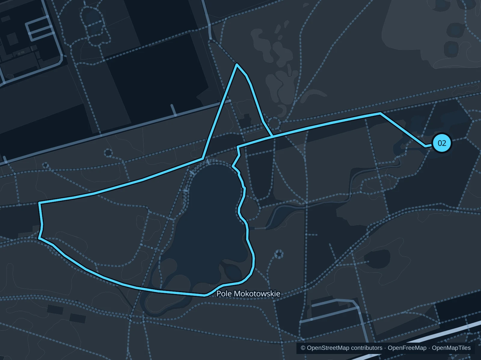
Two laps of a compact route in the park’s western section, through planted areas and along paths near the water gardens.

Map of the 3.1 km Pole Mokotowskie · two park circuits run, with start and finish marked 02.
02 LoopOpen full-size map
Approx. distance3.1 km
Underfoot

Mixed paved and unpaved park paths with small footbridges

02

Start here

At the public path junction beside the small park footbridge west of the National Library.

Follow the saved western park circuit back to its footbridge starting point, then repeat the entire circuit once for the total distance.

Getting there

From Pole Mokotowskie metro, walk northwest on public paths toward the National Library and continue into the western park to the saved footbridge start.

Before you go

The saved total includes two full circuits. Stay on the park paths and off the planted wetland areas, and keep out of the library grounds and neighboring sports facilities.

Park / route information

Get running directions on your phone

Skaryszewski Park · garden circuit

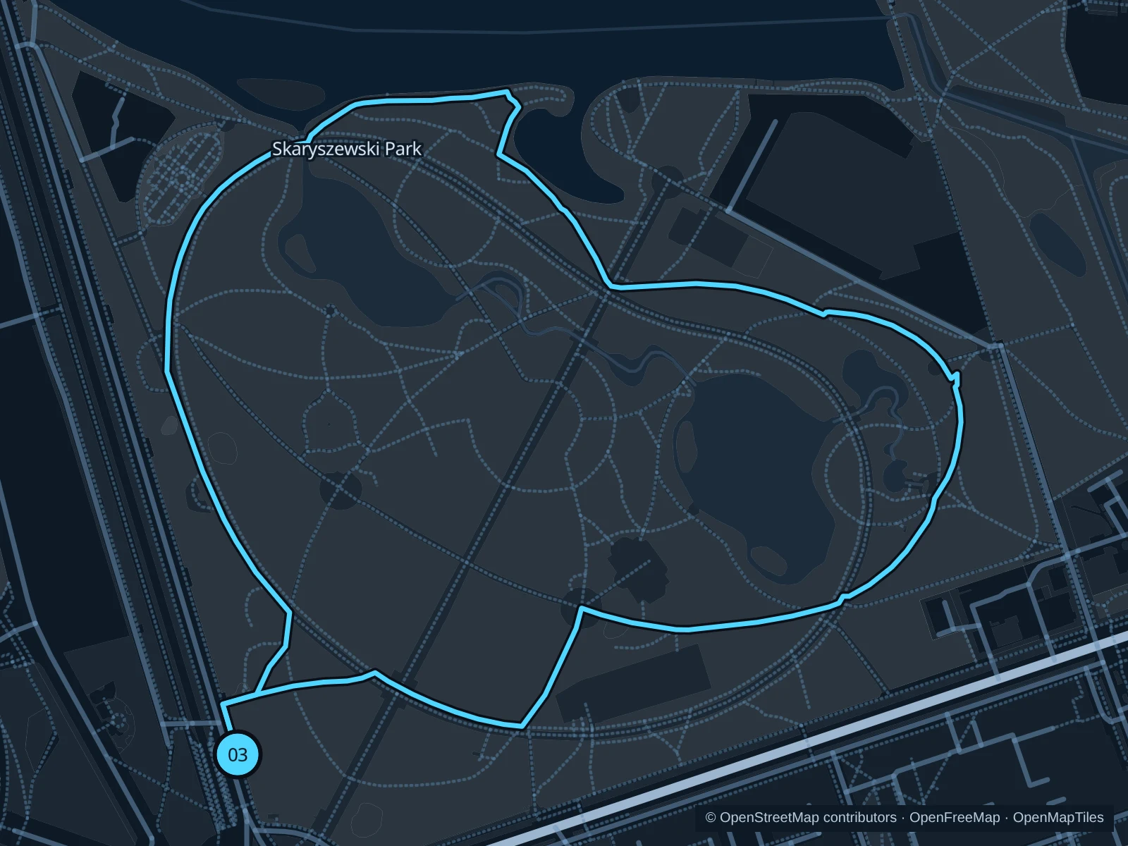
A shorter circuit through a historic landscape park, with curving avenues, ponds and established trees.

Map of the 2.3 km Skaryszewski Park · garden circuit run, with start and finish marked 03.
03 LoopOpen full-size map
Approx. distance2.3 km
Underfoot

Mixed park paths and public entrance connections

03

Start here

On the public park path north of the Rondo Waszyngtona approach.

Follow the saved paths north along the western park side, turn east through the northern garden paths and return through the eastern and southern park paths.

Getting there

Take a tram to the Rondo Waszyngtona stop, use the marked crossings and enter the public park north of the road.

Before you go

Follow current park notices and use only open paths. Keep out of tennis and rowing compounds. This circuit does not need the Międzynarodowa bridge; respect any bridge closures rather than taking shortcuts.

Park / route information Park / route information

Get running directions on your phone

Get running directions on your phone

Choose a distance and start at your hotel. RunFromHere plans a loop back to your door and guides you along it. Download the area’s map before you leave to use it offline.

The app generates its own routes from your chosen start; it doesn’t open the routes in this guide.

More places to run

Saxon Garden · Ogród Saski

A central garden for a shorter, quieter outing among trees, fountains and historic avenues. Slow down near visitors and ceremonies, and respect any construction or restrictions beside the Tomb of the Unknown Soldier.

Park / route information

Moczydło Park · Wola

The public landscaped park in Wola adds ponds and a hill away from the central riverfront. Choose its open park paths; the adjacent water park is a separate ticketed facility, not part of this running suggestion.

Park / route information

Sources & route notes

Researched using the official visitor and park sources below; not checked on foot. Maps and GPX files use the same saved OpenStreetMap pedestrian paths. Distances are approximate. Check local notices for access, gate hours and diversions.

Researched