Skip to routes
RunFromHere
Get the app
English
Illustrated panorama of Toronto in white linework.

Toronto

Run beside Lake Ontario from Harbourfront, take a shorter wooded outing in High Park, or make time for an island run after the ferry crossing. The three starts suit different bases and trip lengths.

Get running directions on your phone

Find a route near your hotel

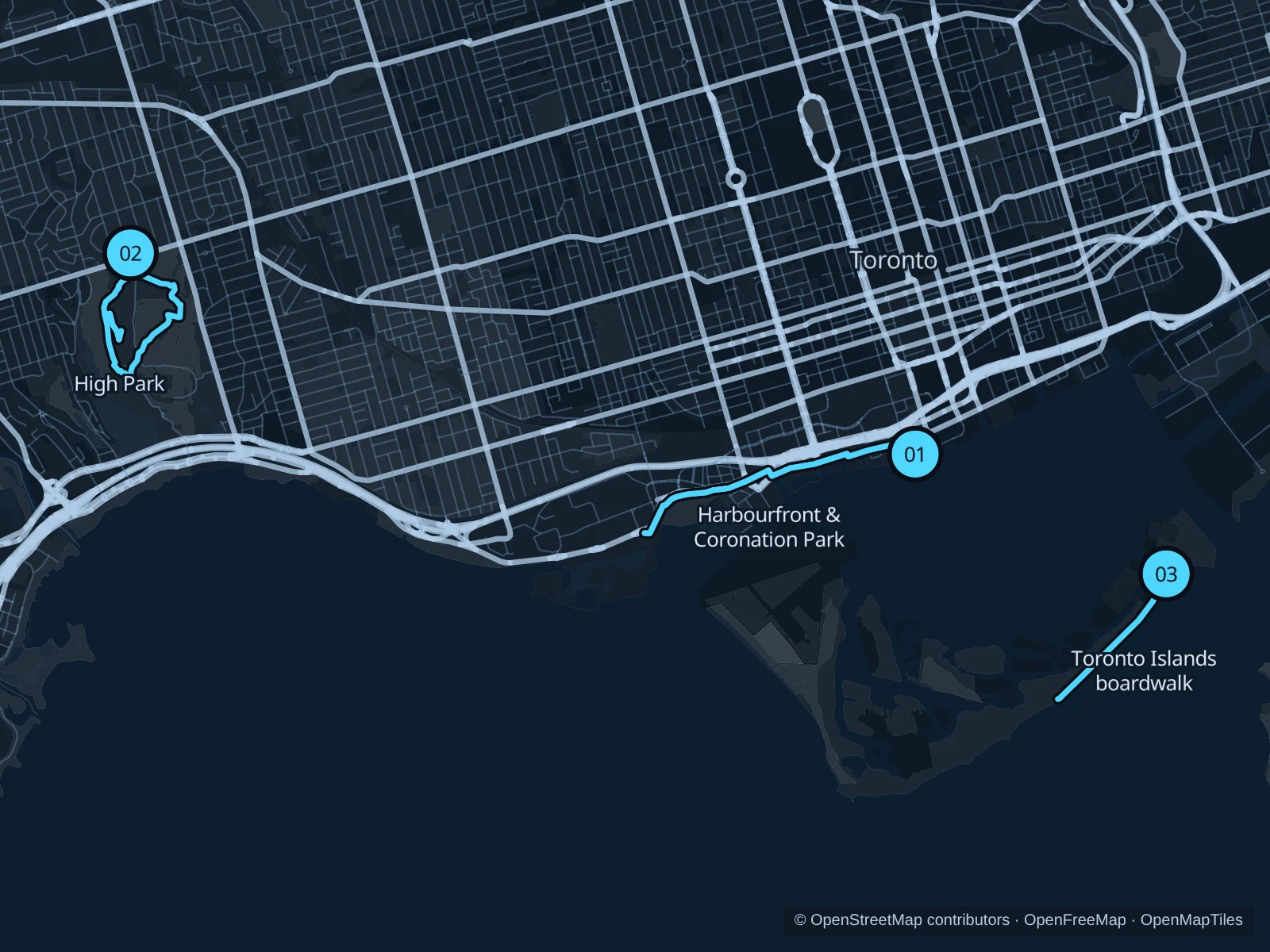
The numbers mark each start. Distances exclude the journey from your accommodation.

Map data: © OpenStreetMap contributors · OpenFreeMap · OpenMapTiles

Where to run in Toronto

Harbourfront & Coronation Park

Quays, marinas and open parkland give this longer waterfront outing a changing city backdrop.
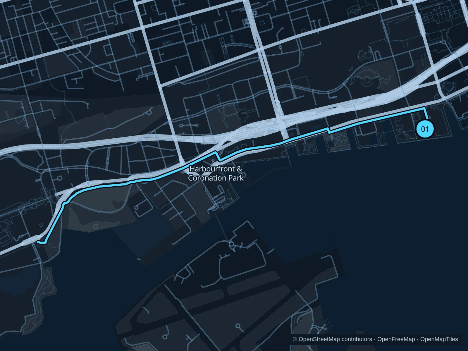
Map of the 5.6 km Harbourfront & Coronation Park run, with start and finish marked 01.
01 Out & backOpen full-size map
Approx. distance5.6 km
Underfoot

Paved pedestrian paths

01

Start here

On the waterfront path at Harbourfront Centre.

Follow the waterfront path to Coronation Park, then return along the same path.

Getting there

From the Queens Quay streetcar stop at Harbourfront Centre, walk to the signed public path.

Before you go

Stick to the pedestrian or shared paths rather than the bike-only lane, and watch for signed construction detours.

Park / route information

Get running directions on your phone
High Park

Wooded slopes and Grenadier Pond offer a greener contrast to the exposed lakeshore.

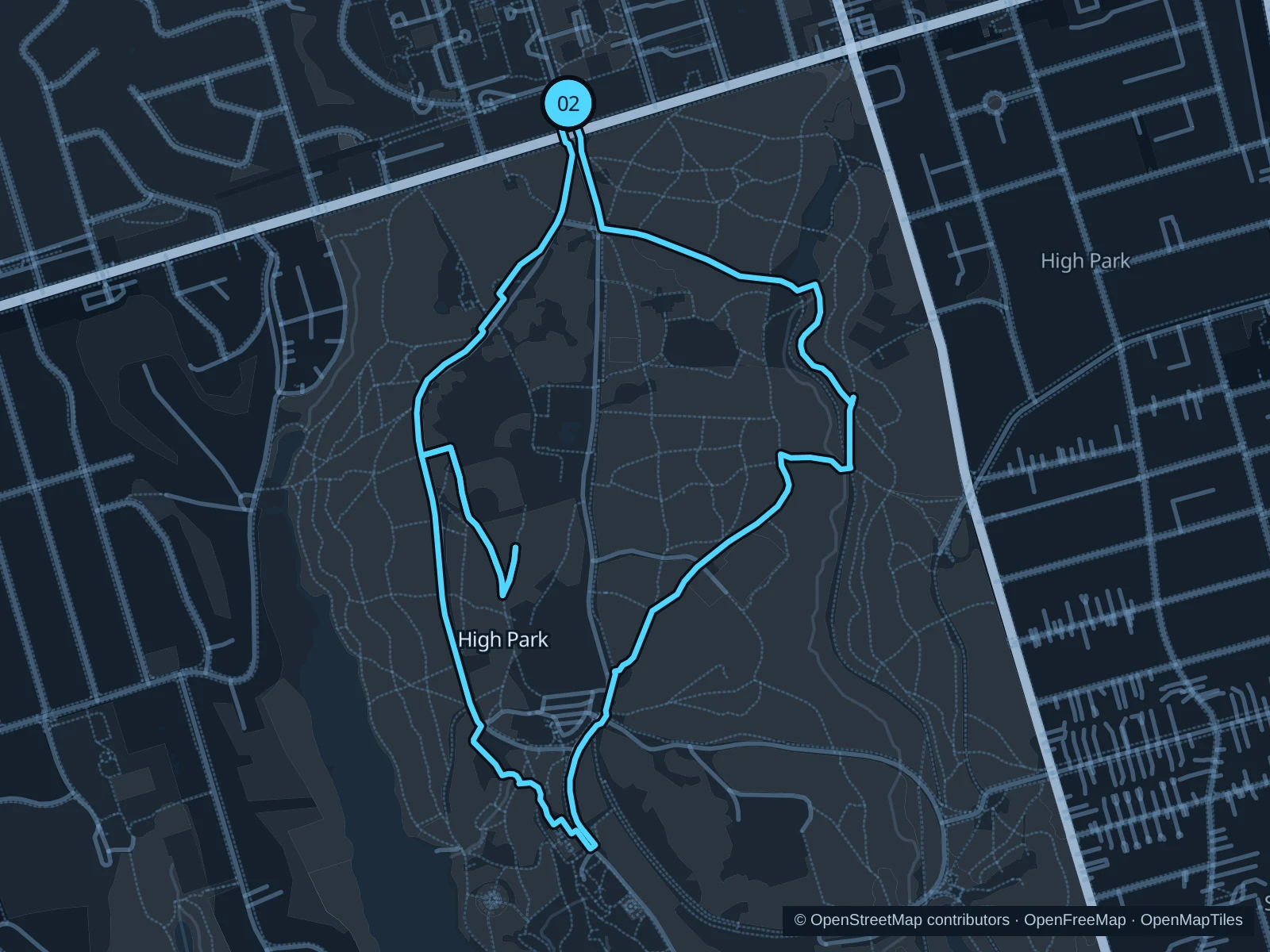
Map of the 3.8 km High Park run, with start and finish marked 02.
02 LoopOpen full-size map
Approx. distance3.8 km
Underfoot

Paved paths and compacted natural surfaces

02

Start here

At the Bloor Street park entrance, opposite High Park Avenue.

Head south through the park toward Grenadier Pond, return through the eastern paths and finish at Bloor Street.

Getting there

Walk from High Park subway station to the signed public path.

Before you go

Stay on marked paths to protect the sensitive woodland and watch for dogs near off-leash areas.

Park / route information

Get running directions on your phone

Toronto Islands boardwalk

The southern shore faces open Lake Ontario, with quieter paths beyond the ferry landings.

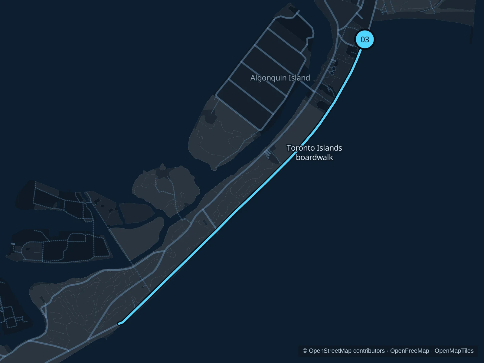
Map of the 2.9 km Toronto Islands boardwalk run, with start and finish marked 03.
03 Out & backOpen full-size map
Approx. distance2.9 km
Underfoot

Paved pedestrian paths

03

Start here

At the northern end of the Lakeshore Avenue boardwalk beside Ward’s Island Beach.

Follow the Lakeshore Avenue boardwalk southwest to its southern end, then return along the same boardwalk.

Getting there

Take the ferry from Jack Layton Ferry Terminal to Ward’s Island, then walk through the village to the beach boardwalk. The ferry crossing is not part of the saved running route.

Before you go

Check the return ferry and island access notices; the ferry trip is outside the saved running route.

Park / route information

Get running directions on your phone

Get running directions on your phone

Choose a distance and start at your hotel. RunFromHere plans a loop back to your door and guides you along it. Download the area’s map before you leave to use it offline.

The app generates its own routes from your chosen start; it doesn’t open the routes in this guide.

More places to run

Tommy Thompson Park

A long lakefront alternative with restricted weekday access; check the operator’s current hours.

Park / route information

Sources & route notes

Researched using the official visitor and park sources below; not checked on foot. Maps and GPX files use the same saved OpenStreetMap pedestrian paths. Distances are measured from that geometry and rounded for display; actual running distance can vary. Check local notices for access, gate hours and diversions.

Researched