Skip to routes
RunFromHere
Get the app
English
Illustrated panorama of Tokyo in white linework.

Tokyo

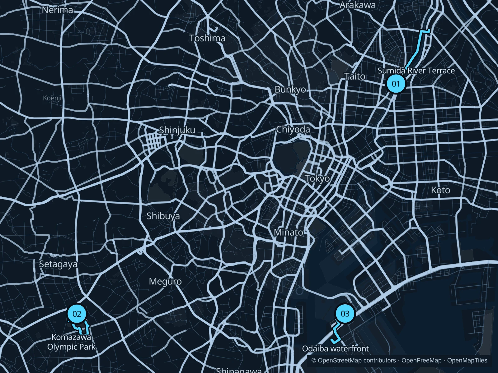
The Sumida River terraces suit an Asakusa stay, Komazawa makes a good park outing and Odaiba has sea views. Together they show three sides of Tokyo, all clear of shrine grounds.

Get running directions on your phone

Find a route near your hotel

The numbers mark each start. Distances exclude the journey from your accommodation.

Map data: © OpenStreetMap contributors · OpenFreeMap · OpenMapTiles

Where to run in Tokyo

Sumida River Terrace

River-level paths lead away from the temple crowds, with bridges framing the northern skyline.
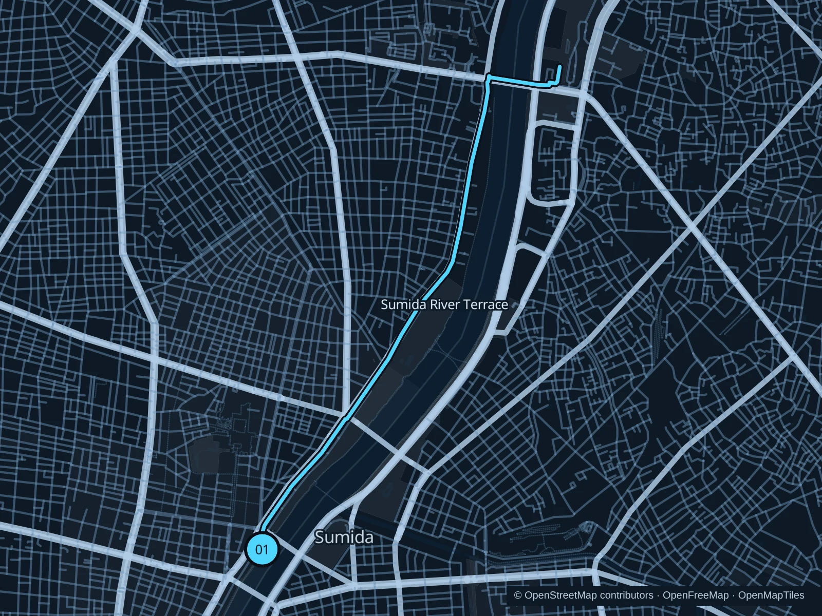
Map of the 5.5 km Sumida River Terrace run, with start and finish marked 01.
01 Out & backOpen full-size map
Approx. distance5.5 km
Underfoot

Paved pedestrian paths

01

Start here

On the west-bank terrace beside Azumabashi.

Follow the Sumida River Terrace to Shirahigebashi, then return along the same path.

Getting there

Walk from Asakusa Station to the signed public path.

Before you go

Bridge approaches can have steps; use signed terrace access and turn back at closures.

Park / route information

Get running directions on your phone
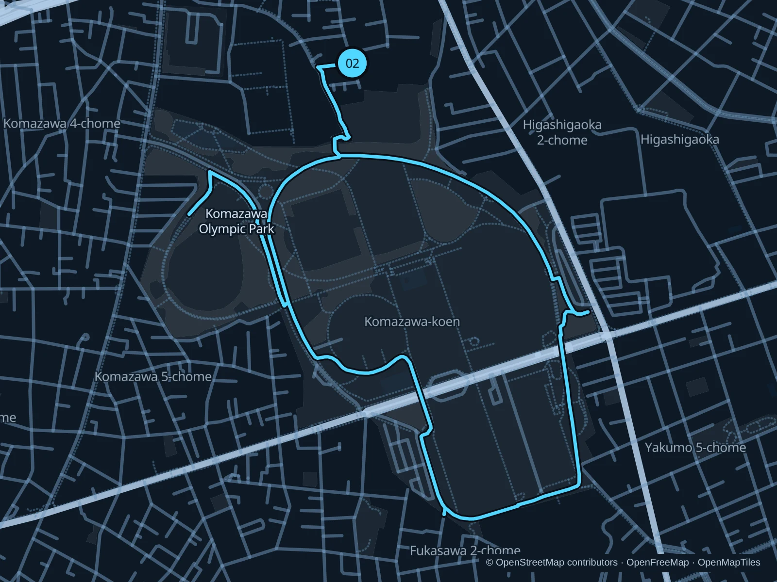
Komazawa Olympic Park

Trees and sports grounds make this park worth the trip out from the busiest hotel districts.

Map of the 3.6 km Komazawa Olympic Park run, with start and finish marked 02.
02 LoopOpen full-size map
Approx. distance3.6 km
Underfoot

Paved pedestrian paths

02

Start here

At the Komazawa-dori entrance.

Follow the connected paths around the western and southern sports grounds, then return on the eastern side.

Getting there

Walk from Komazawa-daigaku Station to the signed public path.

Before you go

Keep out of the blue cycling lane and follow the posted running direction.

Park / route information

Get running directions on your phone

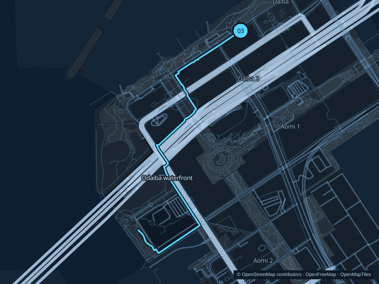
Odaiba waterfront

The bay opens out beyond the shopping complexes, with broad views towards Rainbow Bridge.

Map of the 3.7 km Odaiba waterfront run, with start and finish marked 03.
03 Out & backOpen full-size map
Approx. distance3.7 km
Underfoot

Paved pedestrian paths

03

Start here

On the Odaiba Marine Park promenade.

Follow the Odaiba waterfront to Shiokaze Park, then return along the same path.

Getting there

Walk from Odaiba-kaihinkoen Station to the signed public path.

Before you go

The waterfront is exposed to sun and wind; slow down at busy beach access points.

Park / route information

Get running directions on your phone

Get running directions on your phone

Choose a distance and start at your hotel. RunFromHere plans a loop back to your door and guides you along it. Download the area’s map before you leave to use it offline.

The app generates its own routes from your chosen start; it doesn’t open the routes in this guide.

More places to run

Sources & route notes

Researched using the official visitor and park sources below; not checked on foot. Maps and GPX files use the same saved OpenStreetMap pedestrian paths. Distances are approximate. Check local notices for access, gate hours and diversions.

Researched