Skip to routes
RunFromHere
Get the app
English
Illustrated panorama of Tallinn in white linework.

Tallinn

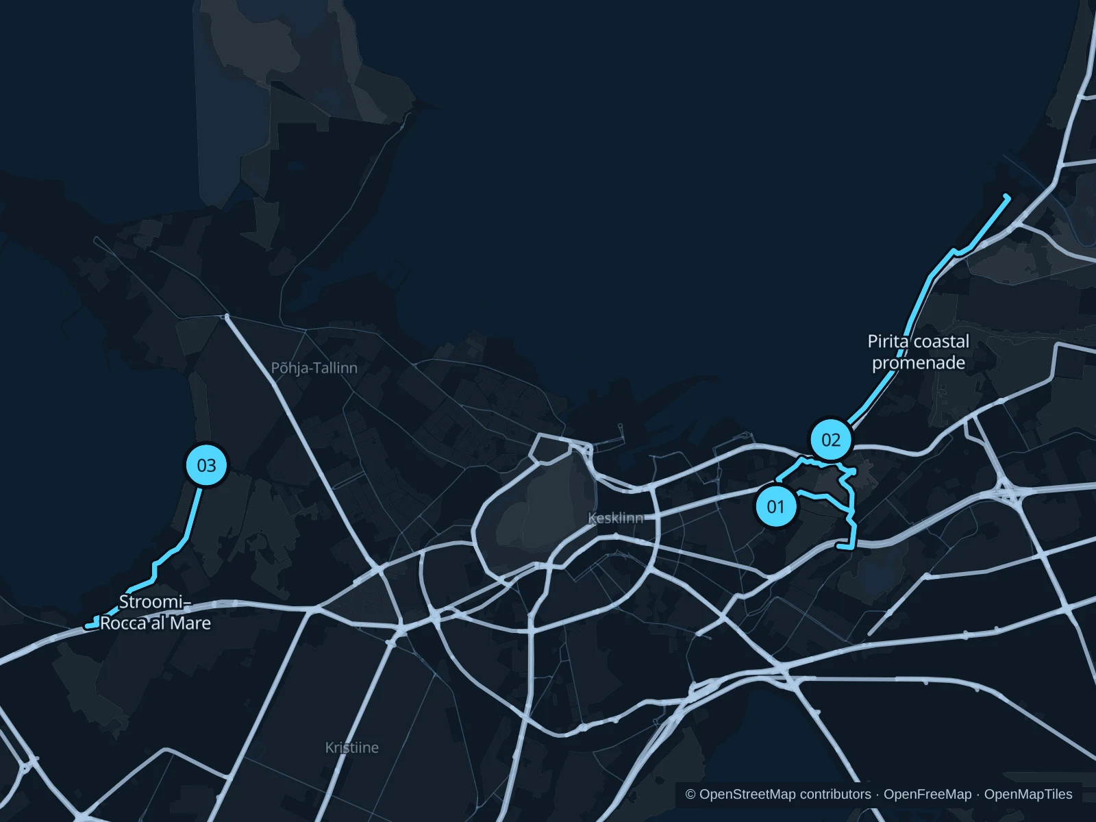
Kadriorg gives you a park run close to the city center, while the Pirita and Rocca al Mare promenades let you follow the coast for longer. Pick based on where you’re staying and which way the wind is blowing; the exposed waterfront feels very different from the sheltered park paths.

Get running directions on your phone

Find a route near your hotel

The numbers mark each start. Distances exclude the journey from your accommodation.

Map data: © OpenStreetMap contributors · OpenFreeMap · OpenMapTiles

Where to run in Tallinn

Kadriorg Park

A varied park loop past trees and lawns on public paths outside the palace buildings.
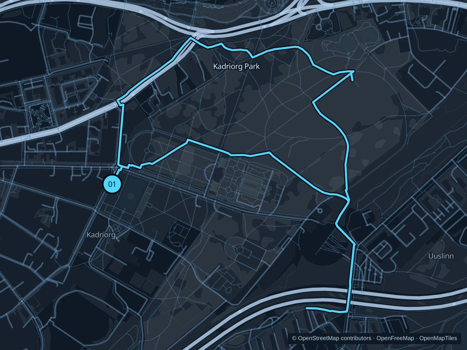
Map of the 3.7 km Kadriorg Park run, with start and finish marked 01.
01 LoopOpen full-size map
Approx. distance3.7 km
Underfoot

Park paths, paved and unpaved

01

Start here

Public western park path beside the Swan Pond, Luigetiik.

Circle the northern and eastern public park paths, then return through the southern park to the Swan Pond.

Getting there

Take the tram to the Kadriorg terminus or walk from the center to the public paths beside the Swan Pond.

Before you go

Stay out of the security areas around the palace, the presidential residence and the museums. Slow down on slopes and wet leaves, and check for closures due to tree work or storms. The route includes steps; walk these sections.

Park / route information

Get running directions on your phone
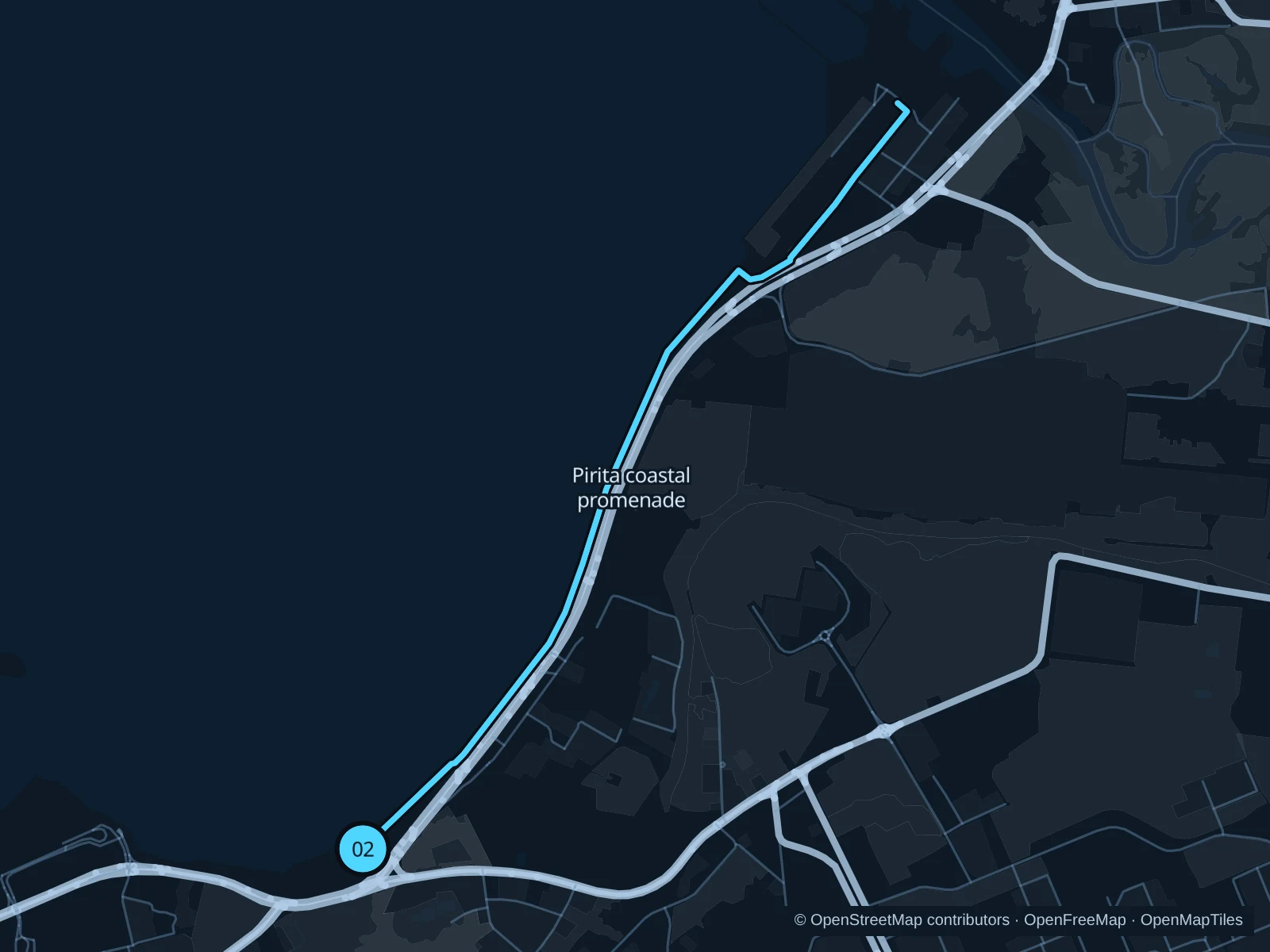
Pirita coastal promenade

An open coastal out-and-back toward the mouth of the Pirita River, with views across Tallinn Bay.

Map of the 6.2 km Pirita coastal promenade run, with start and finish marked 02.
02 Out & backOpen full-size map
Approx. distance6.2 km
Underfoot

Paved waterfront paths

02

Start here

Public seafront promenade just northeast of the Russalka memorial.

Follow the mapped paths to the marked turnaround on the public promenade near the mouth of the Pirita River, then return the same way.

Getting there

Walk from Kadriorg toward the Russalka memorial, using the designated crossings to reach the waterfront.

Before you go

Keep to the pedestrian side of the coastal corridor. Strong wind, freezing spray and ice can make this unsuitable; turn back before exposed sections become unsafe. The route includes steps; walk these sections.

Park / route information

Get running directions on your phone

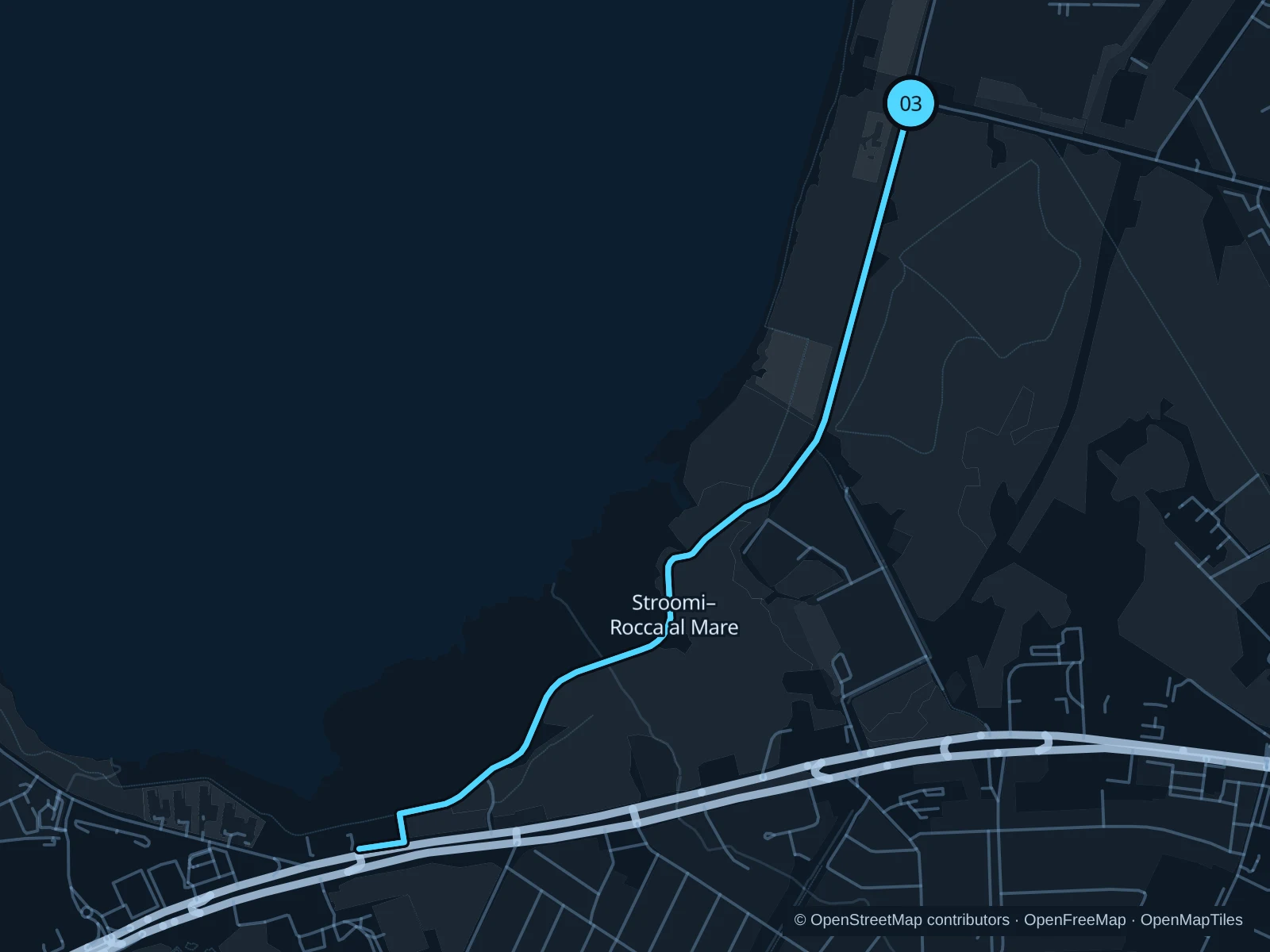
Stroomi & Rocca al Mare promenade

A coastal outing from Stroomi toward Rocca al Mare, using the public promenade and boardwalk connections.

Map of the 4.4 km Stroomi & Rocca al Mare promenade run, with start and finish marked 03.
03 Out & backOpen full-size map
Approx. distance4.4 km
Underfoot

Paved paths and boardwalk sections

03

Start here

Public promenade at the main Stroomi beach approach from Pelguranna.

Follow the mapped paths along the western promenade toward Rocca al Mare to the marked turnaround, then return the same way.

Getting there

Take a bus to Supelranna, then walk through the public beach park to the promenade start.

Before you go

Leave the beach and reed beds undisturbed, stay on the promenade and give cyclists room. Wooden surfaces can be slippery after rain or frost.

Park / route information

Get running directions on your phone

Get running directions on your phone

Choose a distance and start at your hotel. RunFromHere plans a loop back to your door and guides you along it. Download the area’s map before you leave to use it offline.

The app generates its own routes from your chosen start; it doesn’t open the routes in this guide.

More places to run

Nõmme woodland paths

A hillier, more wooded alternative southwest of the center. Use signed public recreational paths and check whether winter tracks are reserved for skiing.

Park / route information

Paljassaare nature trails

A quieter northern coastal alternative for an easy outing. Keep to marked public trails, respect wildlife restrictions and leave the reed beds alone.

Park / route information

Sources & route notes

Researched using the official visitor and park sources below; not checked on foot. Maps and GPX files use the same saved OpenStreetMap pedestrian paths. Distances are approximate. Check local notices for access, gate hours and diversions.

Researched