Skip to routes
RunFromHere
Get the app
English
Illustrated panorama of Sydney in white linework.

Sydney

If you’re staying downtown, the harbor is right there: choose the Botanic Garden foreshore or Barangaroo’s sandstone shoreline. Centennial Park offers a longer, greener run beyond the central business district.

Get running directions on your phone

Find a route near your hotel

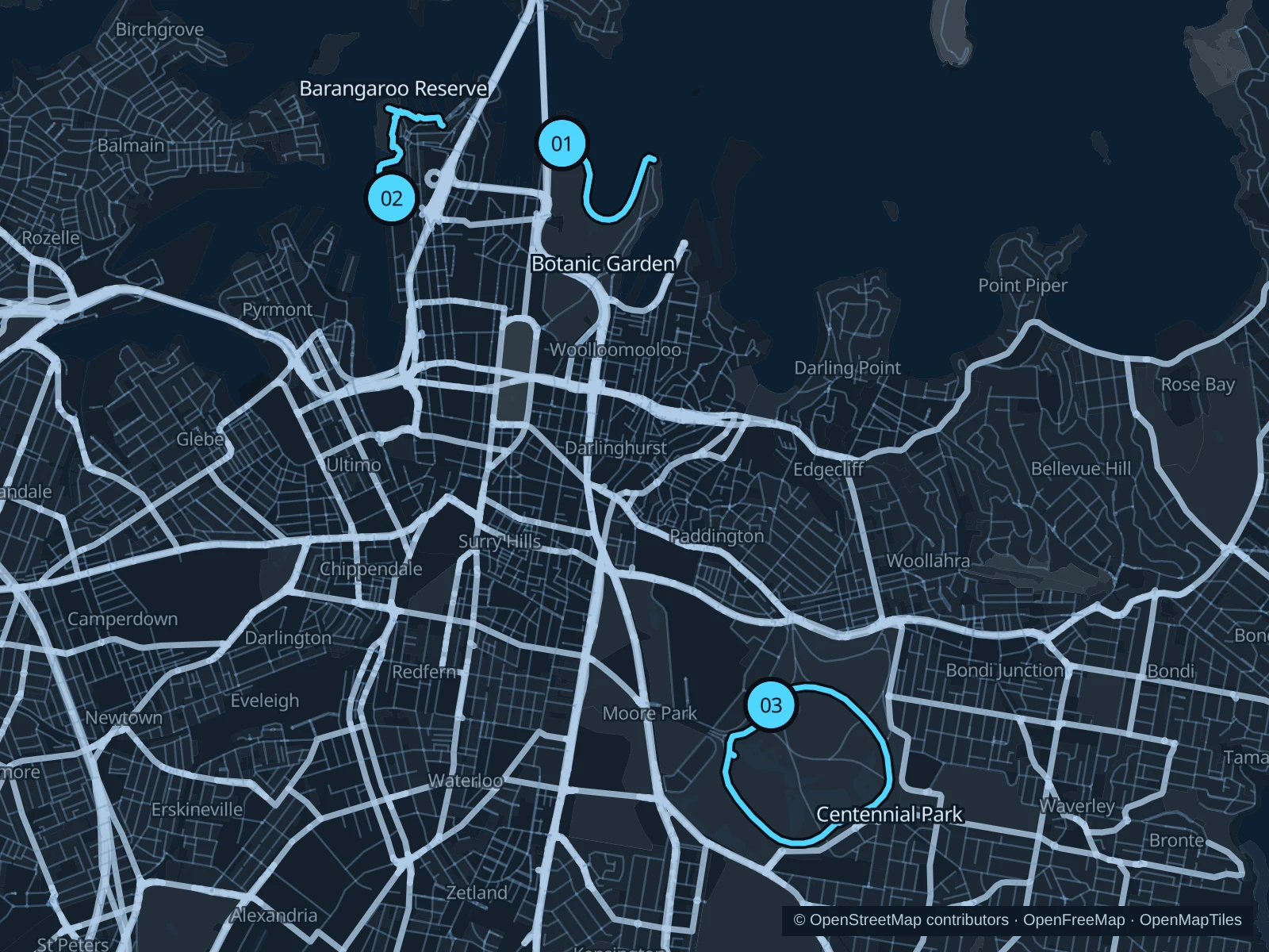
The numbers mark each start. Distances exclude the journey from your accommodation.

Map data: © OpenStreetMap contributors · OpenFreeMap · OpenMapTiles

Where to run in Sydney

Royal Botanic Garden foreshore

Farm Cove curves between the Opera House and Mrs Macquarie’s Point, keeping the harbor in view.
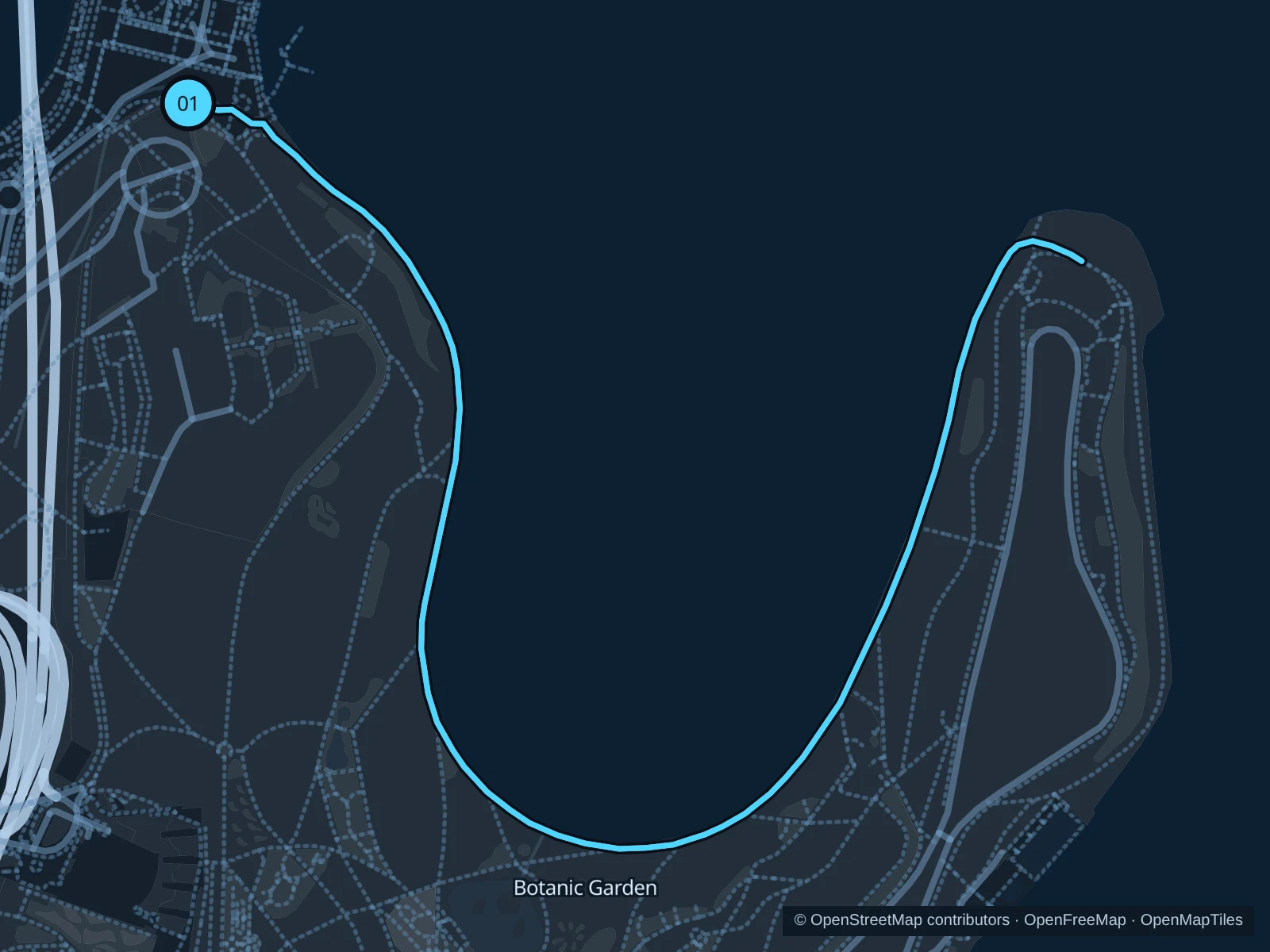
Map of the 2.8 km Royal Botanic Garden foreshore run, with start and finish marked 01.
01 Out & backOpen full-size map
Approx. distance2.8 km
Underfoot

Paved pedestrian paths

01

Start here

At Queen Elizabeth II Gate beside the Opera House.

Follow the Royal Botanic Garden foreshore to Mrs Macquarie’s Chair, then return along the same path.

Getting there

Walk from Circular Quay station to the signed public path.

Before you go

The garden opens at 7 a.m. and closes in the evening, with closing times varying by month. Check current hours and walk through crowded Opera House approaches.

Park / route information

Get running directions on your phone
Barangaroo Reserve

Sandstone coves and native plants give this short foreshore run a different harbor setting.

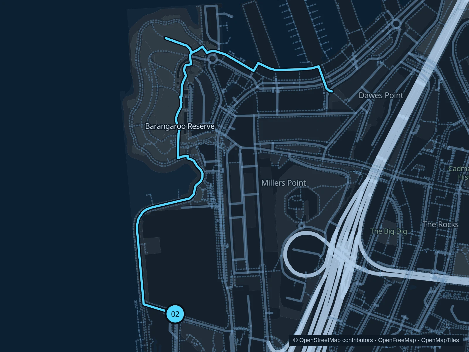
Map of the 2.8 km Barangaroo Reserve run, with start and finish marked 02.
02 Out & backOpen full-size map
Approx. distance2.8 km
Underfoot

Paved pedestrian paths

02

Start here

At Nawi Cove, Wulugul Walk.

Follow Wulugul Walk around Barangaroo Reserve to the public path on Hickson Road by the entrance to Walsh Bay Wharves 8 and 9, then return along the same route.

Getting there

Walk from Barangaroo Metro to the signed public path.

Before you go

Stay on the foreshore for gentler gradients; upper lawns require ramps or stairs.

Park / route information

Get running directions on your phone

Centennial Park

Ponds, open grass and old trees make for a longer park circuit away from the harbor hotels.

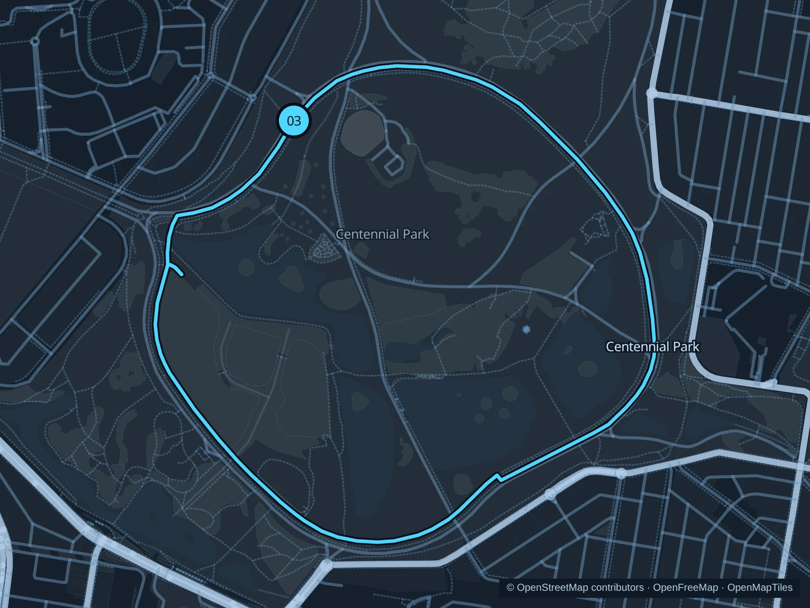
Map of the 3.7 km Centennial Park run, with start and finish marked 03.
03 LoopOpen full-size map
Approx. distance3.7 km
Underfoot

Paved paths and compacted natural surfaces

03

Start here

On the park walking path southeast of Paddington Gates.

Follow the connected pedestrian circuit inside Grand Drive around the park’s open grounds and ponds, then return to the same path junction.

Getting there

Walk from the Oxford Street bus stops to the signed public path.

Before you go

Stick to the walking and running paths, keep clear of the horse tracks and watch for road crossings.

Park / route information

Get running directions on your phone

Get running directions on your phone

Choose a distance and start at your hotel. RunFromHere plans a loop back to your door and guides you along it. Download the area’s map before you leave to use it offline.

The app generates its own routes from your chosen start; it doesn’t open the routes in this guide.

More places to run

Sources & route notes

Researched using the official visitor and park sources below; not checked on foot. Maps and GPX files use the same saved OpenStreetMap pedestrian paths. Distances are measured from that geometry and rounded for display; actual running distance can vary. Check local notices for access, gate hours and diversions.

Researched