Skip to routes
RunFromHere
Get the app
English
Illustrated panorama of Stuttgart in white linework.

Stuttgart

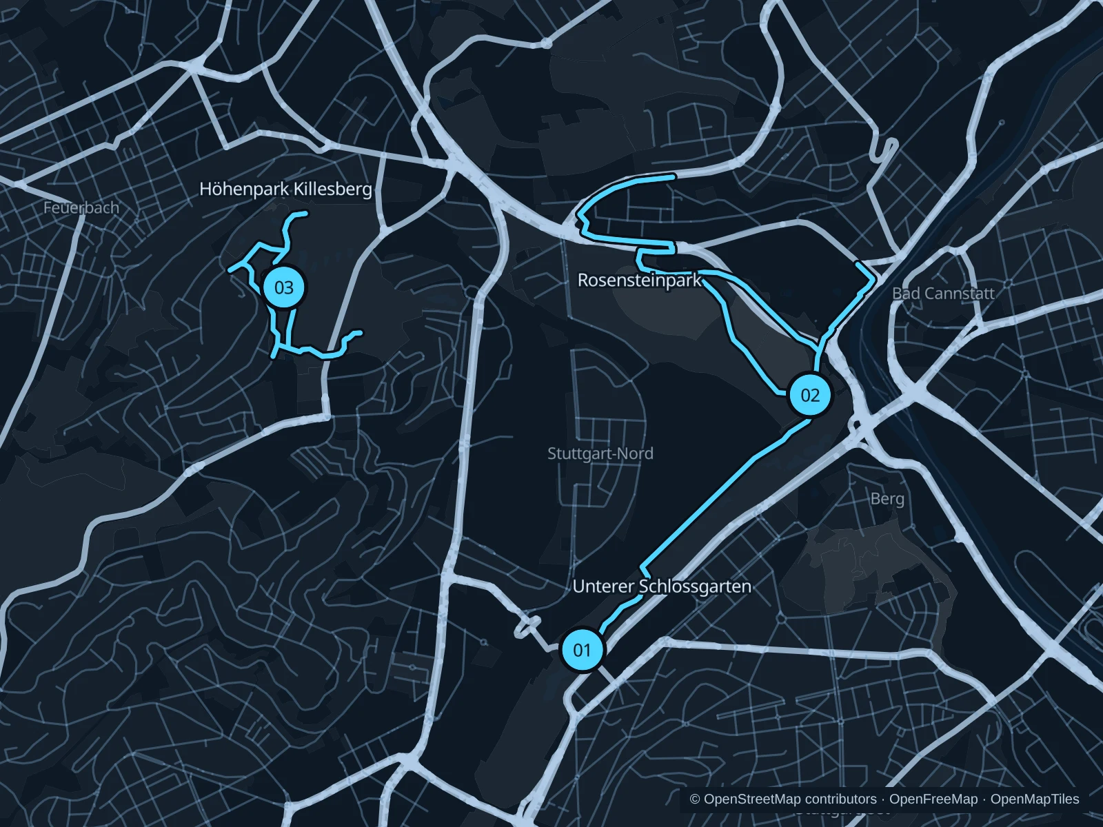
The Schlossgarten links central hotels with longer park paths. Rosensteinpark gives more woodland; Killesberg adds hills and views rather than another flat city circuit.

Get running directions on your phone

Find a route near your hotel

The numbers mark each start. Distances exclude the journey from your accommodation.

Map data: © OpenStreetMap contributors · OpenFreeMap · OpenMapTiles

Where to run in Stuttgart

Unterer Schlossgarten

Long garden avenues are the most practical central option when time is limited.
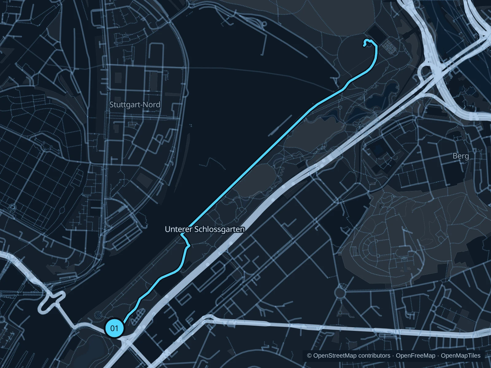
Map of the 3.7 km Unterer Schlossgarten run, with start and finish marked 01.
01 Out & backOpen full-size map
Approx. distance3.7 km
Underfoot

Park paths, paved and unpaved

01

Start here

Public park path at the Neckartor approach.

Follow the saved paths to the northern plane-tree avenue toward Berger Steg, then return along the same route.

Getting there

Use Neckartor station, then the signed park entrance.

Before you go

Construction around Stuttgart Hauptbahnhof affects some western connections. Follow current signs and keep clear of construction access.

Park / route information

Get running directions on your phone
Rosensteinpark

Old trees and broad lawns surround the museum, with a more wooded feel than the palace gardens.

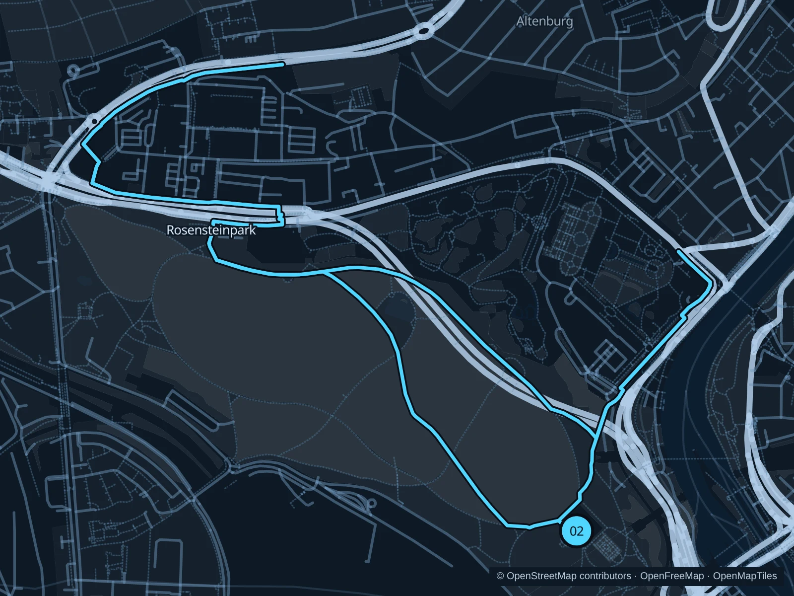
Map of the 6.3 km Rosensteinpark run, with start and finish marked 02.
02 LoopOpen full-size map
Approx. distance6.3 km
Underfoot

Park paths, paved and unpaved

02

Start here

Public path outside Museum Schloss Rosenstein.

Circle the western and northern park paths, returning outside the Wilhelma boundary.

Getting there

Walk into the park from Rosensteinbrücke or Nordbahnhof using public paths.

Before you go

This route stays outside paid zoo grounds. Expect slopes and check signs near roadworks and diversions at park entrances. The route includes steps; walk these sections. Slow to a walk at gates and barriers.

Park / route information

Get running directions on your phone

Höhenpark Killesberg

Rolling landscaped paths and city views make this the hilly option.

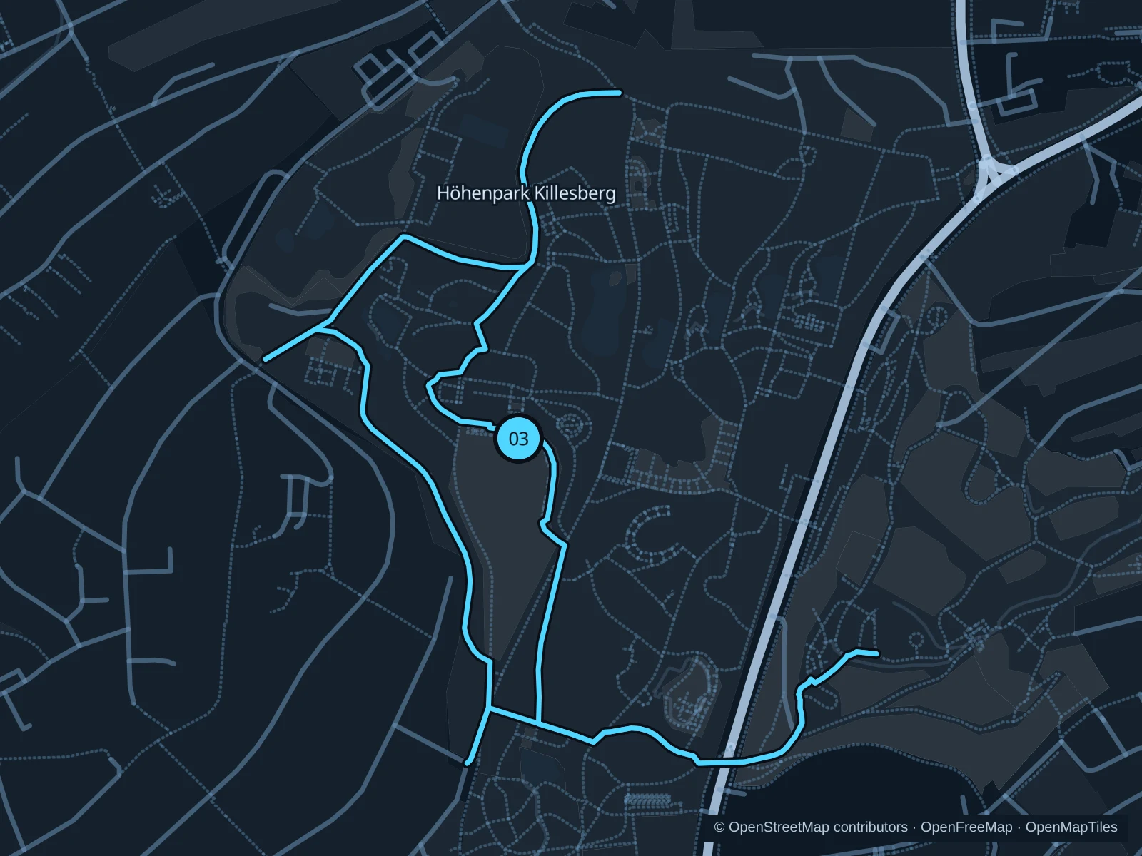
Map of the 3.1 km Höhenpark Killesberg run, with start and finish marked 03.
03 LoopOpen full-size map
Approx. distance3.1 km
Underfoot

Park paths, paved and unpaved

03

Start here

Public park path near Killesbergturm.

Follow the sloping park paths around the gardens and tower area, then return to the station side.

Getting there

Walk from Killesberg station into the public park.

Before you go

Walk the steps and railway crossings; keep clear of the small park train and check seasonal gate notices. Walk through gates and barriers.

Park / route information

Get running directions on your phone

Get running directions on your phone

Choose a distance and start at your hotel. RunFromHere plans a loop back to your door and guides you along it. Download the area’s map before you leave to use it offline.

The app generates its own routes from your chosen start; it doesn’t open the routes in this guide.

More places to run

Sources & route notes

Researched using the official visitor and park sources below; not checked on foot. Maps and GPX files use the same saved OpenStreetMap pedestrian paths. Distances are approximate. Check local notices for access, gate hours and diversions.

Researched