Skip to routes
RunFromHere
Get the app
English
Illustrated panorama of Seattle in white linework.

Seattle

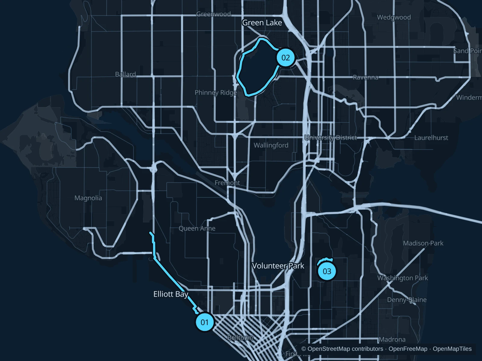
Elliott Bay puts ferries and the Olympic Mountains across the water from your run. Green Lake offers a continuous lakeside circuit north of Downtown; Volunteer Park is the shorter choice on Capitol Hill, with lawns and large trees around the museum.

Get running directions on your phone

Find a route near your hotel

The numbers mark each start. Distances exclude the journey from your accommodation.

Map data: © OpenStreetMap contributors · OpenFreeMap · OpenMapTiles

Where to run in Seattle

Elliott Bay · Myrtle Edwards to Smith Cove

A longer shoreline run past beach coves and working port scenery, with the bay open on one side for most of the way.
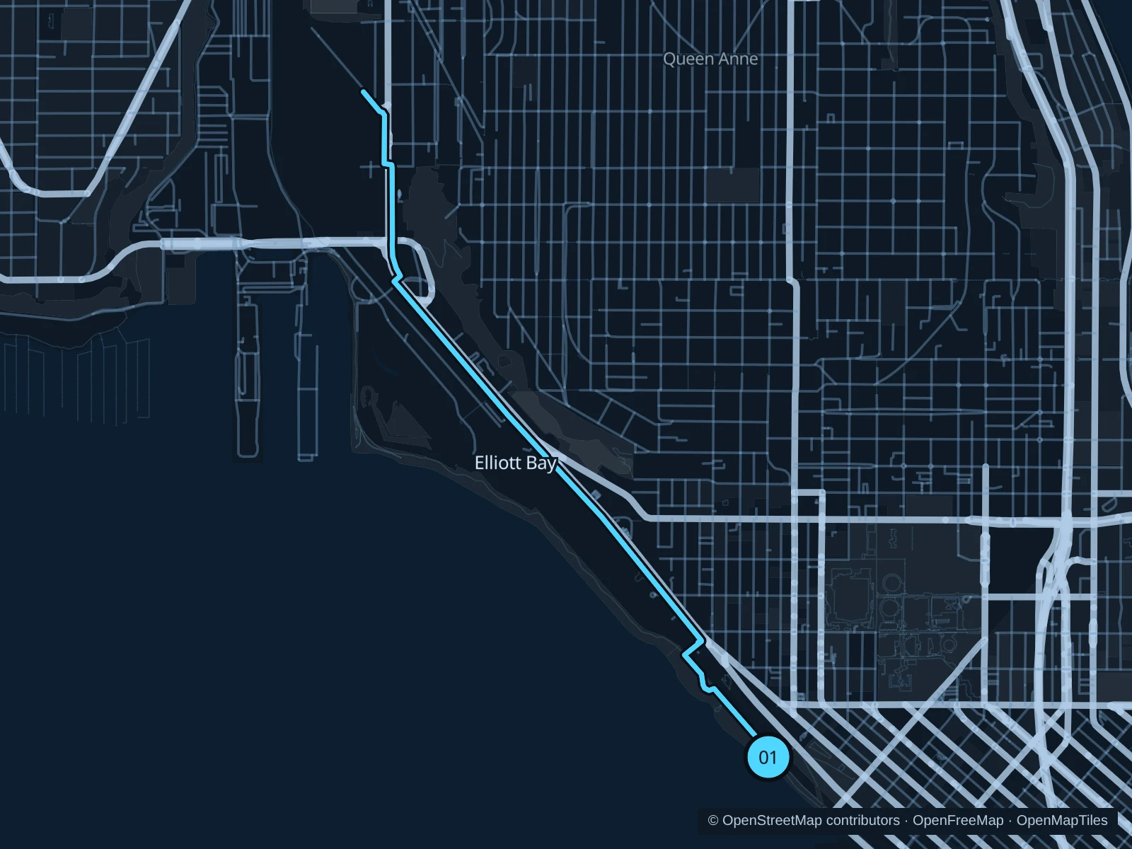
Map of the 6.2 km Elliott Bay · Myrtle Edwards to Smith Cove run, with start and finish marked 01.
01 Out & backOpen full-size map
Approx. distance6.2 km
Underfoot

Paved pedestrian and shared waterfront paths

01

Start here

On the public shoreline path below Olympic Sculpture Park, at the Myrtle Edwards Park approach.

Follow the pedestrian path northwest through Myrtle Edwards and Centennial parks, continue on the Elliott Bay Trail toward Smith Cove, then return.

Getting there

Walk west from Belltown toward Olympic Sculpture Park and take its public paths down to the waterfront.

Before you go

Where the trail splits for bikes, take the pedestrian side. Watch for port driveways and construction notices, and stay on the signed public trail.

Park / route information

Get running directions on your phone
Green Lake · inner path

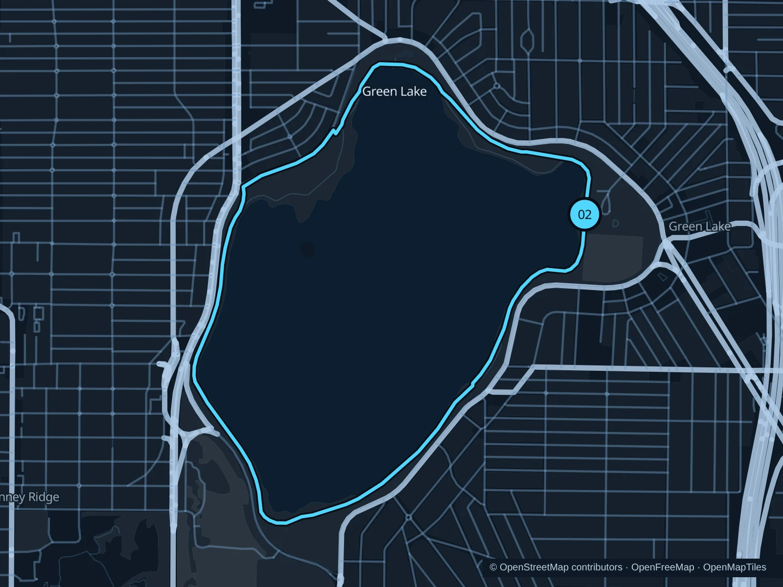
A lake circuit with beaches, rowing activity and trees along the shore. It avoids the repeated street crossings of an urban loop.

Map of the 4.4 km Green Lake · inner path run, with start and finish marked 02.
02 LoopOpen full-size map
Approx. distance4.4 km
Underfoot

Paved lakeside path

02

Start here

On the lake path by Green Lake Community Center on the eastern shore.

Keep to the inner lakeside path for a full circuit, passing the northern shore and the southern boating area before returning.

Getting there

Take a bus to the Green Lake neighborhood and walk from East Green Lake Drive to the community center.

Before you go

Follow the current marked lanes and courtesy signs: this is a popular shared path. Check local notices for diversions around lake facilities.

Park / route information

Get running directions on your phone

Volunteer Park

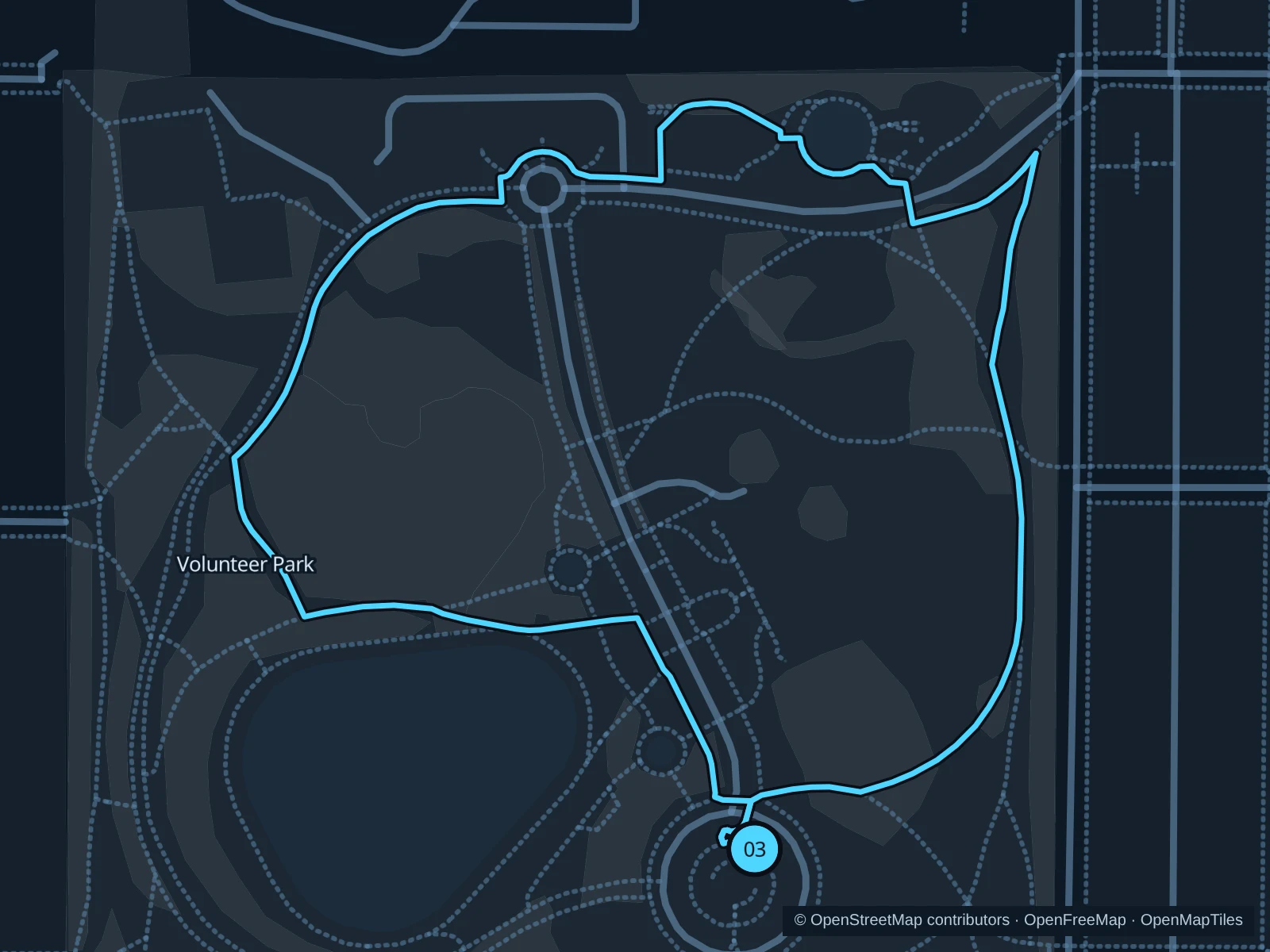
A short park run around lawns and the Asian Art Museum, with big trees and some elevation change, set above the city streets.

Map of the 1.3 km Volunteer Park run, with start and finish marked 03.
03 LoopOpen full-size map
Approx. distance1.3 km
Underfoot

Paved park paths and some steps

03

Start here

At the public park path near the water tower, inside the southern entrance.

Follow the paths north past the museum toward the conservatory, then return on the eastern and southern park paths.

Getting there

Walk north from Capitol Hill station along neighborhood streets to the park’s southern side.

Before you go

The conservatory and museum have their own admission rules. Stay on outdoor public paths and avoid the fenced reservoir and garden beds.

Park / route information

Get running directions on your phone

Get running directions on your phone

Choose a distance and start at your hotel. RunFromHere plans a loop back to your door and guides you along it. Download the area’s map before you leave to use it offline.

The app generates its own routes from your chosen start; it doesn’t open the routes in this guide.

More places to run

Alki Beach

Across the bay in West Seattle, the waterfront trail looks back toward Downtown. Plan the trip to the beach as its own outing rather than tacking it onto a Downtown run.

Park / route information

Burke-Gilman Trail

This long shared trail works well if you’re staying in Fremont or the University District. Pick a public trailhead, watch for cyclists and check crossings and construction before you extend your run.

Park / route information

Sources & route notes

Researched using the official visitor and park sources below; not checked on foot. Maps and GPX files use the same saved OpenStreetMap pedestrian paths. Distances are approximate. Check local notices for access, gate hours and diversions.

Researched