Skip to routes
RunFromHere
Get the app
English
Illustrated panorama of São Paulo in white linework.

São Paulo

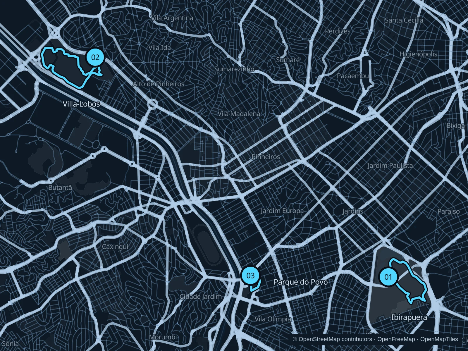
São Paulo’s parks make running simpler than threading through its traffic. Ibirapuera combines lakes and wooded paths, Villa-Lobos has open sports parkland, and Parque do Povo gives the Itaim office district a compact green circuit. Choose the park nearest your accommodation and check its gates.

Get running directions on your phone

Find a route near your hotel

The numbers mark each start. Distances exclude the journey from your accommodation.

Map data: © OpenStreetMap contributors · OpenFreeMap · OpenMapTiles

Where to run in São Paulo

Parque Ibirapuera

Lakes, trees and modernist cultural buildings make a varied park outing south of Avenida Paulista.
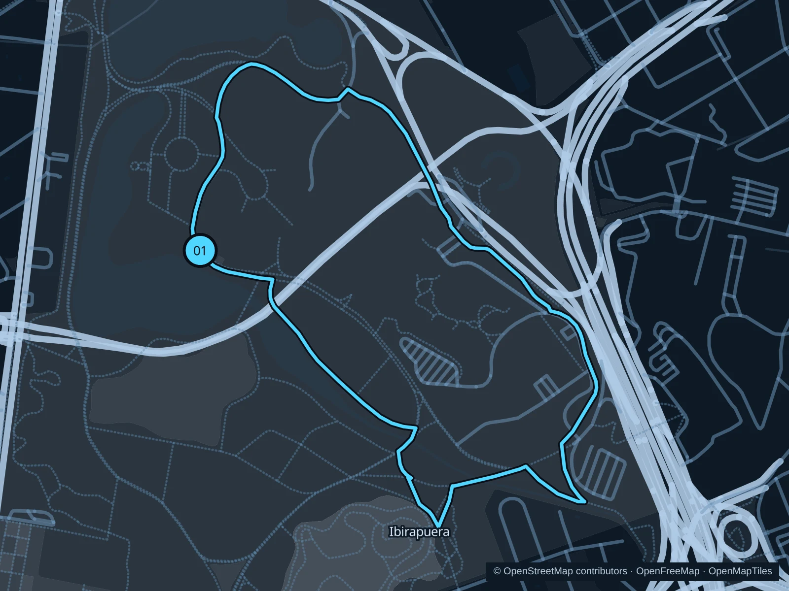
Map of the 2.9 km Parque Ibirapuera run, with start and finish marked 01.
01 LoopOpen full-size map
Approx. distance2.9 km
Underfoot

Paved and compacted park paths

01

Start here

On the public path in the western part of the park, on the Avenida República do Líbano side.

Follow the public park paths around the lake areas and southern greenery, then return past the northern lawns to the western starting path.

Getting there

Take a bus along Avenida República do Líbano and use a signed public park entrance.

Before you go

Use marked running paths and respect cycle-only sections and closed building areas. Gate opening times vary; check the entrance you plan to use.

Park / route information

Get running directions on your phone
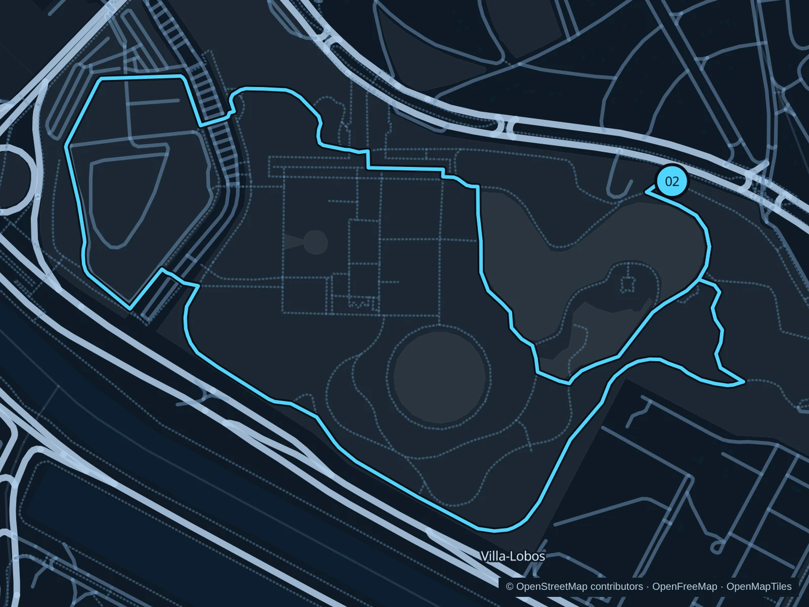
Parque Villa-Lobos

Open lawns and sports facilities give this western park a different feel from Ibirapuera’s lakes and cultural buildings.

Map of the 4.5 km Parque Villa-Lobos run, with start and finish marked 02.
02 LoopOpen full-size map
Approx. distance4.5 km
Underfoot

Paved park walking and running paths

02

Start here

Inside the main public entrance from Avenida Professor Fonseca Rodrigues.

Follow the public walking and running paths around the park’s sports areas and lawns, returning to the main entrance.

Getting there

Approach from Villa-Lobos–Jaguaré rail station using the signed public streets and park access.

Before you go

Use the running and walking route rather than the separate cycle circuit. Check event notices and gate hours; parts of the circuit have little shade.

Park / route information

Get running directions on your phone

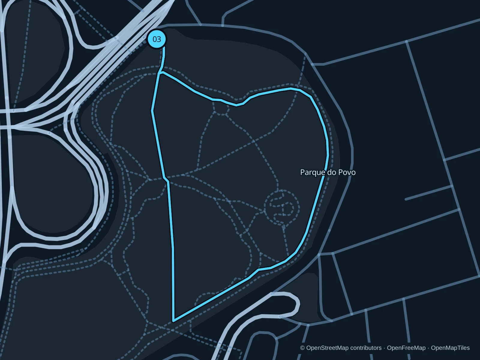
Parque do Povo · Mário Pimenta Camargo

Two short park circuits with a brief public approach, useful for an easy outing near Itaim Bibi’s offices and hotels. The saved distance includes both laps.

Map of the 1.8 km Parque do Povo · Mário Pimenta Camargo run, with start and finish marked 03.
03 LoopOpen full-size map
Approx. distance1.8 km
Underfoot

Paved park paths

03

Start here

On the public approach path on Avenida Henrique Chamma, north of Parque do Povo.

Follow the public approach into the park, circle the outdoor park paths and return to the northern approach. Repeat this circuit once for the saved total.

Getting there

Walk from Itaim Bibi hotels or use the public street approach from Vila Olímpia station.

Before you go

Keep clear of courts and planted beds. Follow posted park rules and current gate hours; the riverside road outside the park is not part of this run.

Park / route information

Get running directions on your phone

Get running directions on your phone

Choose a distance and start at your hotel. RunFromHere plans a loop back to your door and guides you along it. Download the area’s map before you leave to use it offline.

The app generates its own routes from your chosen start; it doesn’t open the routes in this guide.

More places to run

Parque Augusta

A small central park in Consolação, better for a brief outing on foot than distance training. Check its opening hours and give other visitors space.

Park / route information

Parque Bruno Covas

The west-bank linear park beside Rio Pinheiros offers longer distances. Access is through designated gateways and bridges, so check the operator’s current access map before traveling.

Park / route information

Sources & route notes

Researched using the official visitor and park sources below; not checked on foot. Maps and GPX files use the same saved OpenStreetMap pedestrian paths. Distances are approximate. Check local notices for access, gate hours and diversions.

Researched