Skip to routes
RunFromHere
Get the app
English
Illustrated panorama of Santiago de Chile in white linework.

Santiago de Chile

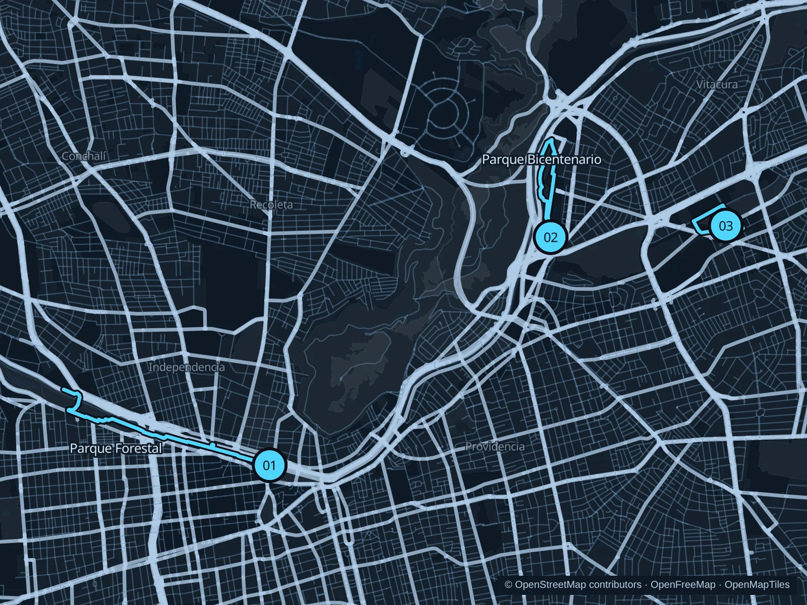
The parks beside the Mapocho give central Santiago a longer running corridor. Farther east, Bicentenario and Araucano offer shorter park circuits in Vitacura and Las Condes. These routes stay in the city’s lower parks; Cerro San Cristóbal is a separate, hillier outing.

Get running directions on your phone

Find a route near your hotel

The numbers mark each start. Distances exclude the journey from your accommodation.

Map data: © OpenStreetMap contributors · OpenFreeMap · OpenMapTiles

Where to run in Santiago de Chile

Parque Forestal · Parque de los Reyes

A longer run linking central parkland with the broader lawns west of the historic center, following the Mapocho.
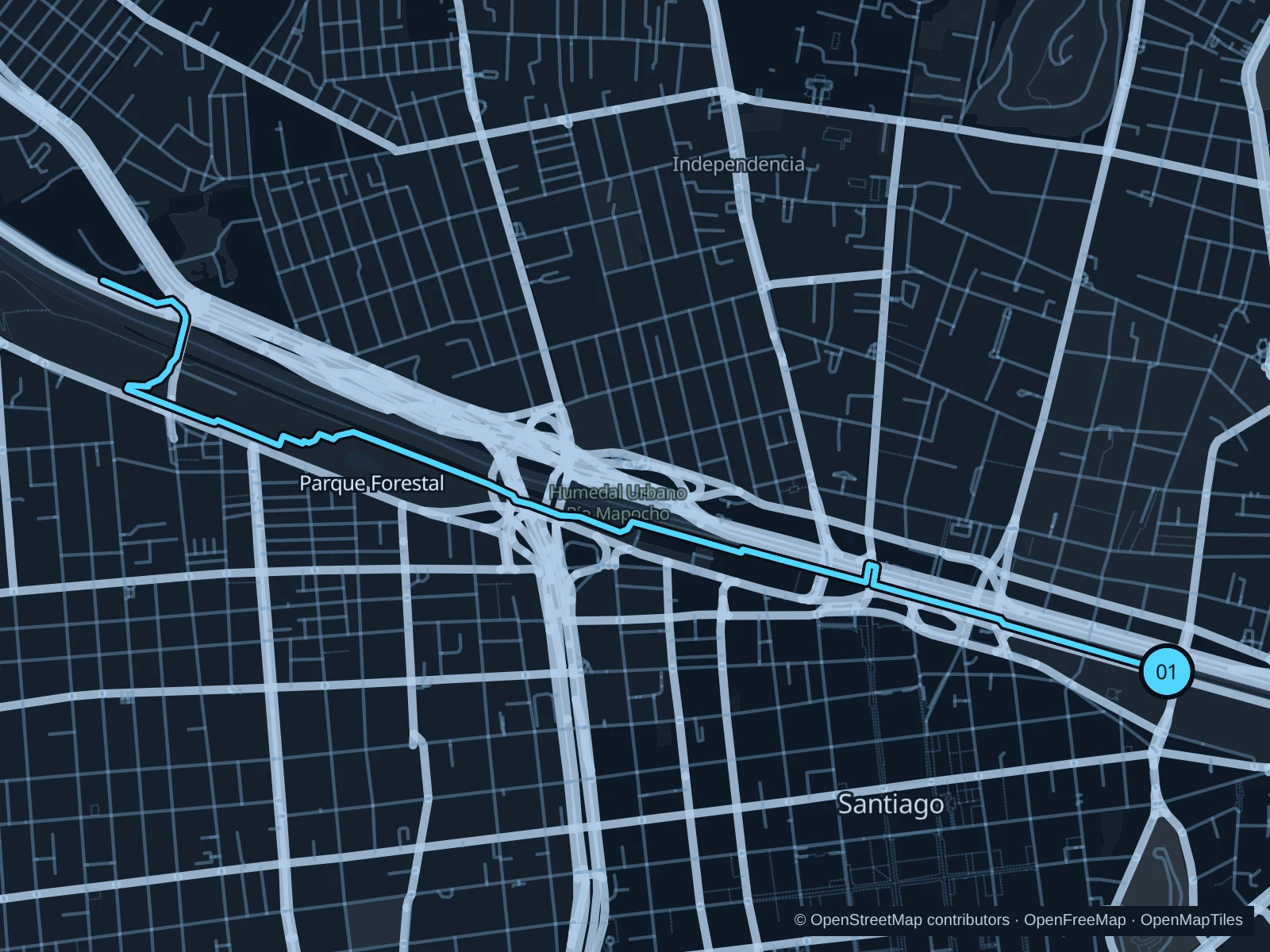
Map of the 7.3 km Parque Forestal · Parque de los Reyes run, with start and finish marked 01.
01 Out & backOpen full-size map
Approx. distance7.3 km
Underfoot

Park footpaths, gravel and connecting sidewalks

01

Start here

On the public park path north of Museo Nacional de Bellas Artes.

Follow Parque Forestal west past the museum district, use public sidewalks and crossings to reach Parque de los Reyes, then head back.

Getting there

Walk north from Bellas Artes metro station toward the museum and the public park paths.

Before you go

The parks do not form an uninterrupted traffic-free trail. Use pedestrian crossings at bridges and connecting roads, and respect event fencing.

Park / route information Park / route information

Get running directions on your phone
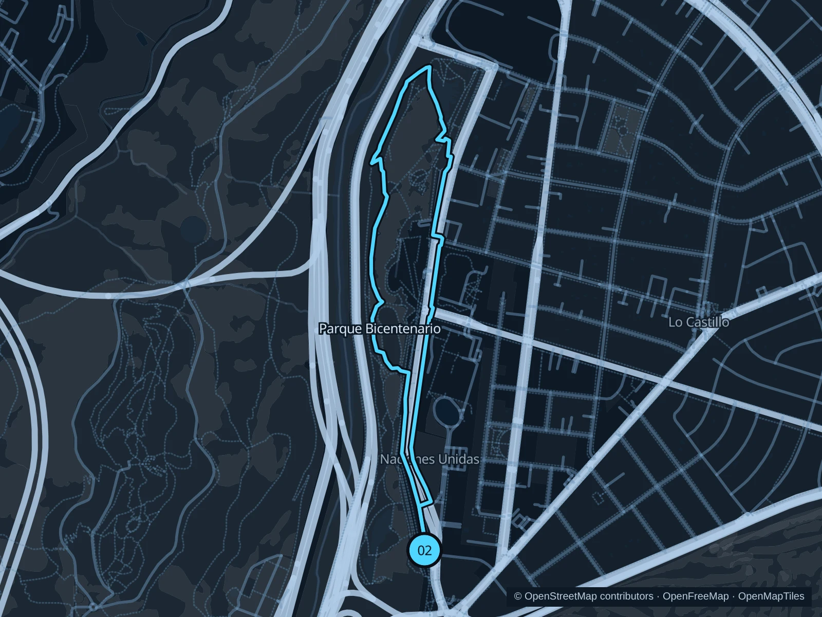
Parque Bicentenario de Vitacura

Open lawns, planted paths and ornamental lagoons give this park a different feel from the central river corridor.

Map of the 3.0 km Parque Bicentenario de Vitacura run, with start and finish marked 02.
02 LoopOpen full-size map
Approx. distance3.0 km
Underfoot

Paved and compacted park paths

02

Start here

On the public paths at the south end of the park, near Avenida Bicentenario.

Circle the park on public paths past the lagoons and northern lawns, then return south.

Getting there

Take a bus to Vitacura and walk to a signed entrance on Avenida Bicentenario.

Before you go

Stay outside the lagoon enclosures and give waterbirds space. Fairs and exhibitions use parts of the park, so follow current access signs.

Park / route information

Get running directions on your phone

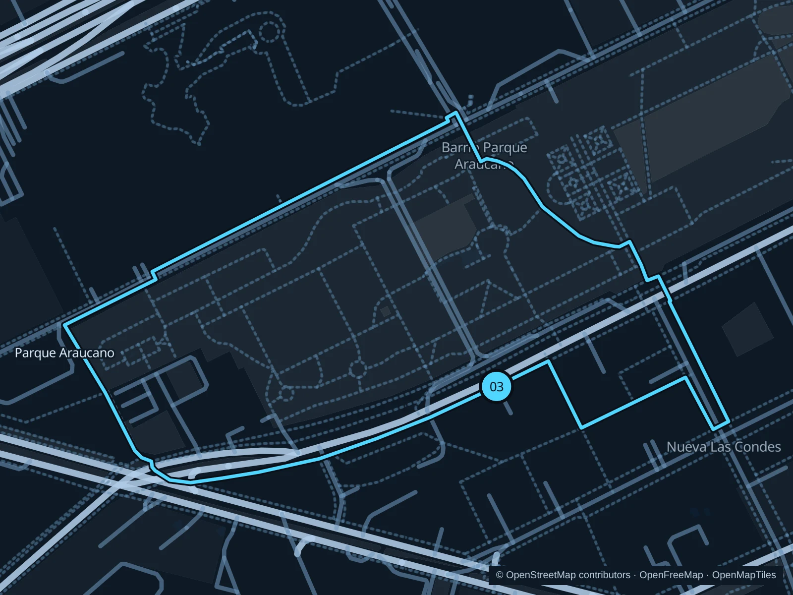
Parque Araucano

A compact park circuit near the office and shopping district, with lawns, trees and sports areas rather than a long river stretch.

Map of the 1.8 km Parque Araucano run, with start and finish marked 03.
03 LoopOpen full-size map
Approx. distance1.8 km
Underfoot

Paved and compacted park paths

03

Start here

At the public park paths by Avenida Presidente Riesco.

Follow the outer public paths around the park’s lawns, staying out of the sports courts and visitor attractions.

Getting there

Walk from Manquehue metro station along the sidewalks toward Avenida Presidente Riesco and the park.

Before you go

The park includes separate sports and leisure facilities. Stay on public paths, slow down near play areas and watch for posted gate notices and event diversions.

Park / route information

Get running directions on your phone

Get running directions on your phone

Choose a distance and start at your hotel. RunFromHere plans a loop back to your door and guides you along it. Download the area’s map before you leave to use it offline.

The app generates its own routes from your chosen start; it doesn’t open the routes in this guide.

More places to run

Cerro San Cristóbal

The hill in Parque Metropolitano adds substantial climbing and city views. Check pedestrian entrances and current park conditions before planning a hill run.

Park / route information

Parque Quinta Normal

A separate park on the city’s west side, beside Quinta Normal metro, with trees and public paths around the museum district. Check gate times, and note that museum admission areas are separate from the public park.

Park / route information

Sources & route notes

Researched using the official visitor and park sources below; not checked on foot. Maps and GPX files use the same saved OpenStreetMap pedestrian paths. Distances are approximate. Check local notices for access, gate hours and diversions.

Researched