Skip to routes
RunFromHere
Get the app
English
Illustrated panorama of San Sebastián in white linework.

San Sebastián

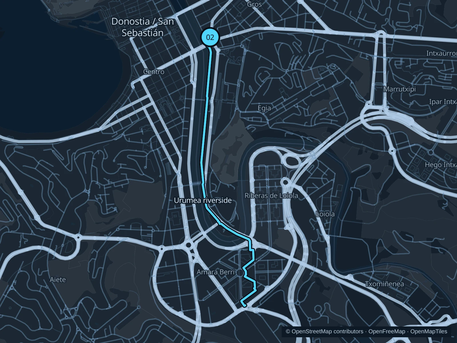
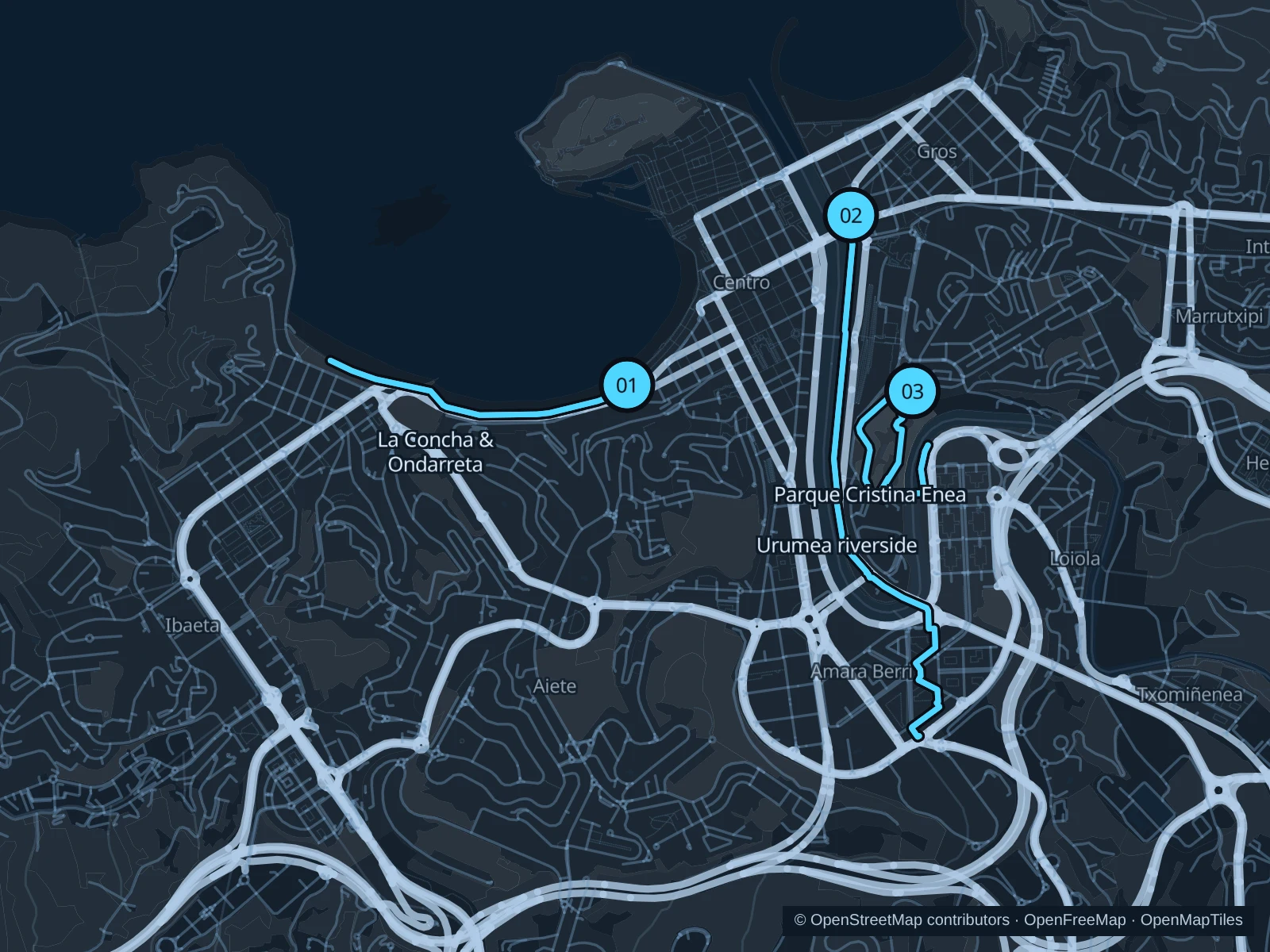
La Concha puts a scenic promenade run beside central hotels. The Urumea offers a longer river route, while Cristina Enea adds a quieter park circuit near the rail and bus stations.

Get running directions on your phone

Find a route near your hotel

The numbers mark each start. Distances exclude the journey from your accommodation.

Map data: © OpenStreetMap contributors · OpenFreeMap · OpenMapTiles

Where to run in San Sebastián

La Concha & Ondarreta

A bay-front run on the promenade, linking the central beach with Ondarreta.
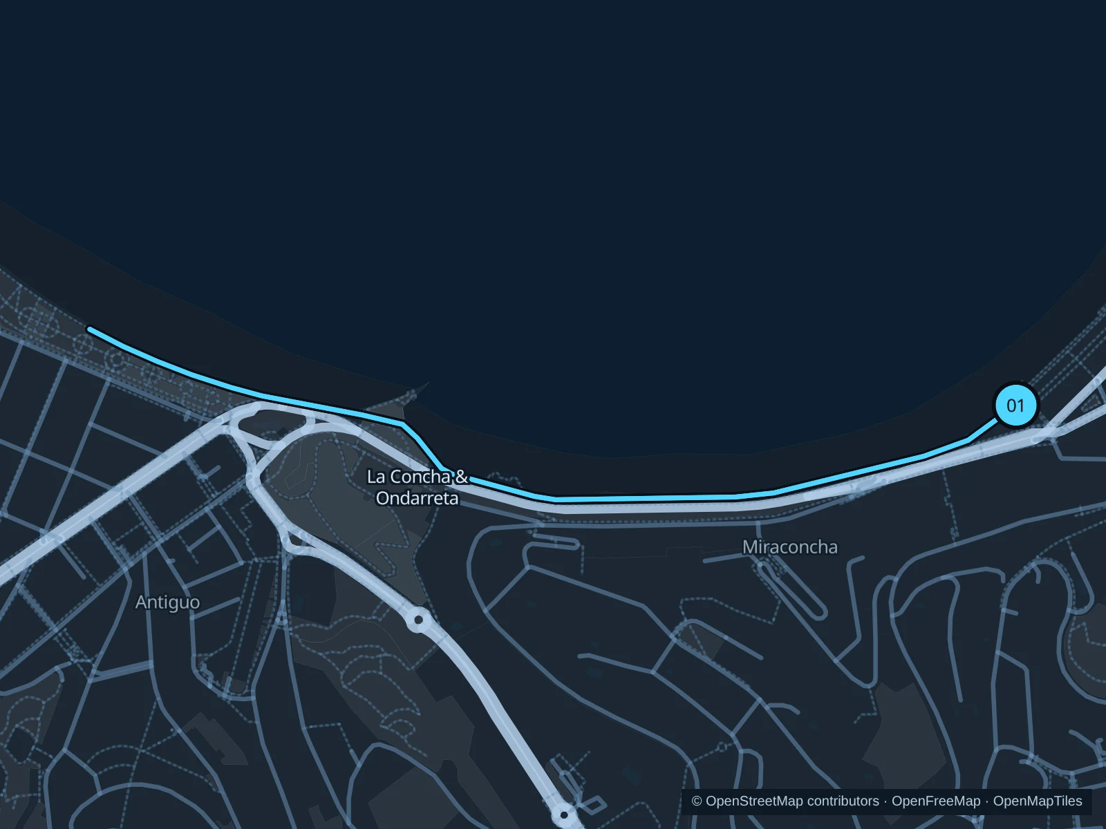
Map of the 2.5 km La Concha & Ondarreta run, with start and finish marked 01.
01 Out & backOpen full-size map
Approx. distance2.5 km
Underfoot

Paved paths

01

Start here

Public La Concha promenade beside La Perla, outside the bathing facility.

Follow the mapped paths toward the Ondarreta promenade on the western side of the bay, then return along the same route.

Getting there

Walk from the center to the public promenade, staying off the separate bike lane.

Before you go

Go early to avoid beach crowds. Waves, sand and storm closures can affect the promenade; don’t go past coastal barriers.

Park / route information

Get running directions on your phone
Urumea riverside

Follow the river inland for a longer outing away from the busiest bay-front stretch.

Map of the 5.0 km Urumea riverside run, with start and finish marked 02.
02 Out & backOpen full-size map
Approx. distance5.0 km
Underfoot

Paved paths

02

Start here

Public east-bank promenade beside Puente de la Zurriola, outside the Kursaal.

Follow the saved riverside paths toward Riberas de Loiola, then return along the same route.

Getting there

Walk from Gros or the centre to the Kursaal-side river path.

Before you go

Pause at road crossings and share the paths with cyclists. The return follows the same mapped bank and connections.

Park / route information

Get running directions on your phone

Parque Cristina Enea

A wooded hill circuit near Tabakalera, with more shade and slopes than the promenade.

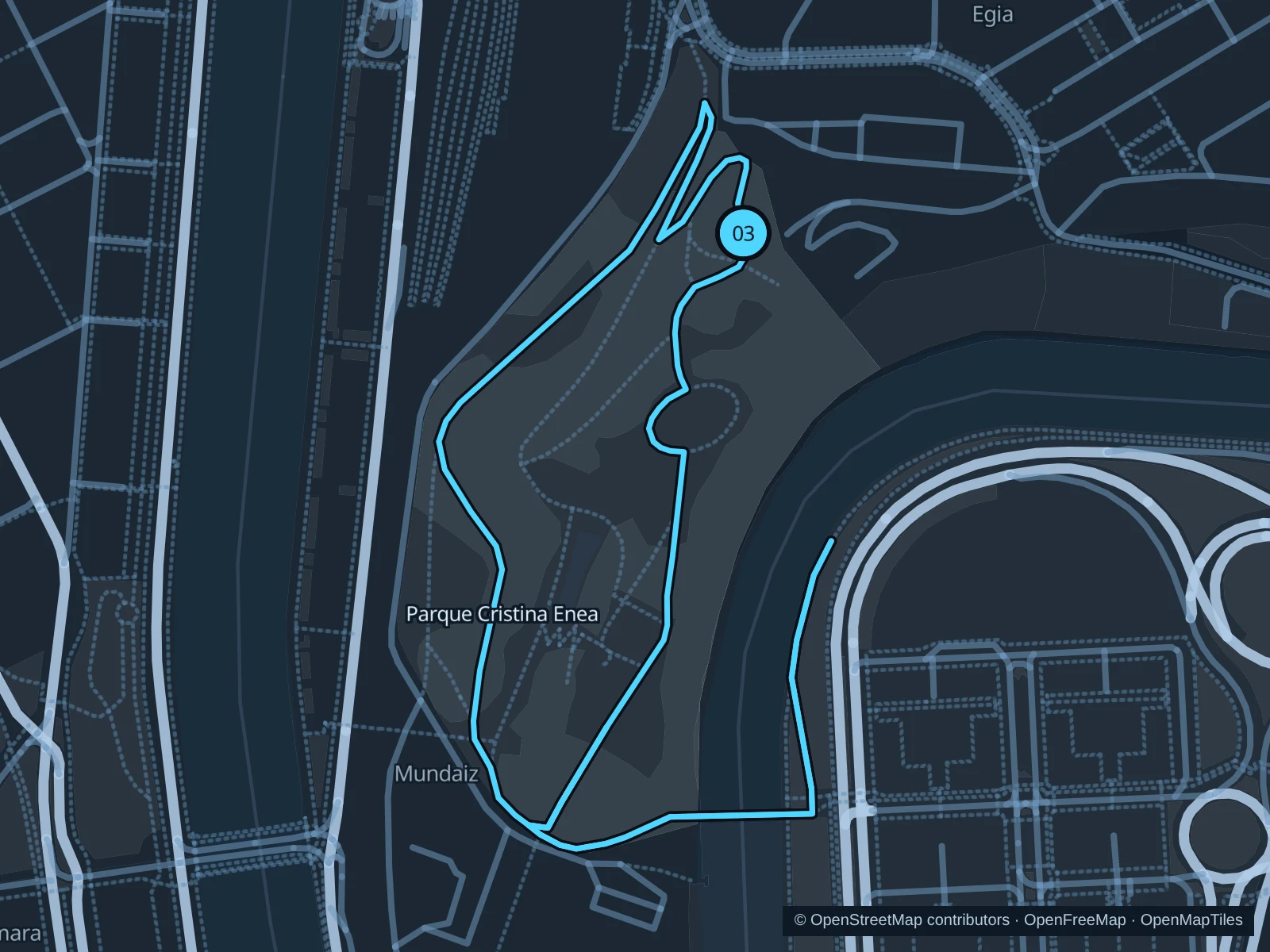
Map of the 2.4 km Parque Cristina Enea run, with start and finish marked 03.
03 LoopOpen full-size map
Approx. distance2.4 km
Underfoot

Park paths, paved and unpaved

03

Start here

Public park entrance behind Tabakalera, on Paseo Duque de Mandas.

Circle the wooded public paths through the park and return to the Tabakalera-side gate.

Getting there

Walk from Tabakalera to the nearby public park entrance on Paseo del Duque de Mandas.

Before you go

Check gate hours and use daylight. Give peacocks, swans and walkers space; steep shaded corners can be wet. Slow to a walk at gates and barriers.

Park / route information

Get running directions on your phone

Get running directions on your phone

Choose a distance and start at your hotel. RunFromHere plans a loop back to your door and guides you along it. Download the area’s map before you leave to use it offline.

The app generates its own routes from your chosen start; it doesn’t open the routes in this guide.

More places to run

Zurriola promenade

The Kursaal–Sagüés seafront suits stays in Gros; watch for surfers and people crossing from the beach.

Park / route information

Sources & route notes

Researched using the official visitor and park sources below; not checked on foot. Maps and GPX files use the same saved OpenStreetMap pedestrian paths. Distances are approximate. Check local notices for access, gate hours and diversions.

Researched