Skip to routes
RunFromHere
Get the app
English
Illustrated panorama of Salzburg in white linework.

Salzburg

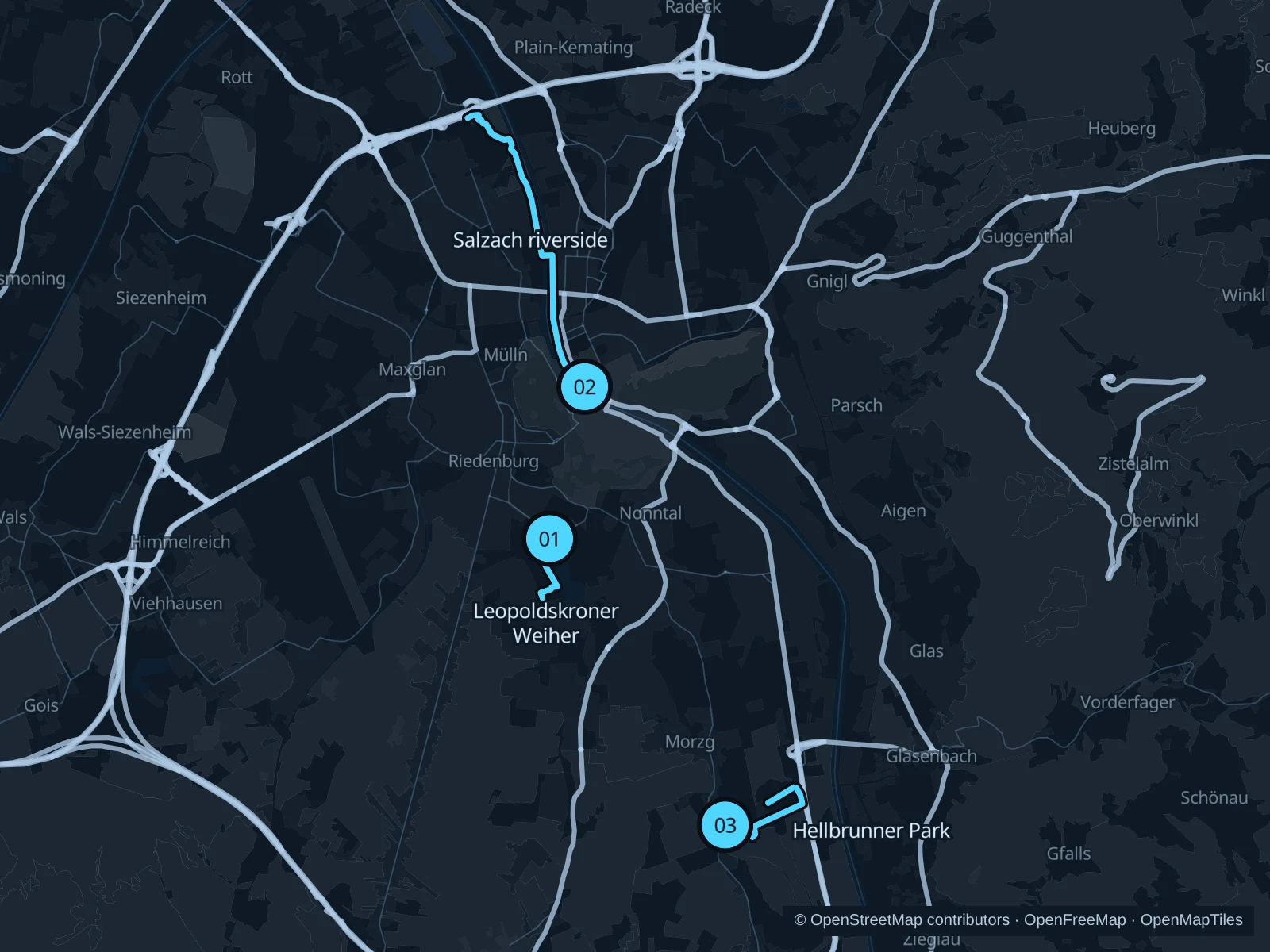
The Salzach gives you a central riverside run. Hellbrunner Park adds public paths south of the city, while Leopoldskron offers a shorter waterside outing below the fortress.

Get running directions on your phone

Find a route near your hotel

The numbers mark each start. Distances exclude the journey from your accommodation.

Map data: © OpenStreetMap contributors · OpenFreeMap · OpenMapTiles

Where to run in Salzburg

Leopoldskroner Weiher

A pond-side run with views of the palace and fortress from the public shore.
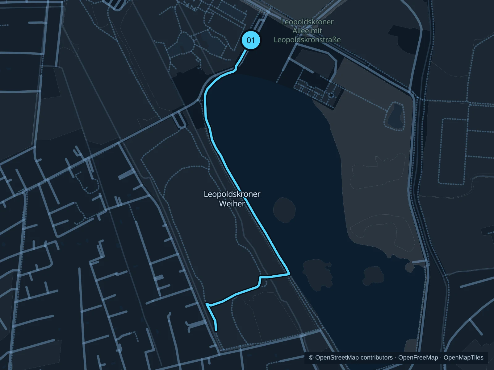
Map of the 1.6 km Leopoldskroner Weiher run, with start and finish marked 01.
01 Out & backOpen full-size map
Approx. distance1.6 km
Underfoot

Park paths, paved and unpaved

01

Start here

Public shore path by the northern end of Leopoldskroner Weiher.

Follow the western shore paths toward the southern end of the pond, then return the same way.

Getting there

Walk from Riedenburg to the public pond paths via Leopoldskronstraße.

Before you go

The palace gardens are private. Stay on public shore paths, give birds space and return along the saved route.

Park / route information

Get running directions on your phone
Salzach · Makartsteg to Lehen

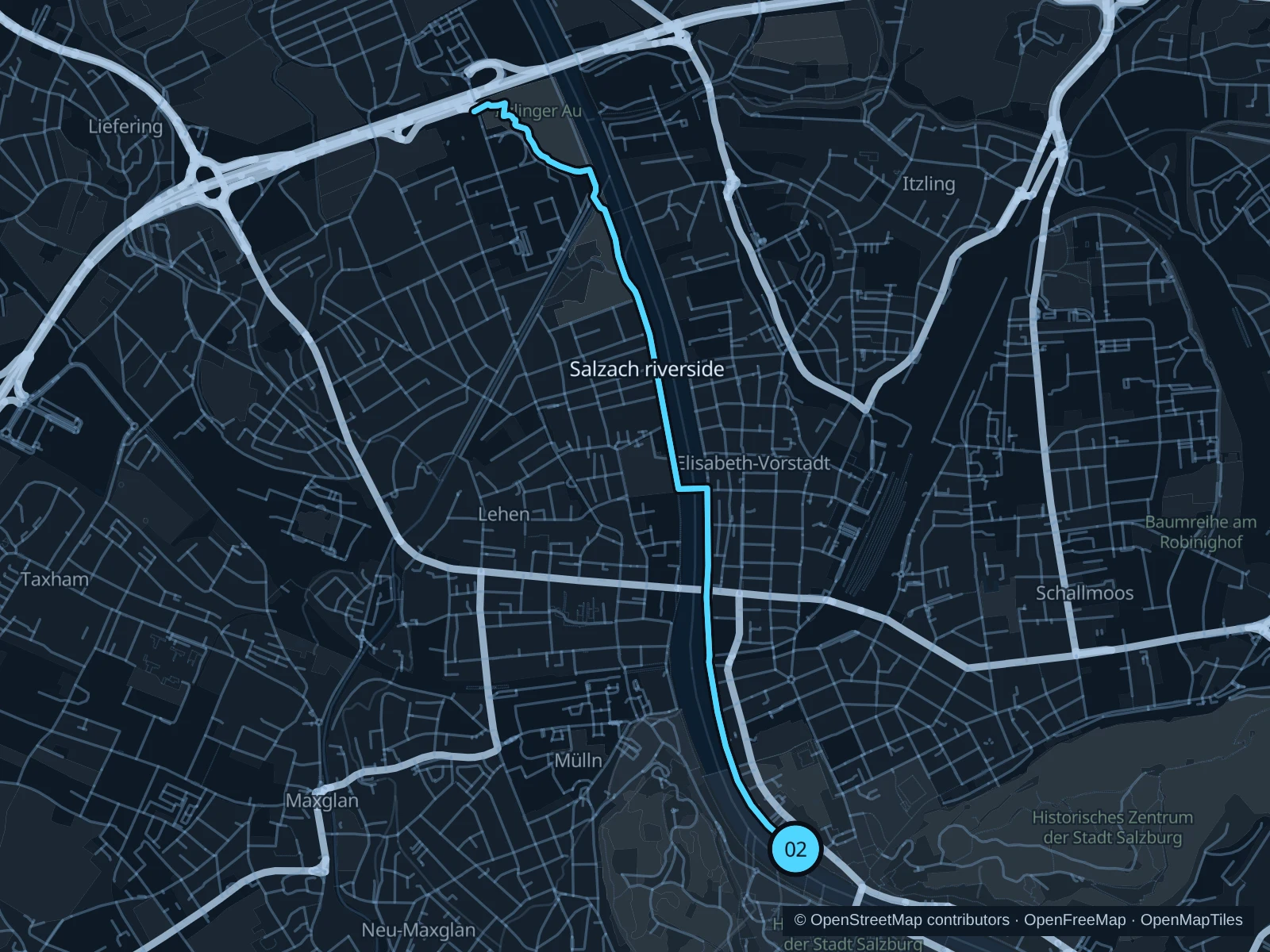
A steady river run below bridges and central facades, extending north beyond the old town.

Map of the 6.6 km Salzach · Makartsteg to Lehen run, with start and finish marked 02.
02 Out & backOpen full-size map
Approx. distance6.6 km
Underfoot

Paved waterfront paths

02

Start here

Right-bank path beside Makartsteg, Mirabell side.

Follow the saved riverside paths north toward Lehen, then return along the same route.

Getting there

Walk from Mirabellplatz to Makartsteg and the river path.

Before you go

Share the path with bicycles. Lower riverside sections can close after high water or become icy in winter. The route includes steps; walk these sections. Slow to a walk at gates and barriers.

Park / route information

Get running directions on your phone

Hellbrunner Park

Park and woodland paths near Hellbrunn Palace make a green alternative to the river.

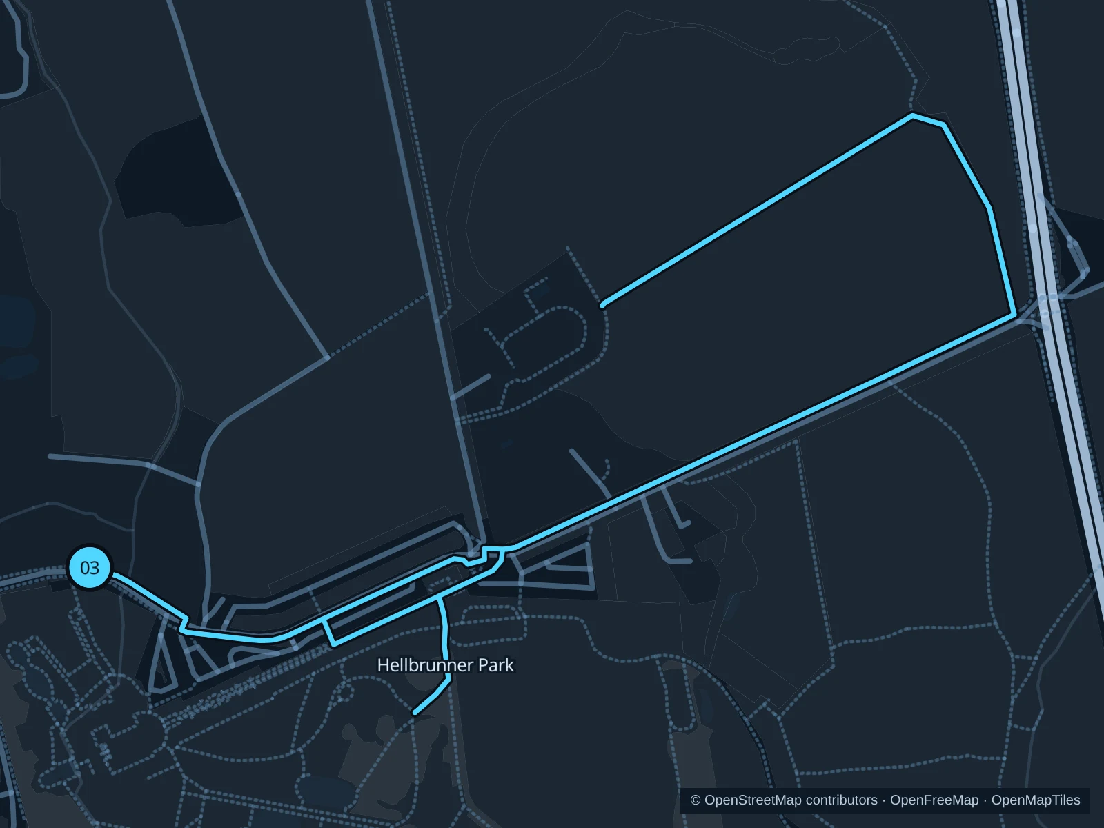
Map of the 3.0 km Hellbrunner Park run, with start and finish marked 03.
03 LoopOpen full-size map
Approx. distance3.0 km
Underfoot

Park paths, paved and unpaved

03

Start here

Public northern park approach outside the palace courtyards.

Circle the public park paths east and north of the palace, outside the ticketed trick fountains and zoo.

Getting there

Take public transport to Hellbrunn and walk to the park entrance.

Before you go

Check park opening times and follow signs for public paths. Woodland slopes and leaves can be slippery. Slow to a walk at gates and barriers.

Park / route information

Get running directions on your phone

Get running directions on your phone

Choose a distance and start at your hotel. RunFromHere plans a loop back to your door and guides you along it. Download the area’s map before you leave to use it offline.

The app generates its own routes from your chosen start; it doesn’t open the routes in this guide.

More places to run

Mönchsberg

Hill paths above the old town add climbs, steps and viewpoints; choose daylight for unfamiliar sections.

Park / route information

Hellbrunner Allee

The long tree-lined avenue offers a separate running corridor between the city and Hellbrunn. Use the public avenue and check crossings and local access signs.

Park / route information

Sources & route notes

Researched using the official visitor and park sources below; not checked on foot. Maps and GPX files use the same saved OpenStreetMap pedestrian paths. Distances are approximate. Check local notices for access, gate hours and diversions.

Researched