Skip to routes
RunFromHere
Get the app
English
Illustrated panorama of Phuket in white linework.

Phuket

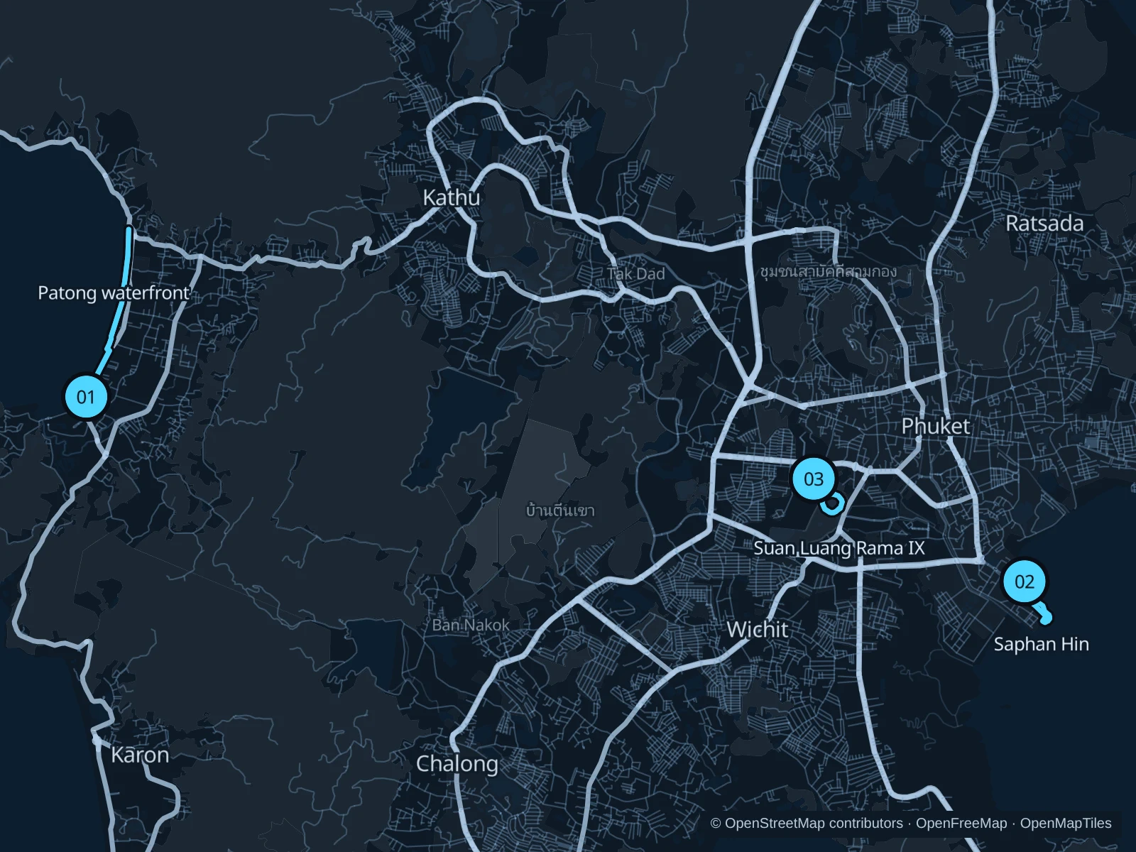
Phuket’s running options depend on where you stay. Patong has a busy beachfront, while Saphan Hin and Suan Luang offer park settings near Phuket Town. Each is a separate trip across an island with steep roads, so use transport between areas, run in cooler hours and plan for humidity and rain.

Get running directions on your phone

Find a route near your hotel

The numbers mark each start. Distances exclude the journey from your accommodation.

Map data: © OpenStreetMap contributors · OpenFreeMap · OpenMapTiles

Where to run in Phuket

Patong · beachfront walkways

An urban beachfront out-and-back, useful when staying in Patong without traveling across the island.
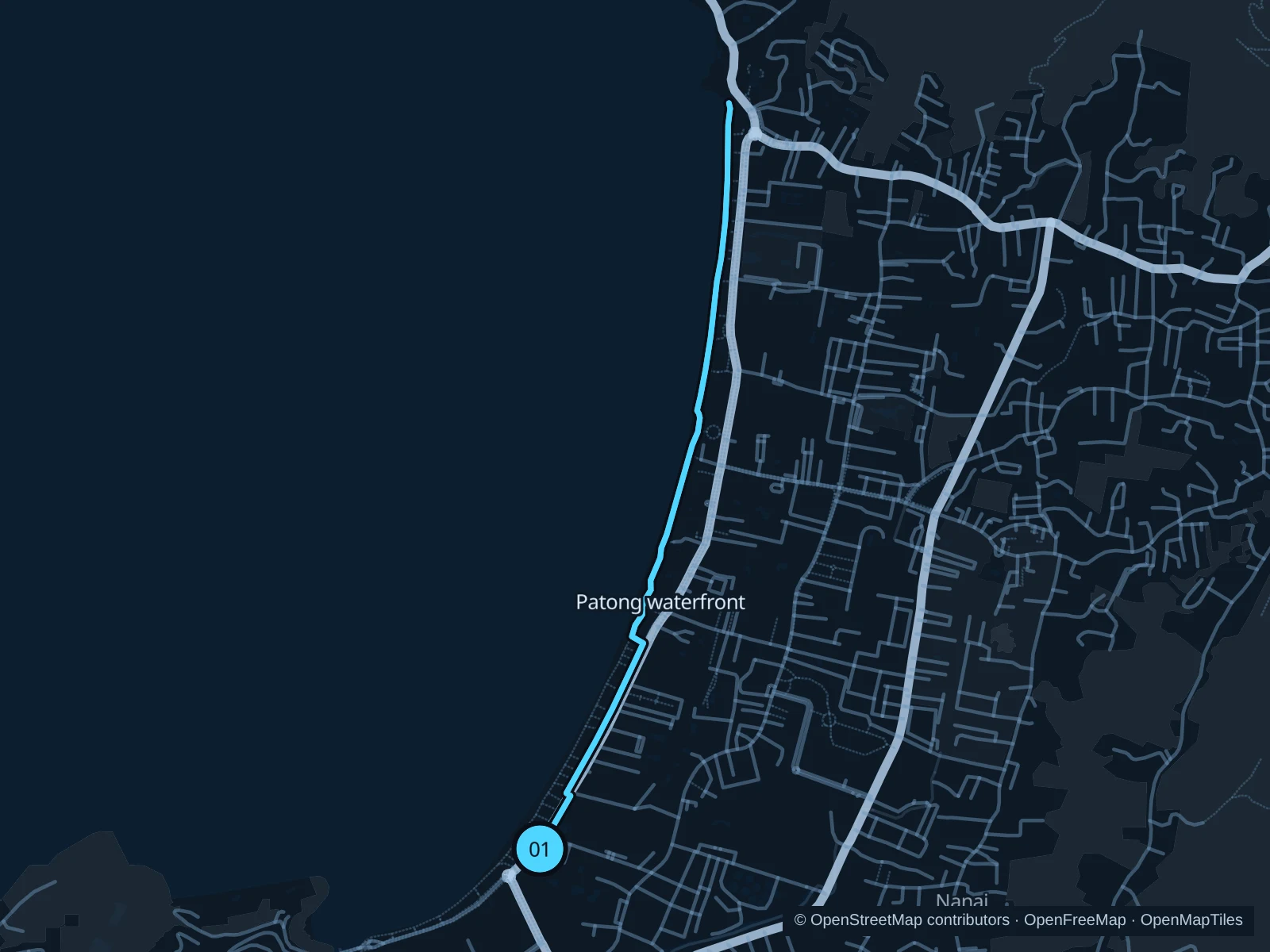
Map of the 4.5 km Patong · beachfront walkways run, with start and finish marked 01.
01 Out & backOpen full-size map
Approx. distance4.5 km
Underfoot

Paved beachfront walkways and access crossings

01

Start here

On the public beachfront walkway in southern Patong, beside Thawewong Road.

Follow the saved public beachfront walkways north along the curve of Patong’s bay, then retrace them from the recorded turnaround.

Getting there

Walk from Patong hotels to the beachfront using marked road crossings.

Before you go

Beach vendors, scooters and driveway crossings interrupt the flow. Keep to public walkways, slow down around other visitors and turn back if storm debris or flooding blocks the path.

Park / route information

Get running directions on your phone
Saphan Hin · coastal park

A coastal park circuit near the town’s sports grounds, with a more local exercise atmosphere.

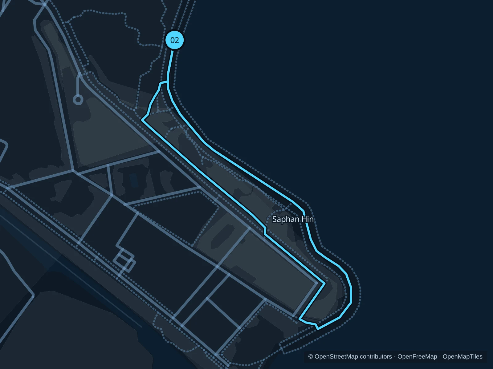
Map of the 1.4 km Saphan Hin · coastal park run, with start and finish marked 02.
02 LoopOpen full-size map
Approx. distance1.4 km
Underfoot

Park footpaths and paved coastal paths

02

Start here

On the public park path near the northern Saphan Hin approach from Phuket Road.

Follow the recorded paths around the coastal park and return through the public park links to the northern approach.

Getting there

Take a taxi or local transport from Phuket Town to Saphan Hin at the end of Phuket Road.

Before you go

Stay outside sports enclosures and shrine courtyards. Public events can occupy paths; use open pedestrian routes and keep clear of slippery seawall edges.

Park / route information

Get running directions on your phone

Suan Luang Rama IX · park paths

A greener inland park outing among large trees and ponds left from the area’s mining past.

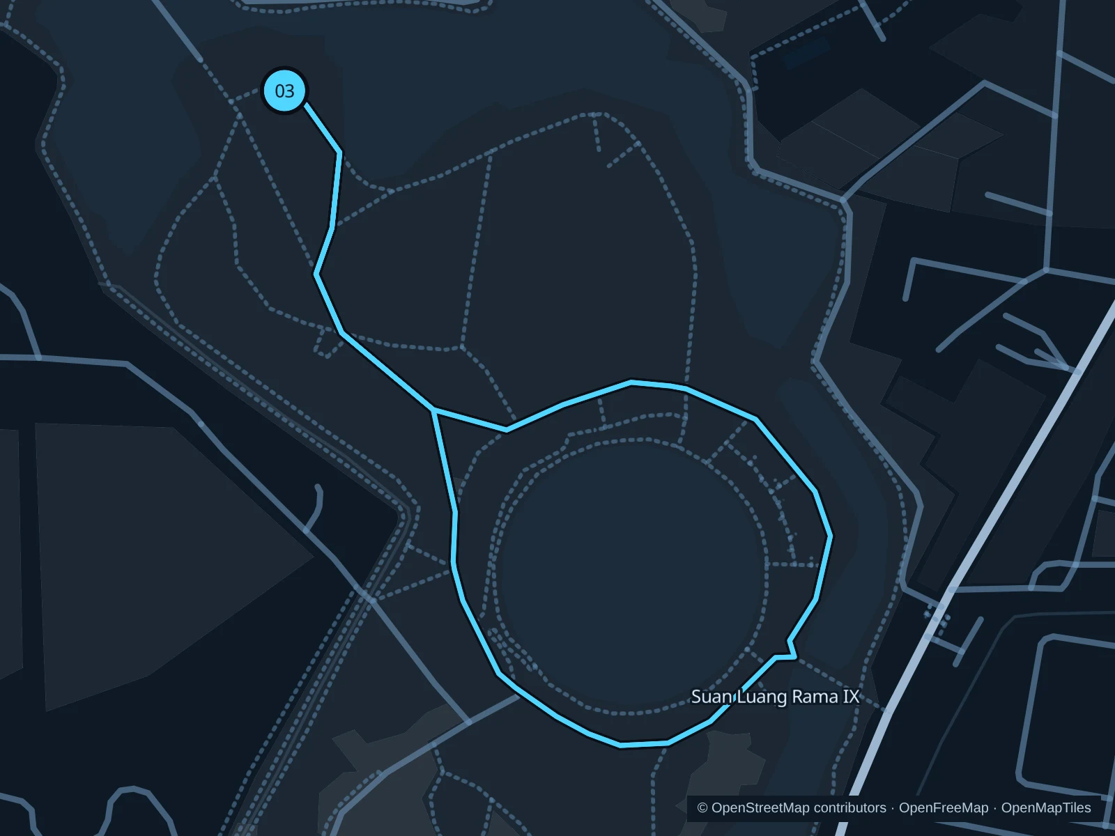
Map of the 2.7 km Suan Luang Rama IX · park paths run, with start and finish marked 03.
03 LoopOpen full-size map
Approx. distance2.7 km
Underfoot

Park paths with mixed paved sections

03

Start here

On the public park path in the northern part of Suan Luang Rama IX.

Follow the northern approach to the central circular park path, complete the circuit and return to the starting point. Repeat the entire saved circuit, including the northern approach, once for the total distance.

Getting there

Take a taxi or local transport to Suan Luang Rama IX near Chao Fa Road and enter through an open public gate.

Before you go

Give morning and evening exercise groups room. Follow gate notices, avoid flooded low paths after rain and keep off sports fields and planted beds.

Park / route information

Get running directions on your phone

Get running directions on your phone

Choose a distance and start at your hotel. RunFromHere plans a loop back to your door and guides you along it. Download the area’s map before you leave to use it offline.

The app generates its own routes from your chosen start; it doesn’t open the routes in this guide.

More places to run

Nai Harn lagoon

A freshwater lagoon sits inland from Nai Harn Beach in the island’s south. Check the public lakeside paths and road crossings before planning a loop; don’t use resort grounds as a through route.

Park / route information

Khao Rang

The viewpoint hill above Phuket Town adds climbing and an exercise-park setting. Check the pedestrian approach first: hill roads carry vehicles, and the summit is a sightseeing area rather than a dedicated running track.

Park / route information

Sources & route notes

Researched using the official visitor and park sources below; not checked on foot. Maps and GPX files use the same saved OpenStreetMap pedestrian paths. Distances are approximate. Check local notices for access, gate hours and diversions.

Researched