Skip to routes
RunFromHere
Get the app
English
Illustrated panorama of Nice in white linework.

Nice

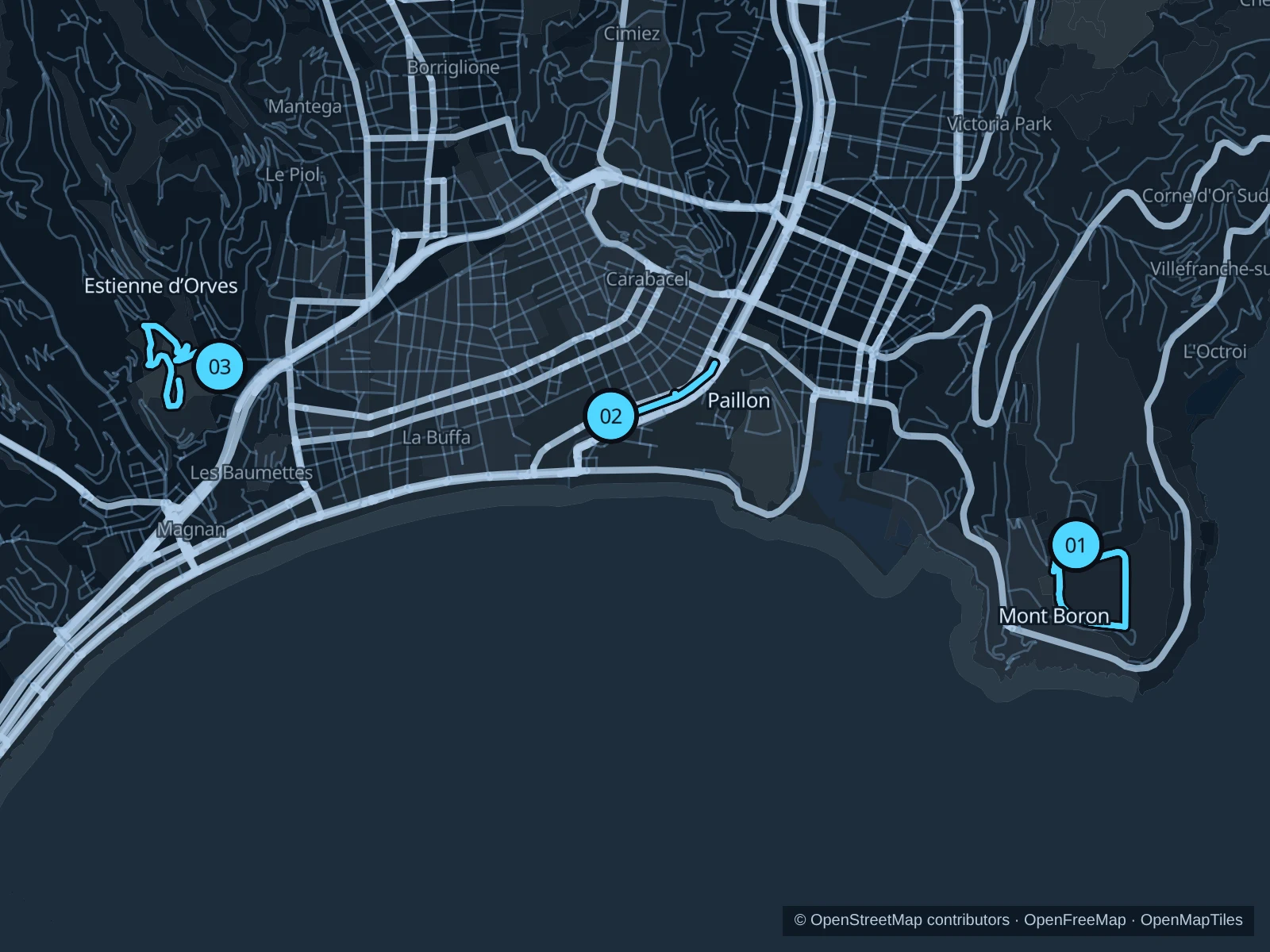
Nice combines short central garden runs with wooded hills above the sea. Head to the Paillon for an easy outing close to the old town, Estienne d’Orves for a winding park circuit, or Mont Boron for a longer, hillier session. Allow time for the uphill ride to the start and check seasonal access before leaving.

Get running directions on your phone

Find a route near your hotel

The numbers mark each start. Distances exclude the journey from your accommodation.

Map data: © OpenStreetMap contributors · OpenFreeMap · OpenMapTiles

Where to run in Nice

Mont Boron forest paths

Two out-and-back repetitions on hilly public forest paths, for a longer session above the coast.
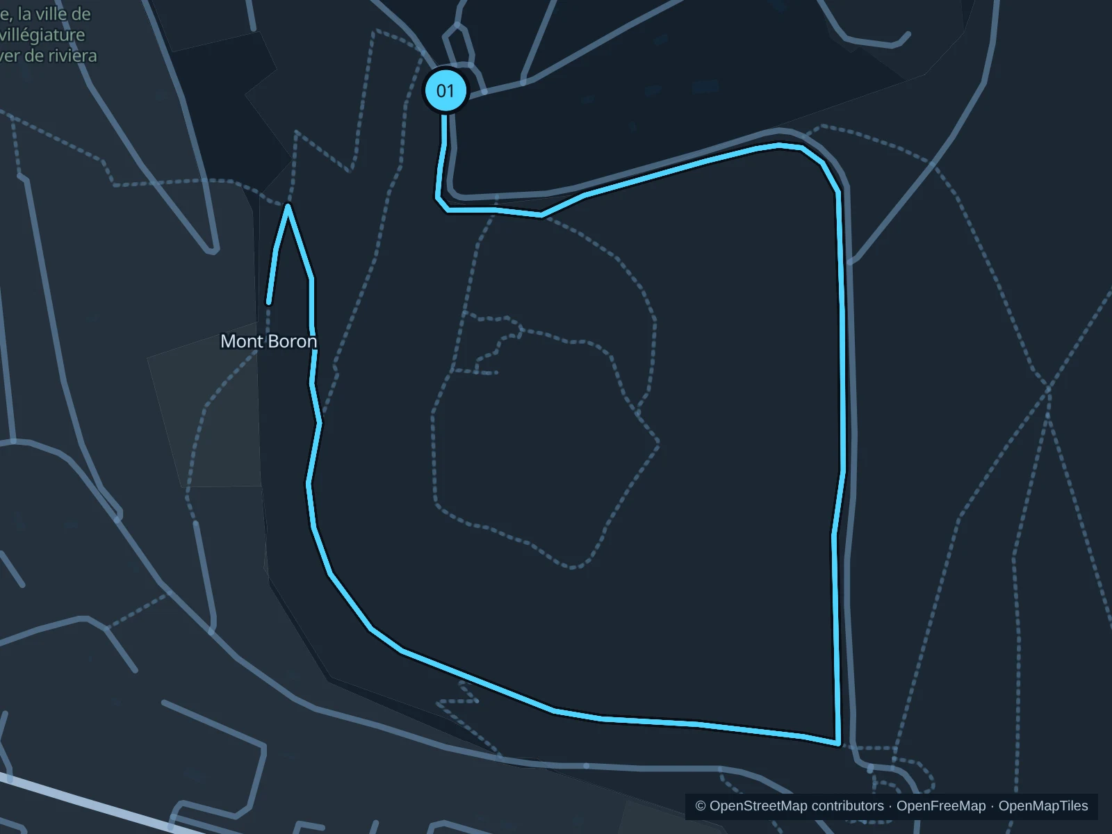
Map of the 5.3 km Mont Boron forest paths run, with start and finish marked 01.
01 Out & backOpen full-size map
Approx. distance5.3 km
Underfoot

Paved paths and compacted natural surfaces

01

Start here

On the public forest path just southwest of the Mont Boron bus terminus.

Follow the Circuit de Bellevue and connecting public forest paths east and south, then curve around to the marked turnaround on Chemin des Écoliers on the western wooded slope, about 1.3 km from the start. Return by the same paths and repeat this out-and-back once. The 5.3 km GPX includes both repetitions combined.

Getting there

Take a local bus or taxi to the Mont Boron terminus and walk southwest to the marked public forest path. The ride and the walk to the start aren’t included in the run distance.

Before you go

Run in daylight, carry water, and check official forest fire and weather restrictions. Expect climbs and uneven ground; stay on the public paths outside the old battery and respect closed gates.

Park / route information

Get running directions on your phone
Promenade du Paillon

A short central park run through the original Paillon gardens, close to the old town.

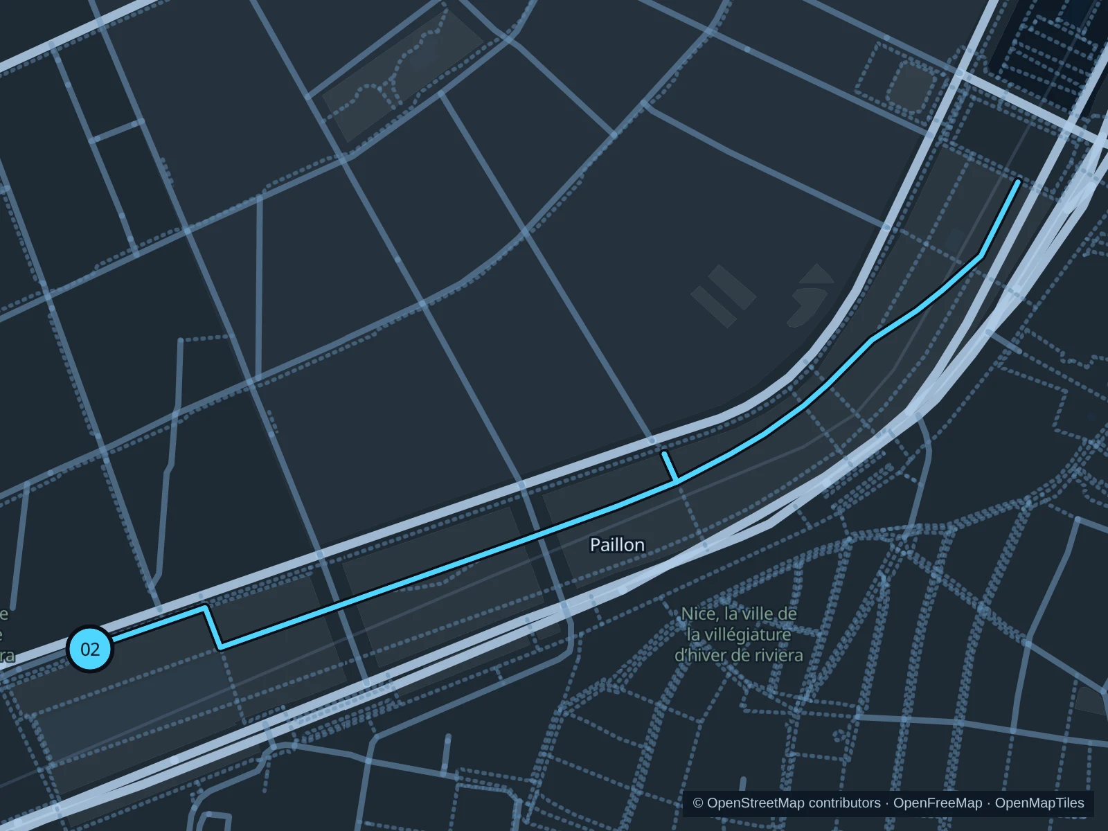
Map of the 1.3 km Promenade du Paillon run, with start and finish marked 02.
02 Out & backOpen full-size map
Approx. distance1.3 km
Underfoot

Paved pedestrian paths

02

Start here

On the public garden path just east of Place Masséna.

Follow the public garden paths northeast beside the old town toward the northern end of the original garden. Turn at the marked point before the MAMAC area and return to Place Masséna.

Getting there

From the Masséna tram stop, walk east across the square using the marked tram crossing, then enter the public garden.

Before you go

For the gardens at Place Masséna, the tourism office lists opening hours of 7am–9pm from October through March. Follow posted gate hours and slow to a walk near the play areas and water mirror. This route stays in the original gardens, before the newer northern extension.

Park / route information

Get running directions on your phone

Parc d’Estienne d’Orves

A hillier park circuit through olive groves and wooded paths above the city.

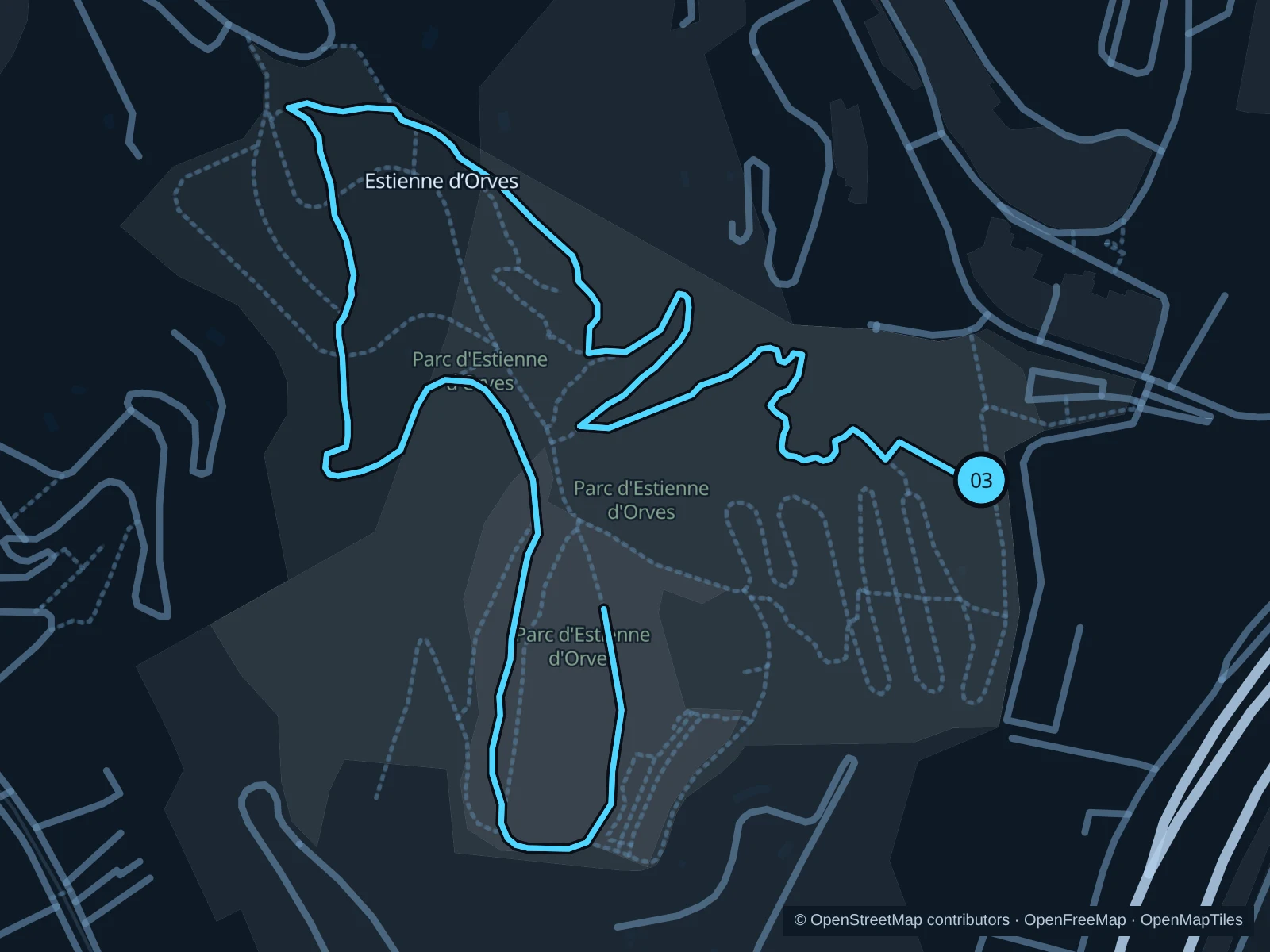
Map of the 3.0 km Parc d’Estienne d’Orves run, with start and finish marked 03.
03 LoopOpen full-size map
Approx. distance3.0 km
Underfoot

Paved paths and compacted natural surfaces

03

Start here

On the public park path inside the eastern entrance from Avenue Honoré d’Estienne d’Orves.

Use the connected public paths west through the olive grove and wooded hillside, then complete the loop back to the eastern entrance. Several paths wind up and down the slope.

Getting there

Take a local bus or taxi to the park entrance at 31 Avenue Honoré d’Estienne d’Orves and use the public pedestrian gate. The approach from the coast is uphill.

Before you go

Check the seasonal gate hours and current departmental notices. Take the climbs gently, watch for loose or wet ground and slow down near family walking groups.

Park / route information

Get running directions on your phone

Get running directions on your phone

Choose a distance and start at your hotel. RunFromHere plans a loop back to your door and guides you along it. Download the area’s map before you leave to use it offline.

The app generates its own routes from your chosen start; it doesn’t open the routes in this guide.

More places to run

Promenade des Anglais

The broad seaside promenade is the classic flat running area. Use the pedestrian space beside the sea, leave the cycle lane clear and check event or storm closures.

Park / route information

Colline du Château

The public hilltop park offers a shorter outing with steps and views. Walk through busy lookout areas and check the seasonal closing time before climbing up.

Park / route information

Sources & route notes

Researched using the official visitor and park sources below; not checked on foot. Maps and GPX files use the same saved OpenStreetMap pedestrian paths. Distances are approximate. Check local notices for access, gate hours and diversions.

Researched