Skip to routes
RunFromHere
Get the app
English
Illustrated panorama of Marseille in white linework.

Marseille

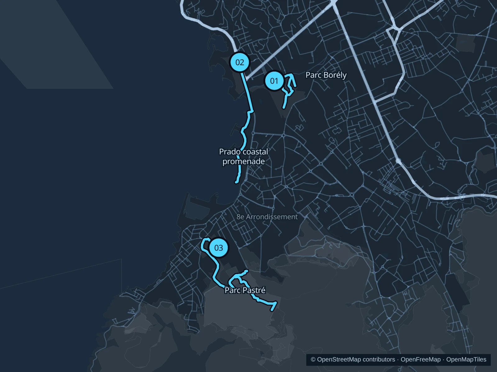
Borély offers a park circuit away from the beach promenade, the Prado gives you sea air and open waterfront paths, and Pastré adds rougher paths at the foot of Marseilleveyre. Borély suits a short outing between plans; Prado and Pastré offer more distance.

Get running directions on your phone

Find a route near your hotel

The numbers mark each start. Distances exclude the journey from your accommodation.

Map data: © OpenStreetMap contributors · OpenFreeMap · OpenMapTiles

Where to run in Marseille

Parc Borély

A park circuit between the lake, long avenues and the gardens around Château Borély.
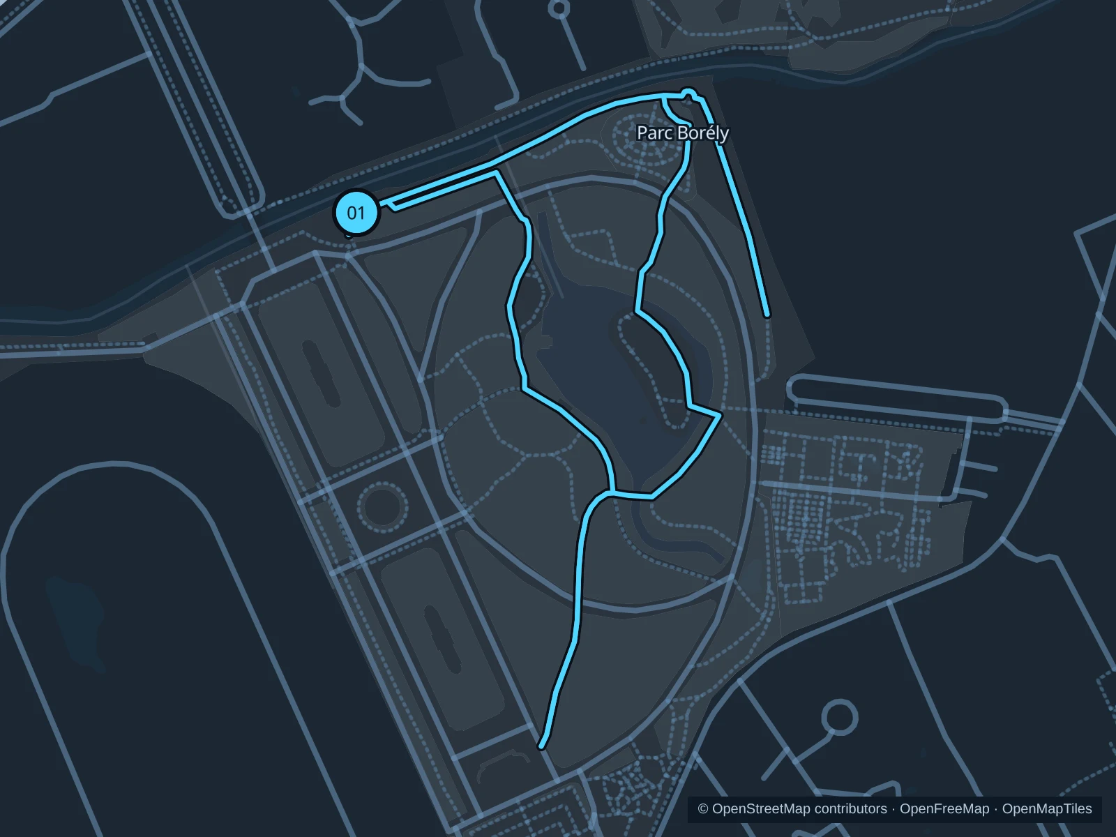
Map of the 1.9 km Parc Borély run, with start and finish marked 01.
01 LoopOpen full-size map
Approx. distance1.9 km
Underfoot

Park paths, paved and unpaved

01

Start here

Public northern park path inside the Avenue du Parc Borély entrance.

Run one lap of the public paths around the lake and château-side gardens, returning to the northern entrance.

Getting there

Take public transit toward Prado, then walk along Avenue du Parc Borély to the northern public entrance.

Before you go

Check gate hours and renovation signs. Visits to the separate botanical garden are free but require advance registration; this circuit stays on the main park paths.

Park / route information

Get running directions on your phone
Prado coastal promenade

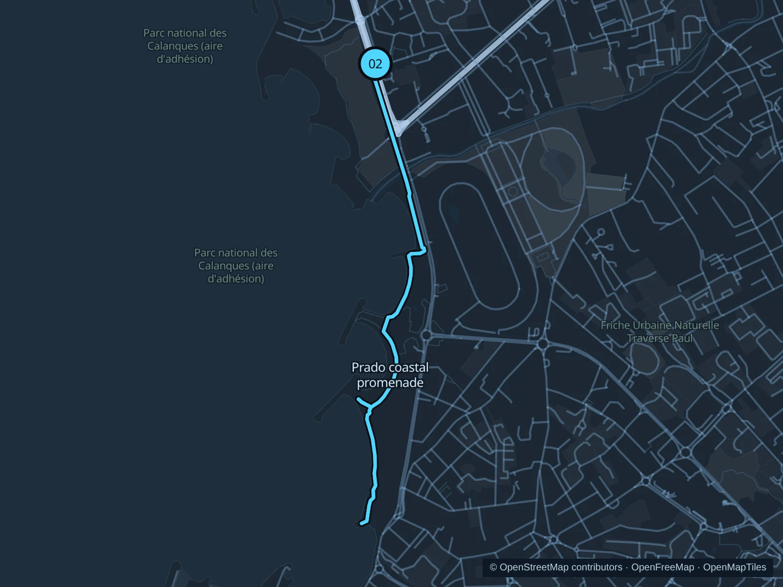
An exposed coastal out-and-back past the Prado beach parks toward Bonneveine.

Map of the 4.4 km Prado coastal promenade run, with start and finish marked 02.
02 Out & backOpen full-size map
Approx. distance4.4 km
Underfoot

Paved waterfront paths

02

Start here

Public beach promenade near the David roundabout, on the seaward side.

Follow the mapped route along the public coastal paths toward Bonneveine, then return the same way.

Getting there

Take a local bus toward the David roundabout, then walk to the public promenade.

Before you go

Mistral winds can make this much harder than the distance suggests. Carry water, give beach visitors room and slow at promenade crossings.

Park / route information

Get running directions on your phone

Parc Pastré

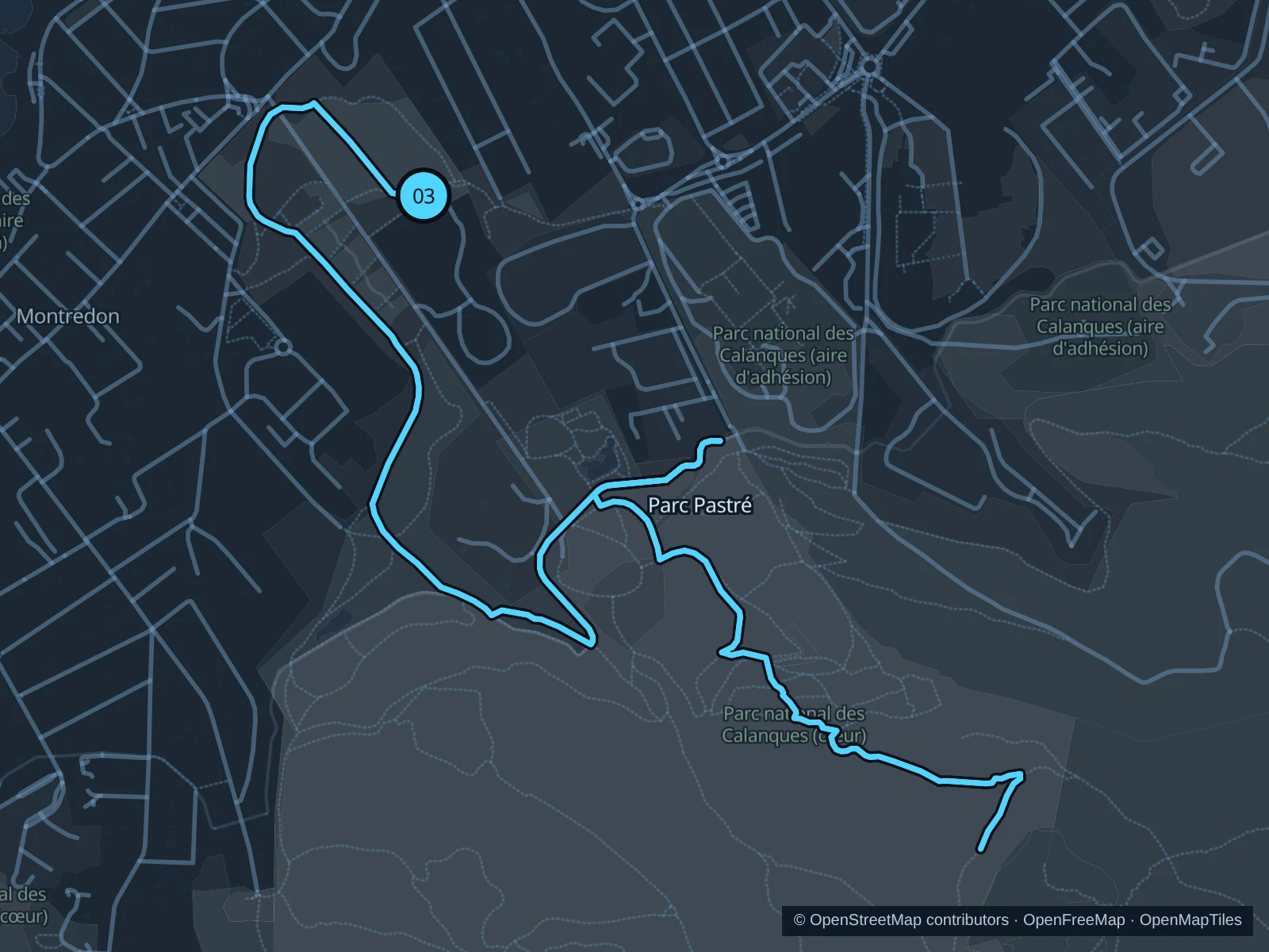
A rising park run from the Montredon side into the Mediterranean woodland above the landscaped grounds.

Map of the 6.4 km Parc Pastré run, with start and finish marked 03.
03 Out & backOpen full-size map
Approx. distance6.4 km
Underfoot

Woodland paths

03

Start here

Public park path inside the 155 Avenue de Montredon entrance.

Follow the mapped paths toward the marked woodland turnaround above the lower park, then return along the same route.

Getting there

Take a local bus toward Montredon and walk in through the signed public park entrance.

Before you go

The upper wooded area is part of the protected Calanques site. Check current fire-risk restrictions before entering, keep to the mapped paths and walk loose or steep sections.

Park / route information

Get running directions on your phone

Get running directions on your phone

Choose a distance and start at your hotel. RunFromHere plans a loop back to your door and guides you along it. Download the area’s map before you leave to use it offline.

The app generates its own routes from your chosen start; it doesn’t open the routes in this guide.

More places to run

Parc Longchamp

A central alternative for a short, hilly park outing around the monumental gardens. Check gate hours and stay on the public paths outside the museum buildings.

Park / route information

Jardin du Pharo

A compact option above the harbor, useful for an easy outing with viewpoints. Leave room for visitors and check access during events.

Park / route information

Sources & route notes

Researched using the official visitor and park sources below; not checked on foot. Maps and GPX files use the same saved OpenStreetMap pedestrian paths. Distances are approximate. Check local notices for access, gate hours and diversions.

Researched