Skip to routes
RunFromHere
Get the app
English
Illustrated panorama of Marrakech in white linework.

Marrakech

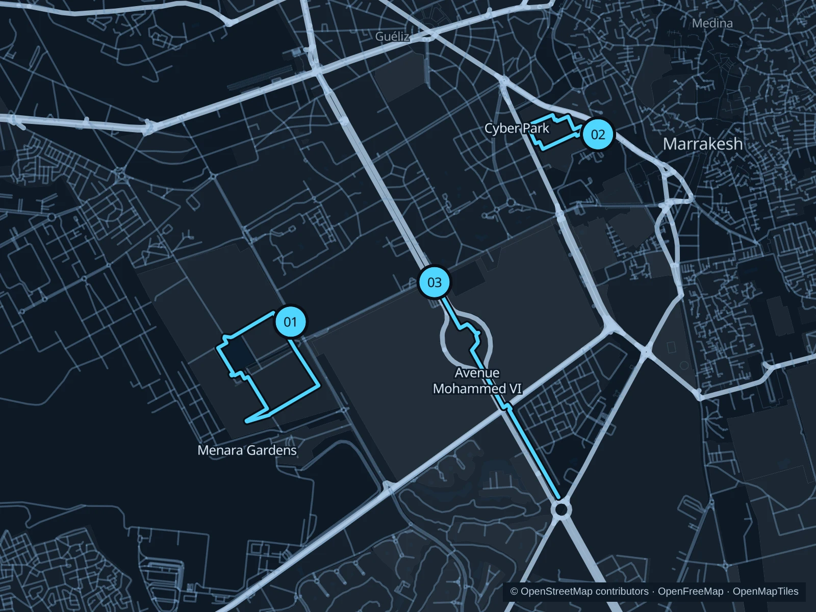
Marrakech’s gardens give you a break from the medina’s narrow lanes. Menara is the most open setting here, Cyber Park fits a short central outing, and the landscaped Mohammed VI promenade adds distance through the hotel districts. Run early for cooler conditions and check garden opening hours before setting out.

Get running directions on your phone

Find a route near your hotel

The numbers mark each start. Distances exclude the journey from your accommodation.

Map data: © OpenStreetMap contributors · OpenFreeMap · OpenMapTiles

Where to run in Marrakech

Menara Gardens

Broad orchard paths and the historic water basin give Menara a more open landscape than the central gardens.
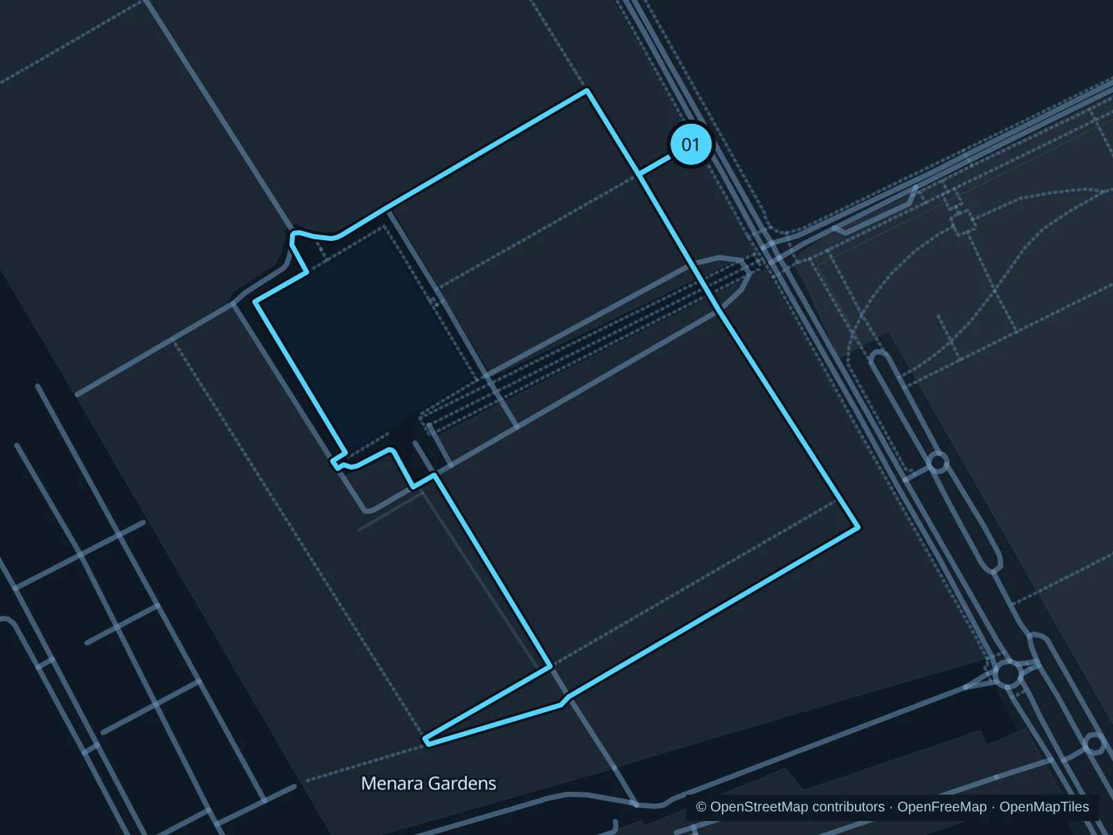
Map of the 2.5 km Menara Gardens run, with start and finish marked 01.
01 LoopOpen full-size map
Approx. distance2.5 km
Underfoot

Olive-grove paths, paved approaches and some steps

01

Start here

At the public orchard-path junction northeast of the Menara basin, inside the visitor entrance.

Follow the established orchard paths around the garden and basin area, returning to the same orchard junction.

Getting there

Use a local bus or taxi to Avenue de la Ménara, then enter through the signed visitor gate.

Before you go

Check current admission for both the garden paths and pavilion before entering, and ask whether running is permitted. Keep out of irrigation beds and carry water.

Park / route information

Get running directions on your phone
Cyber Park · Arsat Moulay Abdeslam

A short garden circuit near the medina, with mature trees and planted walks rather than the bustle of the souks.

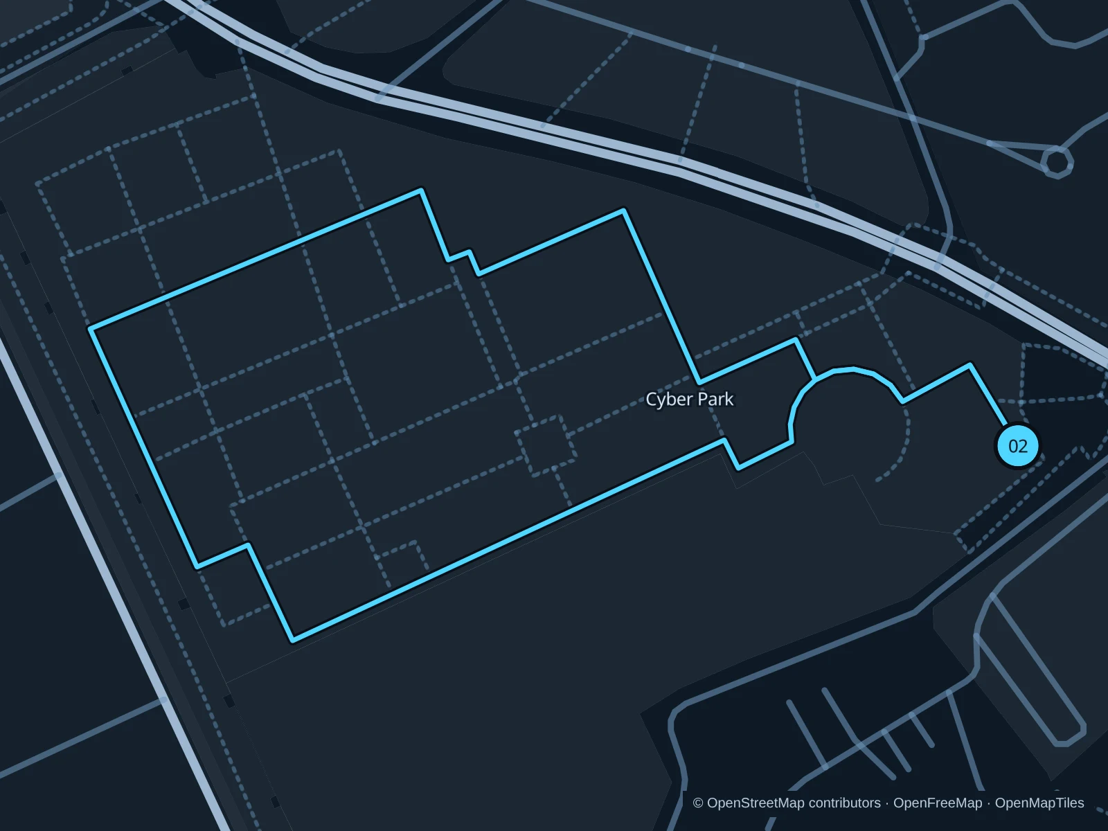
Map of the 1.3 km Cyber Park · Arsat Moulay Abdeslam run, with start and finish marked 02.
02 LoopOpen full-size map
Approx. distance1.3 km
Underfoot

Paved and compacted garden paths

02

Start here

At the public garden path inside the Boulevard Mohammed V entrance.

Follow the outer public garden paths and return through the planted central area.

Getting there

Walk from the Koutoubia area along public sidewalks to the garden’s signed entrance.

Before you go

Keep the pace easy near other visitors and respect garden signs. Check the gate hours locally; shade does not make midday heat comfortable.

Park / route information

Get running directions on your phone

Mohammed VI Avenue promenade

A longer landscaped boulevard run for stays near Ménara Mall and the hotels in Hivernage.

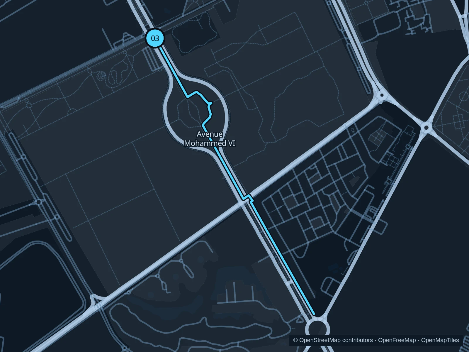
Map of the 3.6 km Mohammed VI Avenue promenade run, with start and finish marked 03.
03 Out & backOpen full-size map
Approx. distance3.6 km
Underfoot

Paved promenade and crosswalks

03

Start here

On the public promenade just south of the Avenue Prince Moulay Rachid intersection.

Follow the public landscaped promenade southeast along Avenue Mohammed VI, then retrace the saved route.

Getting there

Approach from Hivernage or Ménara Mall on public sidewalks and use a marked crosswalk to reach the promenade.

Before you go

Traffic interrupts the promenade at intersections. Use crosswalks and wait for signals; do not cut across hotel driveways or run in the street to keep moving.

Park / route information

Get running directions on your phone

Get running directions on your phone

Choose a distance and start at your hotel. RunFromHere plans a loop back to your door and guides you along it. Download the area’s map before you leave to use it offline.

The app generates its own routes from your chosen start; it doesn’t open the routes in this guide.

More places to run

El Harti Park

A smaller garden in Guéliz, with palms, citrus trees and shaded walks. Treat it as a gentle short outing and follow current garden rules.

Park / route information

Bab Jdid olive grove

The olive-grove area west of the medina offers another change of setting. Use clearly public entrances and established paths, respecting fenced orchards.

Park / route information

Sources & route notes

Researched using the official visitor and park sources below; not checked on foot. Maps and GPX files use the same saved OpenStreetMap pedestrian paths. Distances are approximate. Check local notices for access, gate hours and diversions.

Researched