Skip to routes
RunFromHere
Get the app
English
Illustrated panorama of Lima in white linework.

Lima

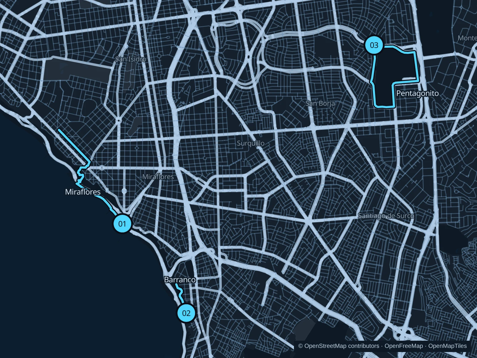
Miraflores links Pacific views with a descent to lower coastal paths and a climb back. Barranco offers a shorter run on its upper malecón, while San Borja’s external Pentagonito circuit adds a separate suburban outing. The cliff-top parks and lower seafront are different levels: follow the saved public connections and allow time for steps.

Get running directions on your phone

Find a route near your hotel

The numbers mark each start. Distances exclude the journey from your accommodation.

Map data: © OpenStreetMap contributors · OpenFreeMap · OpenMapTiles

Where to run in Lima

Miraflores · Cisneros & lower coastal paths

A longer coastal outing that changes level between the cliff-top malecón and lower seafront paths. The descent becomes a climb on the return.
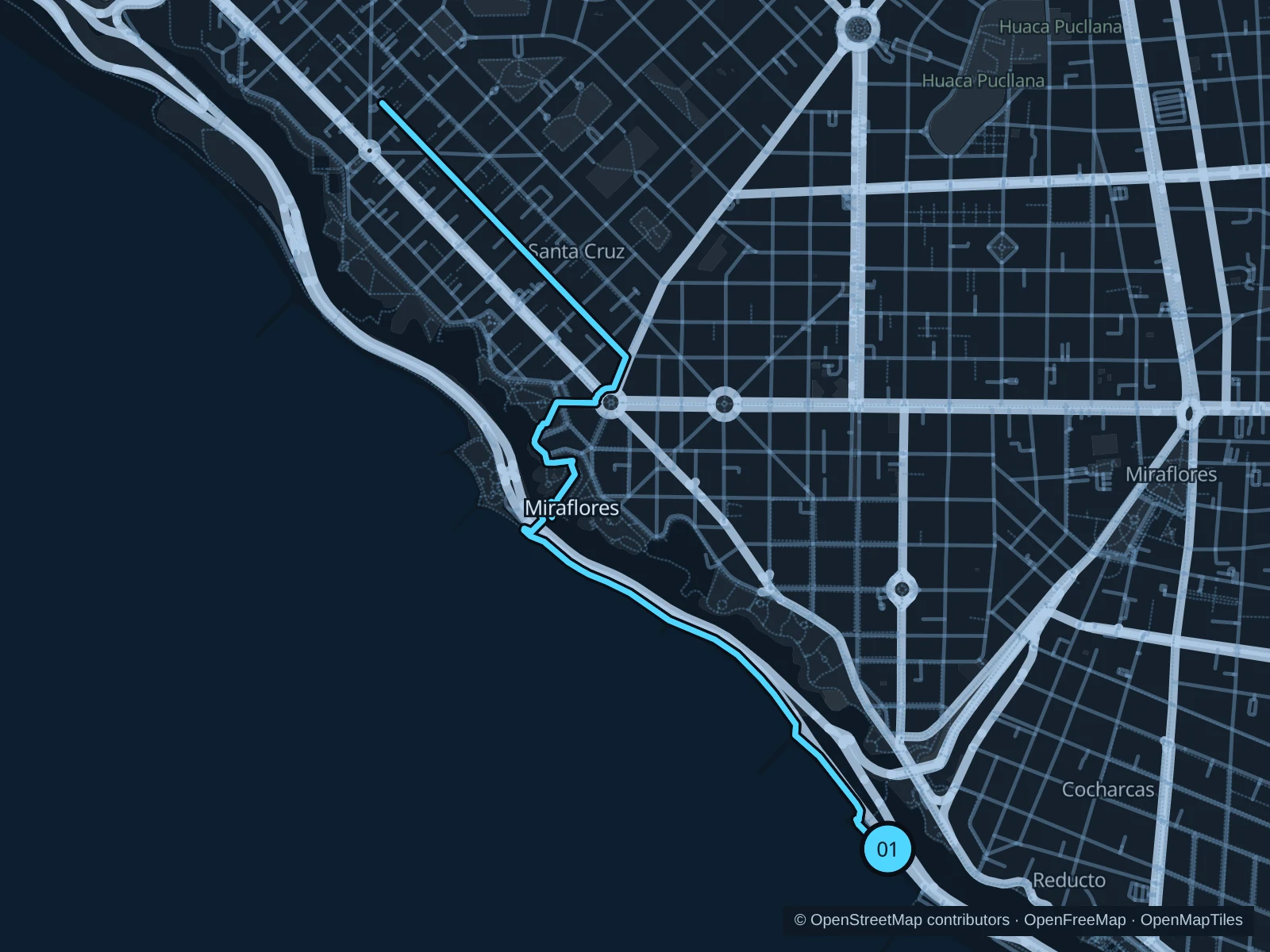
Map of the 6.2 km Miraflores · Cisneros & lower coastal paths run, with start and finish marked 01.
01 Out & backOpen full-size map
Approx. distance6.2 km
Underfoot

Paved paths, sidewalks and a stepped cliff descent

01

Start here

On the public Malecón Cisneros path, north of Parque del Amor.

Follow the public coast-facing paths northwest, take the saved stepped descent and lower paths toward the María Reiche area, then retrace the same route uphill.

Getting there

Walk west from central Miraflores along the public streets toward Parque del Amor and the cliff-top path.

Before you go

Walk the steps if needed and use the marked road crossings. Stay on public footpaths beside the coastal road; do not replace the saved descent with informal cliff shortcuts.

Park / route information

Get running directions on your phone
Barranco · Malecón Paul Harris

A shorter outing on Barranco’s upper coastal paths, passing gardens and viewpoints above the sea.

Map of the 1.4 km Barranco · Malecón Paul Harris run, with start and finish marked 02.
02 Out & backOpen full-size map
Approx. distance1.4 km
Underfoot

Paved paths, public sidewalks and some steps

02

Start here

At the public Malecón Paul Harris path near the western end of Jirón Centenario.

Follow the public upper malecón paths north toward Miraflores and return on the same saved path.

Getting there

Walk from Barranco’s main square via public streets to Jirón Centenario and the malecón.

Before you go

Expect steps and short street connections. This route stays above the coast; do not use informal cliff descents or assume beach-level paths connect.

Park / route information

Get running directions on your phone

San Borja · Pentagonito

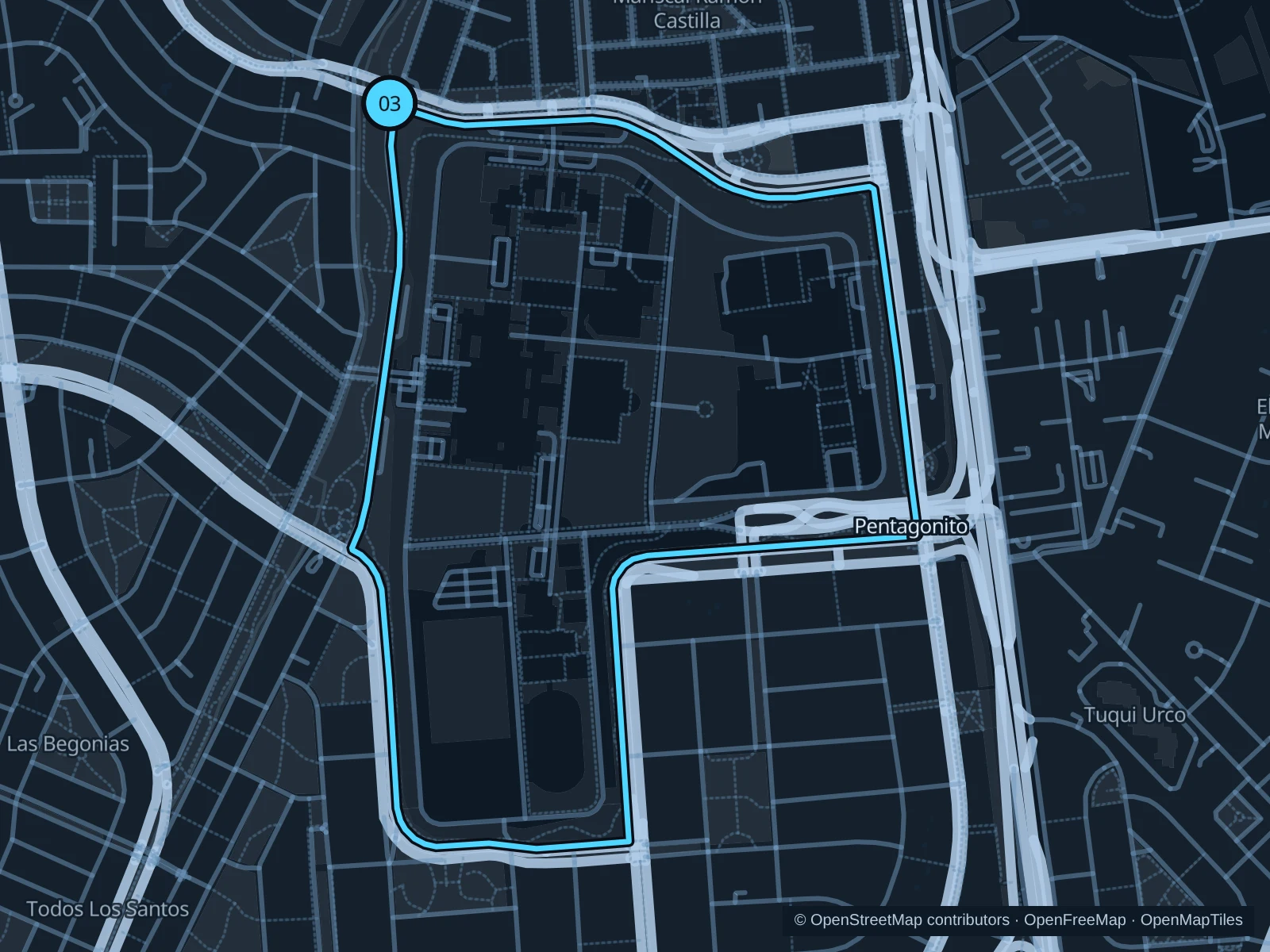
The public exercise corridor runs around the outside of the military complex, with a longer suburban circuit and several roadside stretches.

Map of the 4.1 km San Borja · Pentagonito run, with start and finish marked 03.
03 LoopOpen full-size map
Approx. distance4.1 km
Underfoot

Paved external pedestrian and exercise paths

03

Start here

On the public external path beside Avenida San Borja Norte, near Avenida Boulevard de Surco.

Follow the established public paths around the outside of the Pentagonito complex and return to the northern side.

Getting there

Travel to San Borja, then follow the public sidewalks along Avenida San Borja Norte to the start.

Before you go

Stay outside the military gates and fence. Keep to the pedestrian exercise path rather than the cycle lane, and watch driveways and road crossings.

Park / route information

Get running directions on your phone

Get running directions on your phone

Choose a distance and start at your hotel. RunFromHere plans a loop back to your door and guides you along it. Download the area’s map before you leave to use it offline.

The app generates its own routes from your chosen start; it doesn’t open the routes in this guide.

More places to run

Bosque El Olivar · San Isidro

The historic olive grove is a quieter, shorter alternative near San Isidro hotels. Use the public paths, protect the trees and keep clear of pond edges.

Park / route information

Campo de Marte

A larger park alternative closer to the city center. Check the municipality’s current renovation notices and which entrances are open before making the trip.

Park / route information

Sources & route notes

Researched using the official visitor and park sources below; not checked on foot. Maps and GPX files use the same saved OpenStreetMap pedestrian paths. Distances are approximate. Check local notices for access, gate hours and diversions.

Researched