Skip to routes
RunFromHere
Get the app
English
Illustrated panorama of Kuala Lumpur in white linework.

Kuala Lumpur

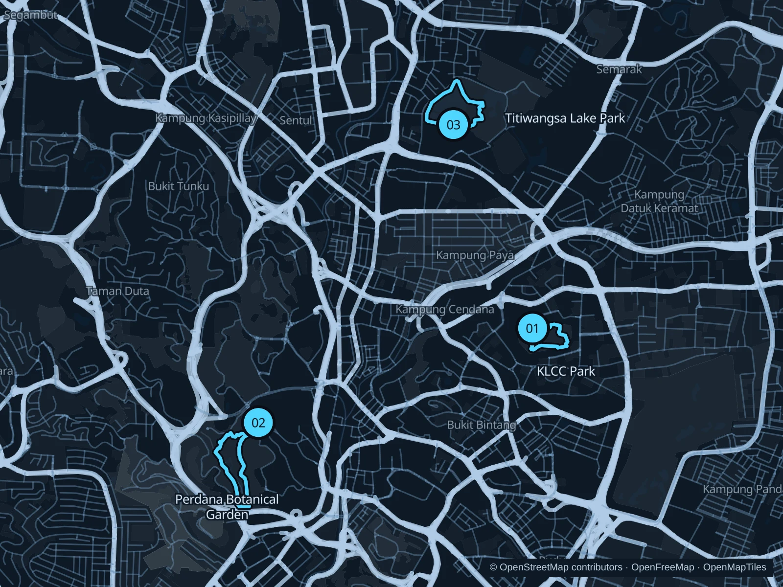
Kuala Lumpur’s parks offer three distinct places to run during a city stay: the towers above KLCC, the planted hills of Perdana and Titiwangsa’s lake landscape. At KLCC and Perdana you repeat a circuit for a proper workout, while Titiwangsa is a single park loop. Plan transport between parks, check which gates are open before an early start and allow for humidity, heavy rain and thunderstorms.

Get running directions on your phone

Find a route near your hotel

The numbers mark each start. Distances exclude the journey from your accommodation.

Map data: © OpenStreetMap contributors · OpenFreeMap · OpenMapTiles

Where to run in Kuala Lumpur

KLCC Park · two circuits

Two compact park circuits beneath the towers, with planted paths and glimpses of the water features.
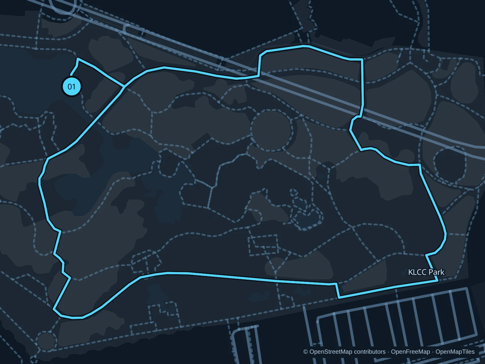
Map of the 2.9 km KLCC Park · two circuits run, with start and finish marked 01.
01 LoopOpen full-size map
Approx. distance2.9 km
Underfoot

Mixed park paths; the saved course is not entirely the rubber running track

01

Start here

On the public park path beside the Lake Symphony area, outside Suria KLCC.

Follow the saved park circuit east and south, return along the western paths to Lake Symphony and repeat the entire circuit once.

Getting there

Take the LRT to KLCC and walk through the public precinct to the park entrance beside Lake Symphony during current access hours.

Before you go

The saved total includes two circuits. Check current park hours rather than assuming dawn access; stay out of children’s play and wading areas and slow down near fountain spectators.

Park / route information

Get running directions on your phone
Perdana · two garden circuits

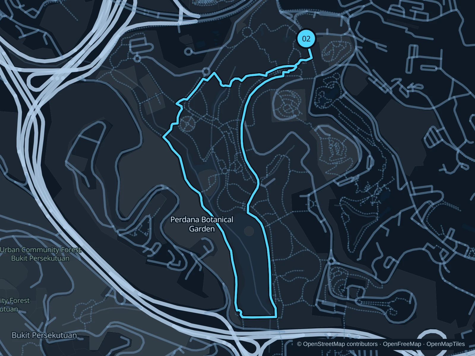
The longest saved outing repeats a rolling circuit through the public botanical garden’s planted slopes and paths.

Map of the 5.3 km Perdana · two garden circuits run, with start and finish marked 02.
02 LoopOpen full-size map
Approx. distance5.3 km
Underfoot

Mixed paved garden paths, pedestrian connections and changes of gradient

02

Start here

At the public path just inside Perdana Botanical Garden’s named Main Entrance.

From the Main Entrance, follow the saved public approach into the garden. Follow the saved paths west and south through the public garden, return north along the eastern paths to the Main Entrance and repeat the entire circuit once.

Getting there

Take a taxi to the botanical garden Main Entrance and continue on foot through the public gate; the saved run excludes the journey from KL Sentral.

Before you go

The total includes two complete circuits and their entrance approach. Check which gates are currently open, keep out of the separately managed bird and plant attractions, and slow down on wet slopes or at service access crossings.

Park / route information Park / route information

Get running directions on your phone

Titiwangsa · lake and park circuit

A single circuit through lake-edge paths and landscaped park areas, with open water and a skyline backdrop.

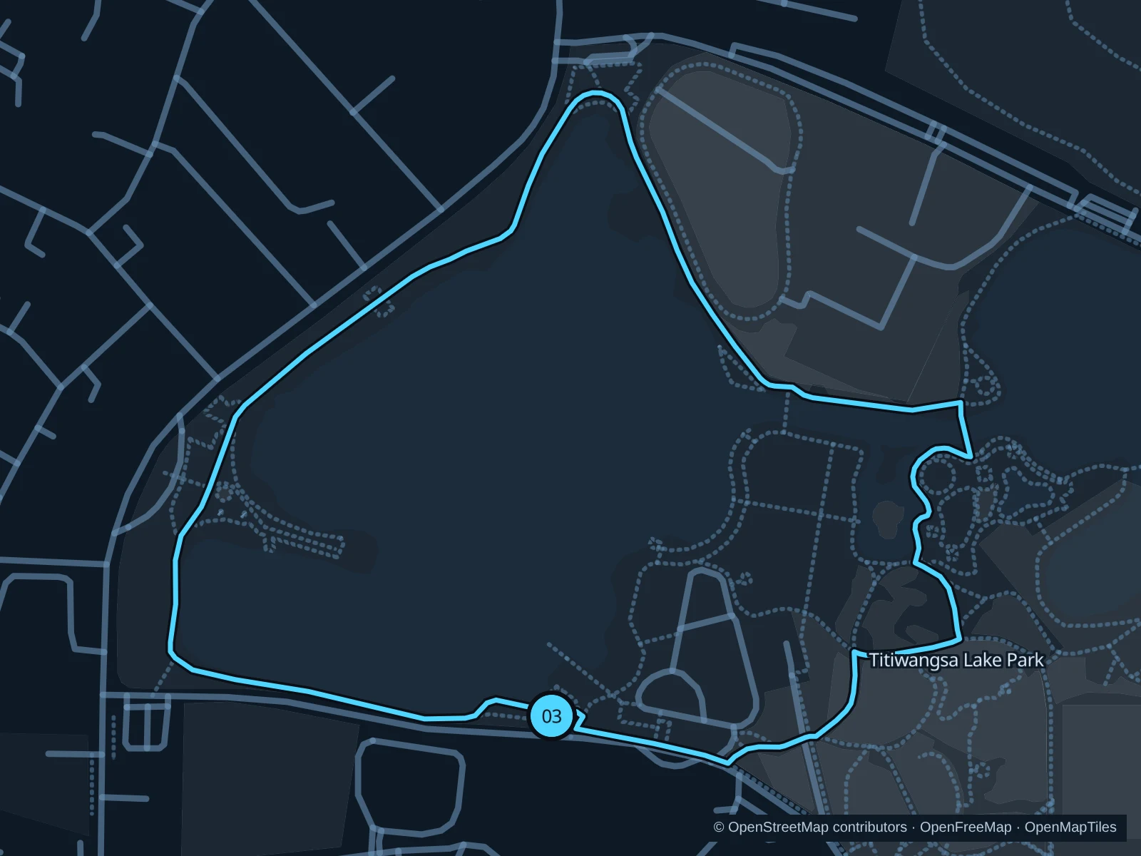
Map of the 1.9 km Titiwangsa · lake and park circuit run, with start and finish marked 03.
03 LoopOpen full-size map
Approx. distance1.9 km
Underfoot

Paved public park paths and garden connections

03

Start here

On the public park path near Dataran Titiwangsa on the southern side of the park.

Follow the saved paths east and north through the garden areas, continue around the western lakeside and return along the southern park paths.

Getting there

Take a taxi toward the Dataran Titiwangsa entrance area and walk onto the public park paths rather than using the separate sports center entrance.

Before you go

Use the saved paths rather than golf or sports grounds, and check which gates are open before starting. Give families room near play spaces and avoid exposed lakeside sections during thunderstorms.

Park / route information Park / route information

Get running directions on your phone

Get running directions on your phone

Choose a distance and start at your hotel. RunFromHere plans a loop back to your door and guides you along it. Download the area’s map before you leave to use it offline.

The app generates its own routes from your chosen start; it doesn’t open the routes in this guide.

More places to run

Taman Tasik Danau Kota

A neighborhood lake park beside Setapak Sentral with a jogging path and outdoor exercise facilities. It suits a separate local outing; check current gate hours and give families space beside the playgrounds.

Park / route information

Taman Bukit Jalil

A hillier public park in southern Kuala Lumpur with themed gardens and several entrances. Plan it as a separate trip rather than an extension of the central run: stick to open public paths and expect more climbing than at KLCC.

Park / route information

Sources & route notes

Researched using the official visitor and park sources below; not checked on foot. Maps and GPX files use the same saved OpenStreetMap pedestrian paths. Distances are approximate. Check local notices for access, gate hours and diversions.

Researched