Skip to routes
RunFromHere
Get the app
English
Illustrated panorama of Krakow in white linework.

Krakow

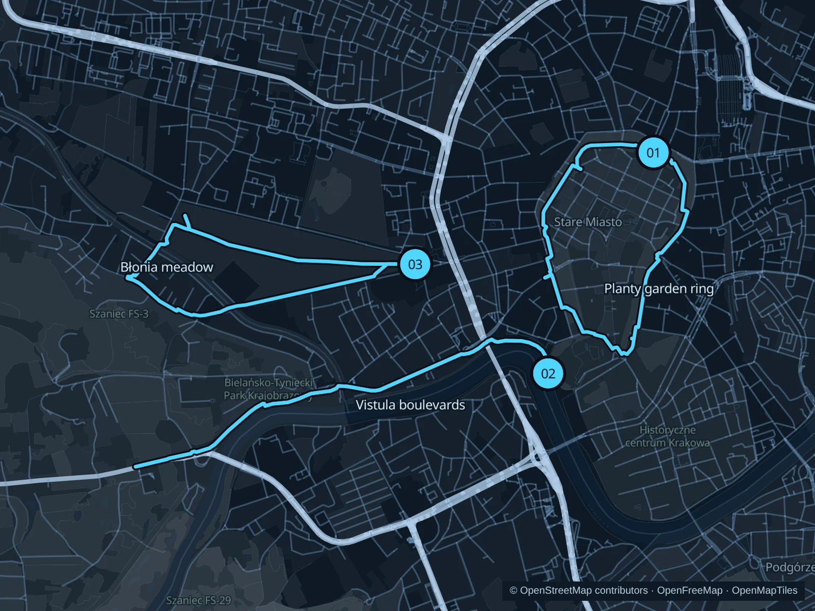
Planty puts a green circuit around the old town, the Vistula gives you a longer riverside outing, and Błonia offers a wide meadow-side loop west of the center. Go early in the morning for Planty, and keep an easy pace on the busiest sightseeing paths.

Get running directions on your phone

Find a route near your hotel

The numbers mark each start. Distances exclude the journey from your accommodation.

Map data: © OpenStreetMap contributors · OpenFreeMap · OpenMapTiles

Where to run in Krakow

Planty garden ring

A central circuit through the green belt outside the former city walls.
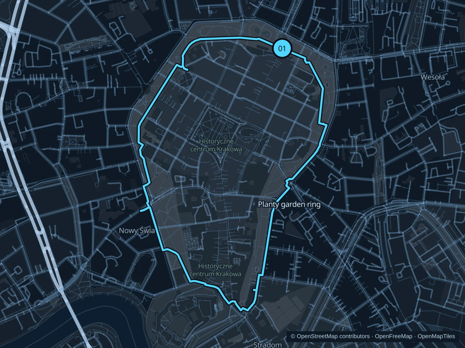
Map of the 3.7 km Planty garden ring run, with start and finish marked 01.
01 LoopOpen full-size map
Approx. distance3.7 km
Underfoot

Paved paths

01

Start here

Public Planty garden path just south of the Barbican, outside its museum entrance.

Follow the public garden ring around the old town and return to the Barbican, using the mapped street crossings.

Getting there

Walk from the station or old town toward the Barbican and enter the public garden paths.

Before you go

This is a city park route with road crossings. Give walkers space, pause at crossings and watch wet leaves beneath the trees.

Park / route information

Get running directions on your phone
Vistula boulevards

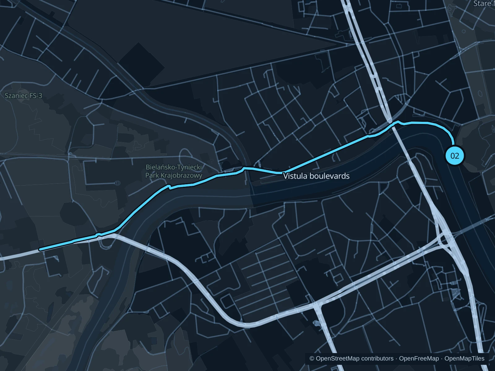
A longer out-and-back west from the public river paths beneath Wawel.

Map of the 5.6 km Vistula boulevards run, with start and finish marked 02.
02 Out & backOpen full-size map
Approx. distance5.6 km
Underfoot

Paved waterfront paths

02

Start here

Public Bulwar Czerwieński riverside path below Wawel, southwest of the Dragon statue and outside castle entrances.

Follow the mapped north-bank paths west past Dębnicki Bridge toward Salwator to the marked turnaround, then return the same way.

Getting there

Walk down from the Wawel area to the public north-bank boulevard.

Before you go

Share the riverside corridor with cyclists and skaters. Lower paths can close during high water; follow local diversions and stay outside moored-boat access areas. The route includes steps; walk these sections.

Park / route information

Get running directions on your phone

Błonia meadow

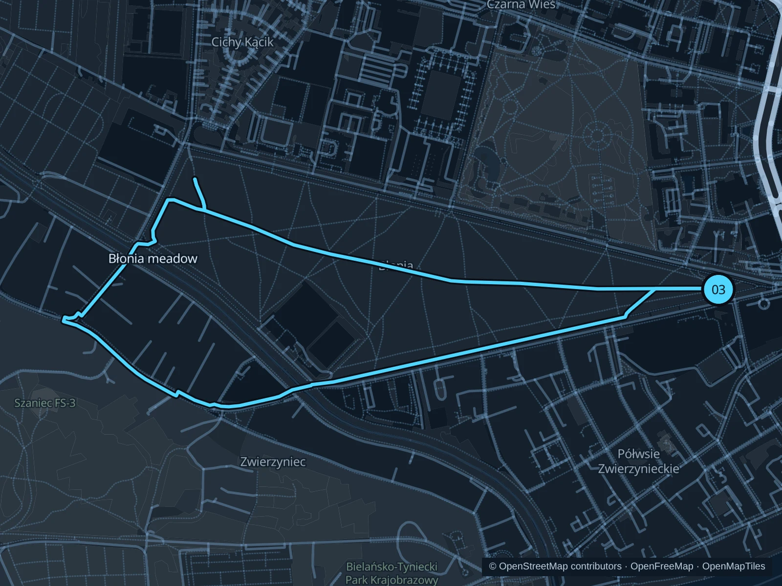
A broad meadow-side circuit with open views and fewer sightseeing pinch points.

Map of the 3.9 km Błonia meadow run, with start and finish marked 03.
03 LoopOpen full-size map
Approx. distance3.9 km
Underfoot

Paved paths

03

Start here

Public eastern meadow path near the meeting of Aleja 3 Maja and Aleja Focha.

Circle the public meadow-edge paths via the northern and western sides, returning along the southern edge.

Getting there

Take a bus to Cracovia Błonia, then walk to the public meadow-side path.

Before you go

The meadow is exposed to wind and summer sun. Use the public perimeter paths outside event compounds and leave room for bikes and inline skaters.

Park / route information

Get running directions on your phone

Get running directions on your phone

Choose a distance and start at your hotel. RunFromHere plans a loop back to your door and guides you along it. Download the area’s map before you leave to use it offline.

The app generates its own routes from your chosen start; it doesn’t open the routes in this guide.

More places to run

Park Jordana

A more sheltered park beside Błonia, with public paths among trees. Stay out of sports courts and play areas, and check gate notices.

Park / route information

Młynówka Królewska

A separate linear park northwest of the centre, useful for an out-and-back on its public paths. Expect several street crossings rather than a continuous secluded trail.

Park / route information

Sources & route notes

Researched using the official visitor and park sources below; not checked on foot. Maps and GPX files use the same saved OpenStreetMap pedestrian paths. Distances are approximate. Check local notices for access, gate hours and diversions.

Researched