Skip to routes
RunFromHere
Get the app
English
Illustrated panorama of Granada in white linework.

Granada

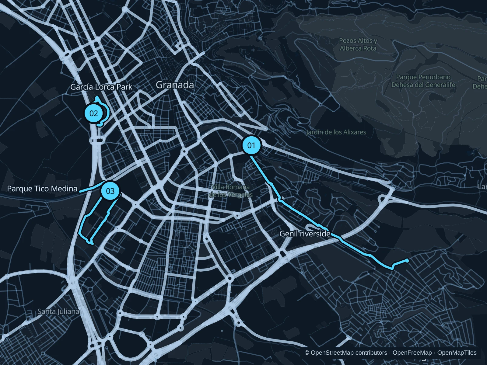
The Genil gives Granada a gentler running corridor below the hills. Add Parque García Lorca for a compact garden loop or Parque Tico Medina for more open park paths southwest of the center.

Get running directions on your phone

Find a route near your hotel

The numbers mark each start. Distances exclude the journey from your accommodation.

Map data: © OpenStreetMap contributors · OpenFreeMap · OpenMapTiles

Where to run in Granada

Genil · Fuente de la Bicha

A longer riverside run upstream, with a gradual escape from the central streets.
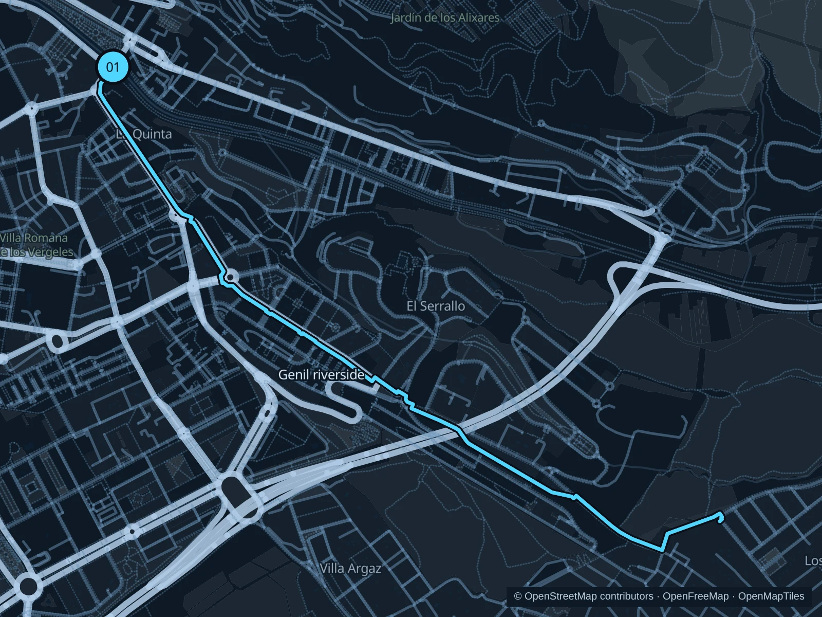
Map of the 5.3 km Genil · Fuente de la Bicha run, with start and finish marked 01.
01 Out & backOpen full-size map
Approx. distance5.3 km
Underfoot

Park paths, paved and unpaved

01

Start here

Public Genil path beside Puente Verde.

Follow the mapped paths toward the Fuente de la Bicha riverside corridor, then return along the same route.

Getting there

Walk from Paseo del Salón to Puente Verde and use the mapped riverside access.

Before you go

Share the path with walkers and cyclists. Carry water in hot weather and turn back at flood or maintenance closures.

Park / route information

Get running directions on your phone
Parque Federico García Lorca

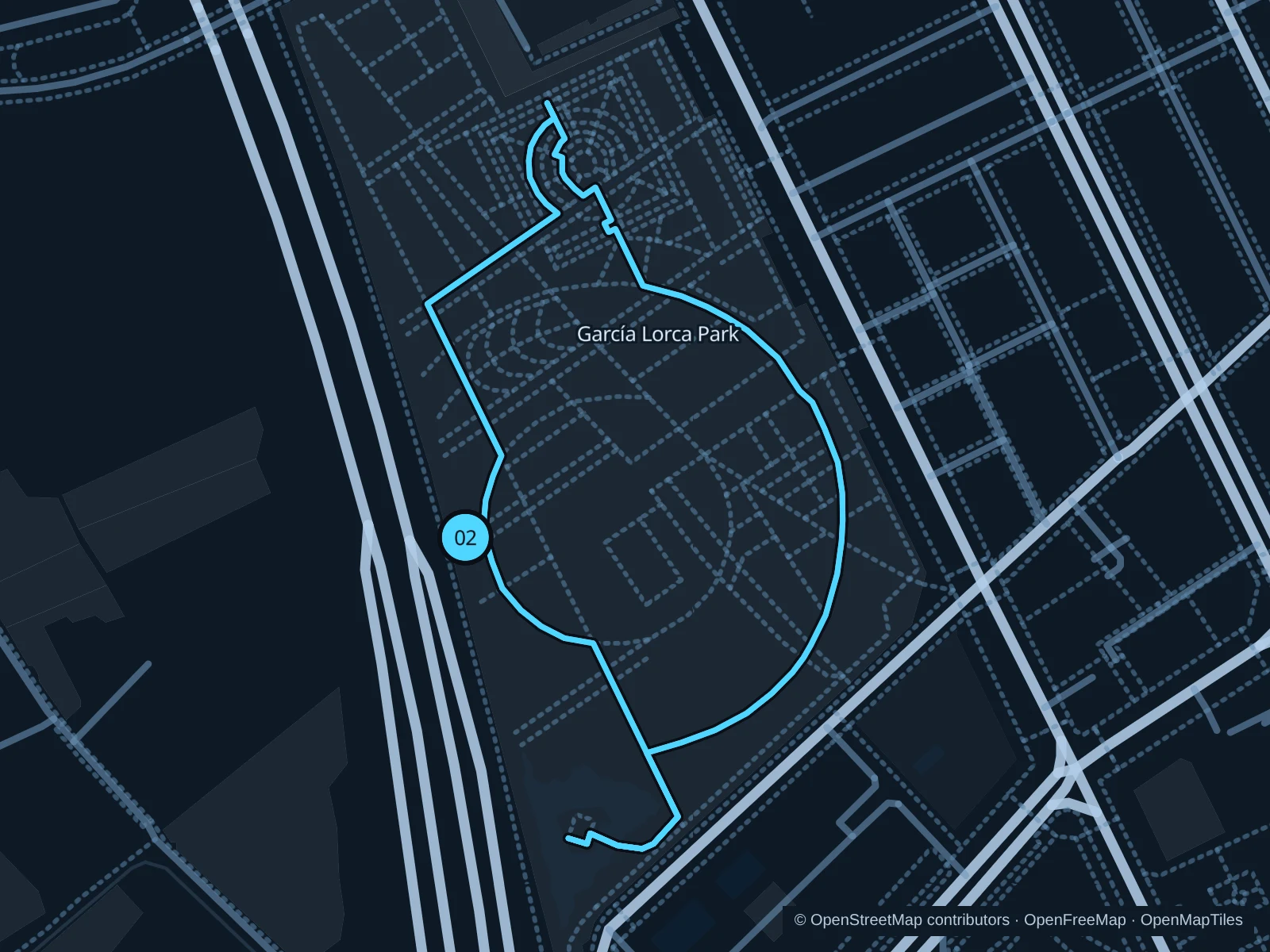
Short park paths around lawns and the garden setting of Huerta de San Vicente.

Map of the 2.0 km Parque Federico García Lorca run, with start and finish marked 02.
02 LoopOpen full-size map
Approx. distance2.0 km
Underfoot

Park paths, paved and unpaved

02

Start here

Public park path inside the western Calle Arabial entrance, outside the museum grounds.

Run two laps of the public garden paths outside the museum, returning each time to the Arabial entrance.

Getting there

Walk from Camino de Ronda or take public transit toward Calle Arabial.

Before you go

Check park gate hours and give walkers space around the rose garden. This is a short easy run, not a fast interval session.

Park / route information

Get running directions on your phone

Parque Tico Medina

Broader paths and open lawns south of the Genil, handy if you’re staying near the Science Park.

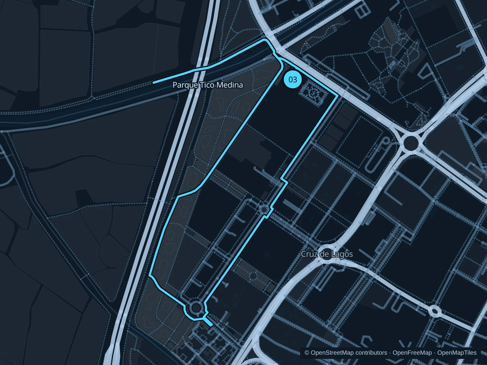
Map of the 2.6 km Parque Tico Medina run, with start and finish marked 03.
03 LoopOpen full-size map
Approx. distance2.6 km
Underfoot

Park paths, paved and unpaved

03

Start here

Public park path on the northern side, toward the Science Park.

Follow the public paths through the park’s southern and western lawns, returning to the northern approach.

Getting there

Walk from the Science Park district to the public park entrance.

Before you go

The open sections have little shade. Avoid the fenced dog area and watch for families on the shared paths.

Park / route information

Get running directions on your phone

Get running directions on your phone

Choose a distance and start at your hotel. RunFromHere plans a loop back to your door and guides you along it. Download the area’s map before you leave to use it offline.

The app generates its own routes from your chosen start; it doesn’t open the routes in this guide.

More places to run

Paseo del Salón & Paseo de la Bomba

Central garden promenades beside the Genil, useful for a warm-up but busy with people crossing.

Park / route information

Fuentenueva

Green paths around the university campus make for another short city run; keep clear of the sports-facility entrances.

Park / route information

Sources & route notes

Researched using the official visitor and park sources below; not checked on foot. Maps and GPX files use the same saved OpenStreetMap pedestrian paths. Distances are approximate. Check local notices for access, gate hours and diversions.

Researched