Skip to routes
RunFromHere
Get the app
English
Illustrated panorama of Faro in white linework.

Faro

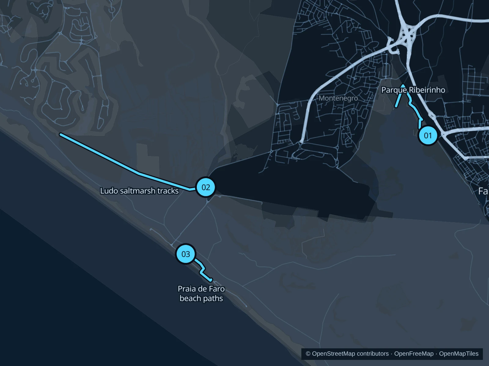
Faro’s best running follows the edge of the Ria Formosa. Parque Ribeirinho is the close-to-town option, Ludo has saltmarsh tracks, and Praia de Faro puts you beside the Atlantic.

Get running directions on your phone

Find a route near your hotel

The numbers mark each start. Distances exclude the journey from your accommodation.

Map data: © OpenStreetMap contributors · OpenFreeMap · OpenMapTiles

Where to run in Faro

Parque Ribeirinho

An easy-to-reach lagoon-edge park run without traveling to the beach.
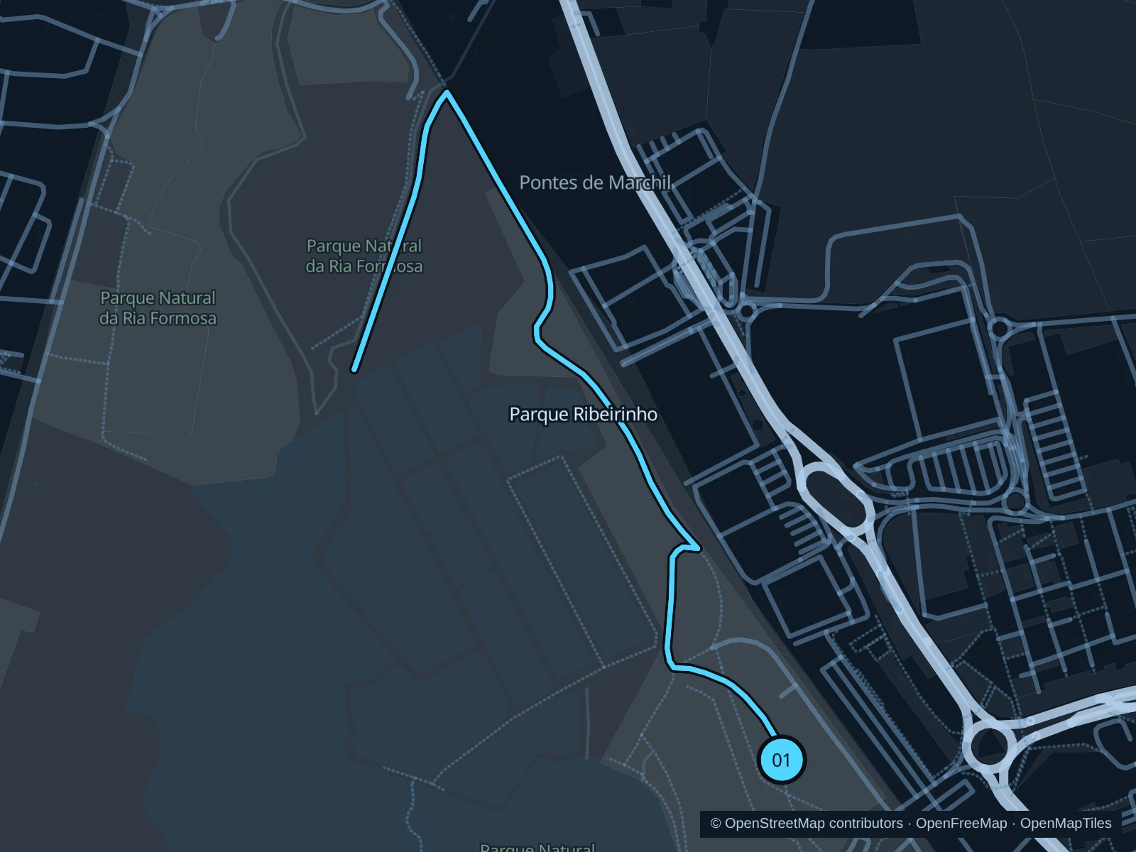
Map of the 2.8 km Parque Ribeirinho run, with start and finish marked 01.
01 Out & backOpen full-size map
Approx. distance2.8 km
Underfoot

Park paths, paved and unpaved

01

Start here

Public park path at the Teatro das Figuras side of Parque Ribeirinho.

Follow the mapped paths west to the lagoon-edge paths, then return along the same route.

Getting there

Approach via Teatro das Figuras and follow signs to the public park entrance. Cross railway tracks only at designated crossings.

Before you go

Stay on marked paths beside the marsh and use public crossings. Shorebirds need space, especially around feeding areas.

Park / route information

Get running directions on your phone
Ludo saltmarsh tracks

A longer outing among saltpans and lagoon channels, with little shelter.

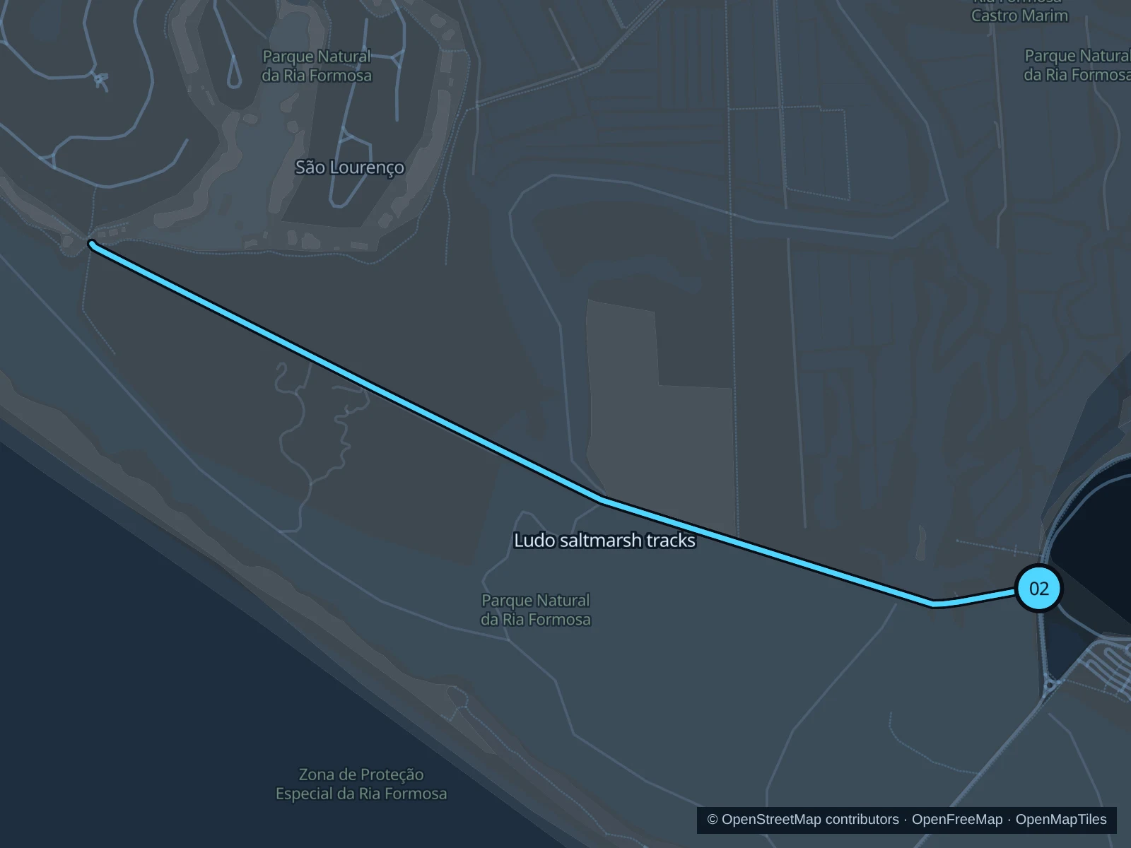
Map of the 5.2 km Ludo saltmarsh tracks run, with start and finish marked 02.
02 Out & backOpen full-size map
Approx. distance5.2 km
Underfoot

Gravel and compacted paths

02

Start here

Public Ludo track entrance off the road toward Praia de Faro, before the beach roundabout when traveling from Faro or the airport.

Follow the mapped paths west along the public saltmarsh tracks toward the lagoon, then return along the same route.

Getting there

Take local transit toward Praia de Faro and walk to the signed Ludo entrance; avoid running along the road shoulder.

Before you go

Carry water and avoid the midday heat. Stay out of working saltpans and private tracks; do not leave the path for birds or photographs. Slow to a walk at gates and barriers.

Park / route information

Get running directions on your phone

Praia de Faro beach paths

A short beachside outing on public footpaths near the bridge.

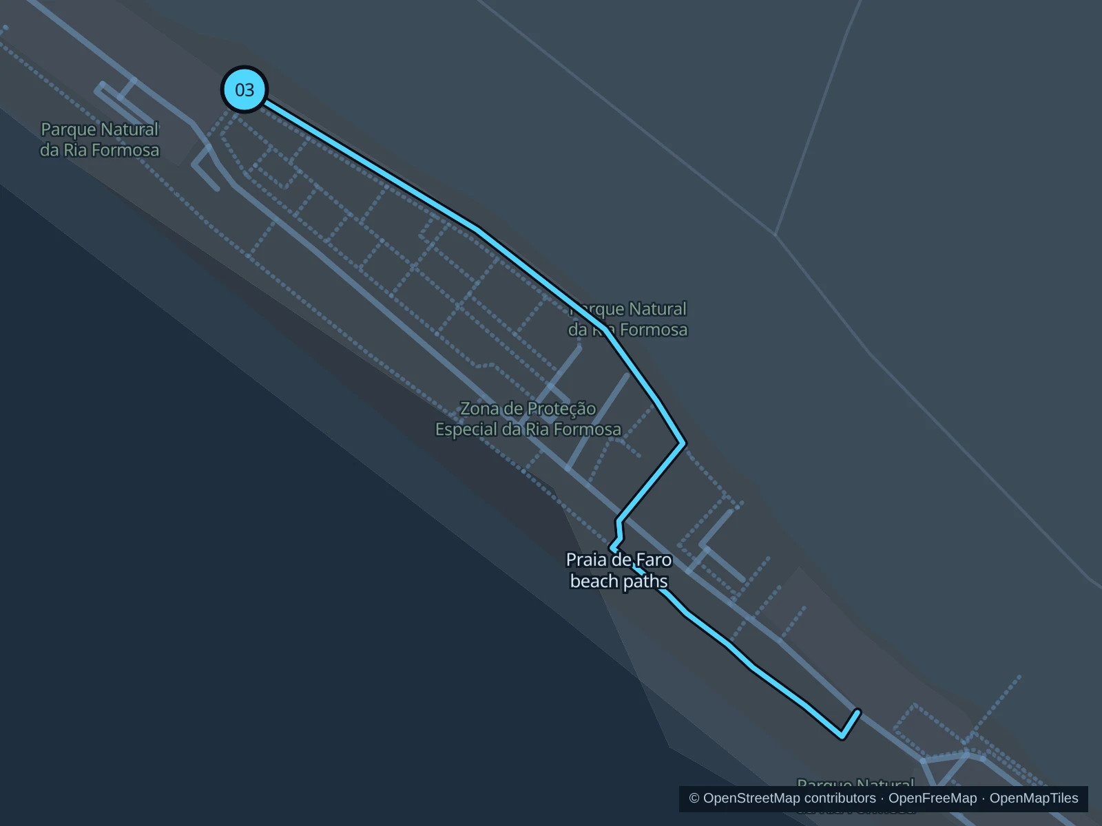
Map of the 1.4 km Praia de Faro beach paths run, with start and finish marked 03.
03 Out & backOpen full-size map
Approx. distance1.4 km
Underfoot

Paving, wooden boardwalk and unpaved paths

03

Start here

Public beach promenade beside the end of the Praia de Faro bridge.

Follow the mapped public beach-access paths southeast through the Praia de Faro settlement, then return the same way.

Getting there

Take local transit to Praia de Faro and walk onto the peninsula.

Before you go

Use boardwalks where provided and keep off dunes. Windblown sand can cover surfaces; turn back where a signed path ends or is closed.

Park / route information

Get running directions on your phone

Get running directions on your phone

Choose a distance and start at your hotel. RunFromHere plans a loop back to your door and guides you along it. Download the area’s map before you leave to use it offline.

The app generates its own routes from your chosen start; it doesn’t open the routes in this guide.

More places to run

Alameda João de Deus

Central garden paths work for an easy warm-up; slow down around families and garden entrances.

Park / route information

Sources & route notes

Researched using the official visitor and park sources below; not checked on foot. Maps and GPX files use the same saved OpenStreetMap pedestrian paths. Distances are approximate. Check local notices for access, gate hours and diversions.

Researched