Skip to routes
RunFromHere
Get the app
English
Illustrated panorama of Doha in white linework.

Doha

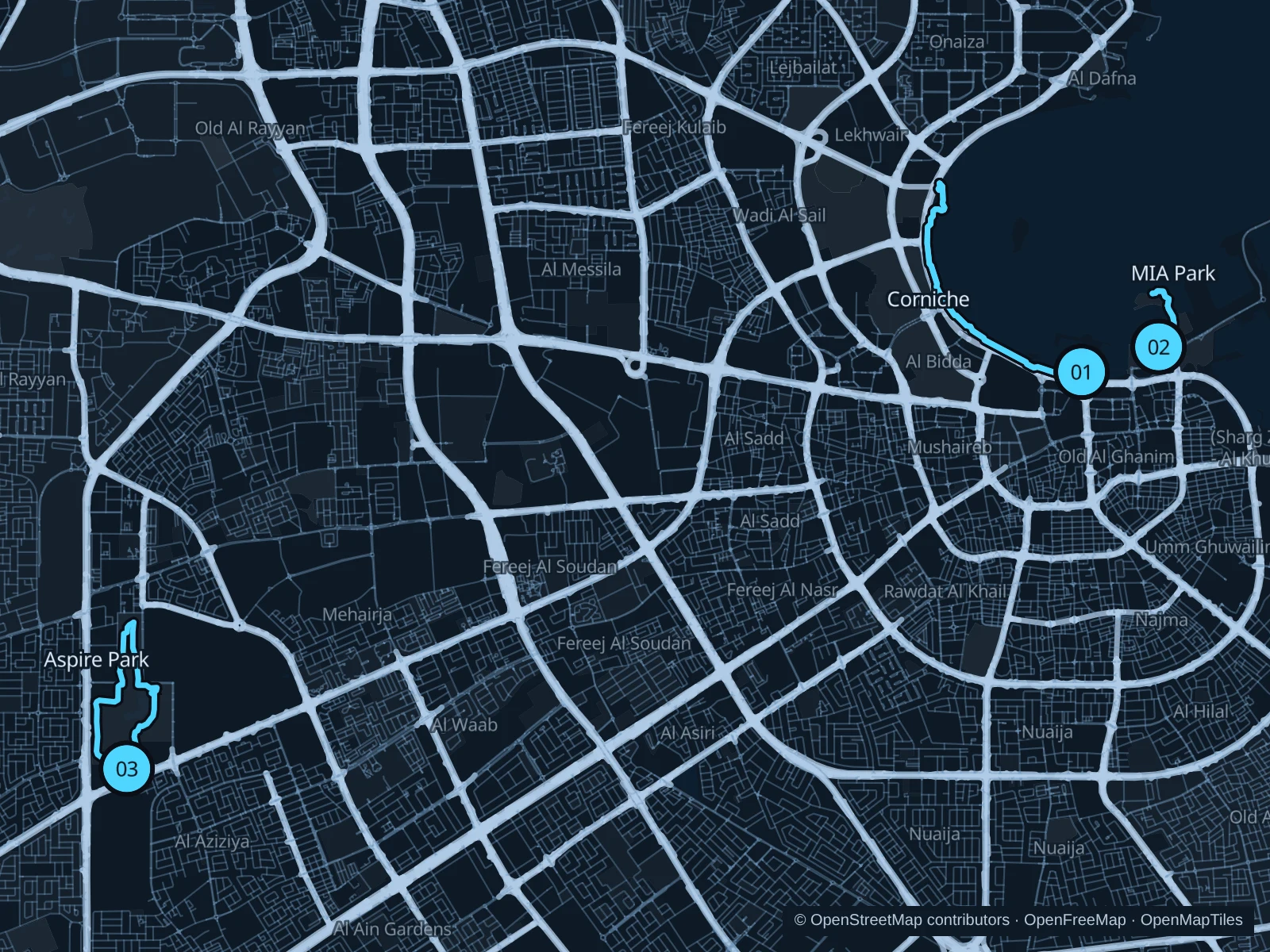
The Corniche gives Doha its longer bayfront run, with the skyline across the water. MIA Park offers a much shorter promenade outing beside the museum, while Aspire Park adds lawns, a lake and running paths away from the center. Plan for heat and humidity, and check event access before heading out.

Get running directions on your phone

Find a route near your hotel

The numbers mark each start. Distances exclude the journey from your accommodation.

Map data: © OpenStreetMap contributors · OpenFreeMap · OpenMapTiles

Where to run in Doha

Doha Corniche

A longer run around the bay’s crescent, with dhows and views toward West Bay. This saved out-and-back covers part of the full Corniche.
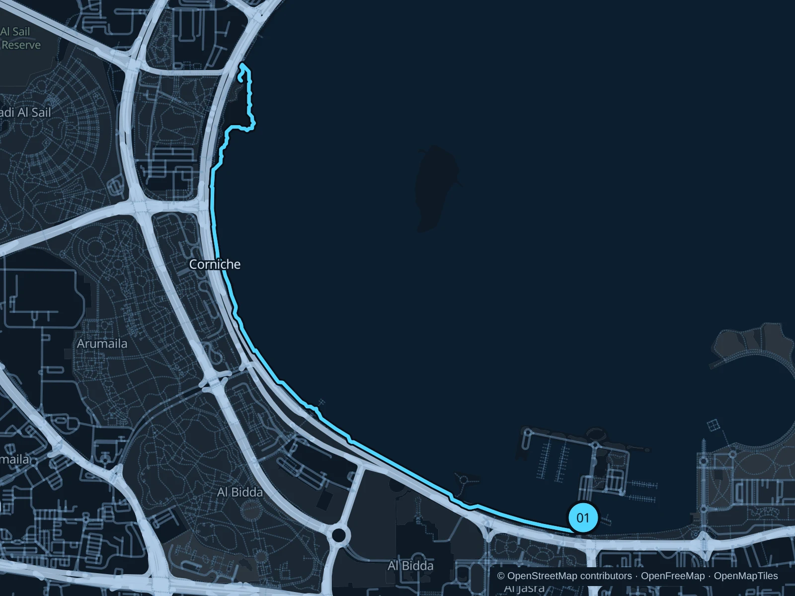
Map of the 6.6 km Doha Corniche run, with start and finish marked 01.
01 Out & backOpen full-size map
Approx. distance6.6 km
Underfoot

Paved public waterfront promenade

01

Start here

On the public Corniche path near the Pearl Monument and dhow harbor.

Follow the bayfront promenade northwest around the crescent toward West Bay, then retrace the saved path.

Getting there

Walk from Souq Waqif metro station toward the Corniche using marked crossings and pedestrian passages.

Before you go

Stay on the promenade rather than the busy road. Crowds and event barriers can slow the run; carry water because much of the waterfront is exposed.

Park / route information

Get running directions on your phone
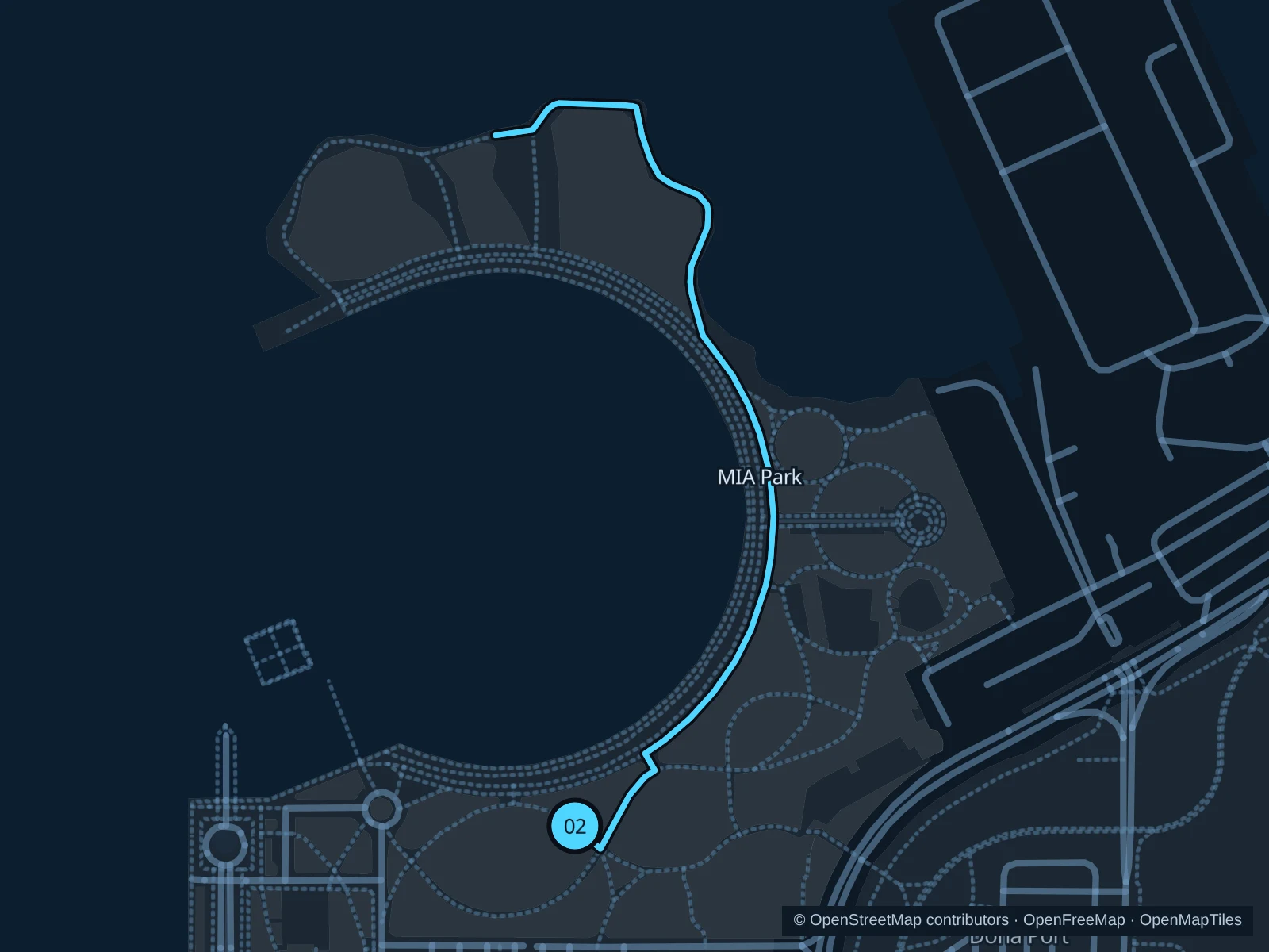
MIA Park · waterfront promenade

A short promenade run with views across the bay and public art nearby, separate from the museum’s indoor galleries.

Map of the 1.7 km MIA Park · waterfront promenade run, with start and finish marked 02.
02 Out & backOpen full-size map
Approx. distance1.7 km
Underfoot

Paved public park promenade

02

Start here

On the public park path east of the museum, inside the southern park approach.

Follow the waterfront curve toward the northern park viewpoint, then return along the same public promenade.

Getting there

Walk from the Corniche toward MIA Park through the public park entrance, following current pedestrian signs.

Before you go

Markets and performances can occupy park paths. Respect the park’s conservative-dress guidance, keep clear of playgrounds and check museum notices separately from park access.

Park / route information

Get running directions on your phone

Aspire Park · running paths

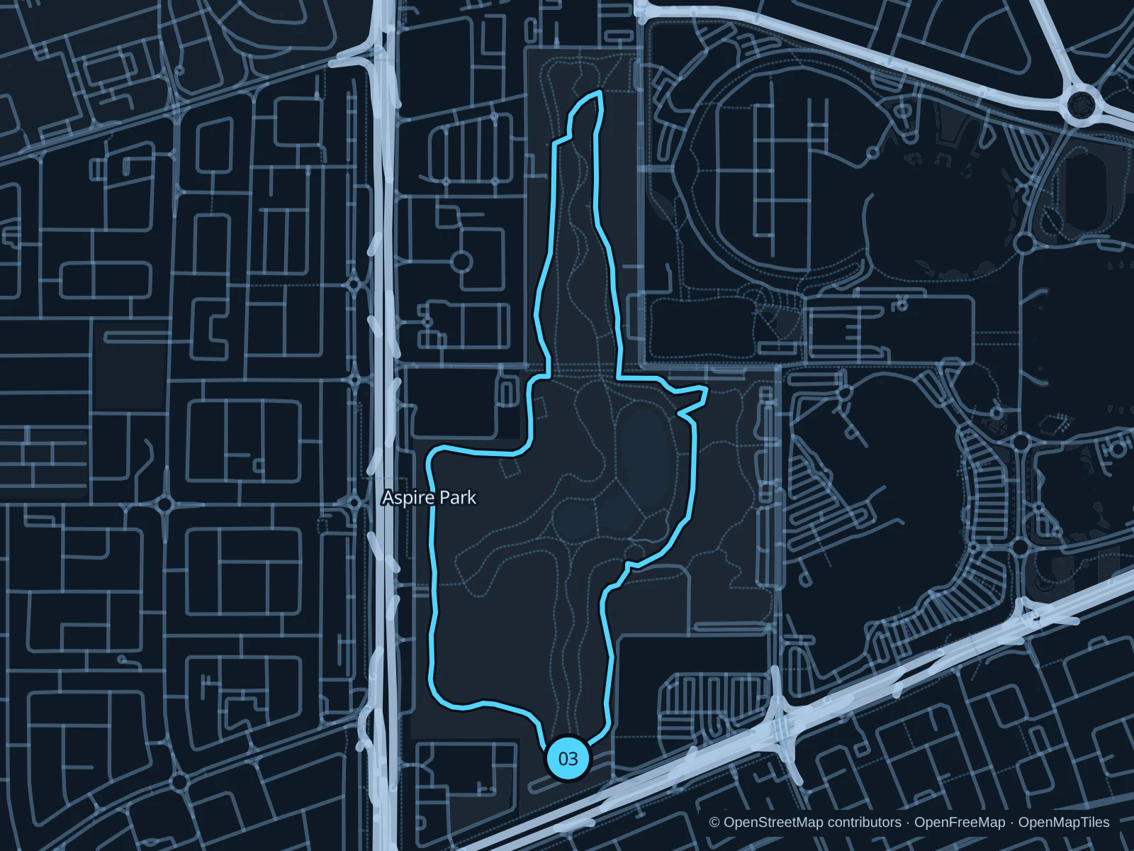
A park circuit on the named running paths, with open lawns, planted sections and the lake landscape away from the waterfront hotels.

Map of the 4.0 km Aspire Park · running paths run, with start and finish marked 03.
03 LoopOpen full-size map
Approx. distance4.0 km
Underfoot

Mixed park running paths, including sand-trail sections

03

Start here

At the southern end of the public Aspire Park Running Trail.

Follow the running paths west and north through the park, then return along the eastern and southern paths.

Getting there

Use a bus or taxi to Aspire Park near Villaggio, then follow the public park paths to the southern end of Aspire Park Running Trail.

Before you go

Sports venues and the mall have separate entrances. Stay on the public running paths, give walkers room and follow current event fencing and park rules.

Park / route information

Get running directions on your phone

Get running directions on your phone

Choose a distance and start at your hotel. RunFromHere plans a loop back to your door and guides you along it. Download the area’s map before you leave to use it offline.

The app generates its own routes from your chosen start; it doesn’t open the routes in this guide.

More places to run

Al Bidda Park

A larger central park across the road from the Corniche. Use the signed pedestrian links and choose a separate park circuit rather than crossing Corniche traffic directly.

Park / route information

Lusail Marina Promenade

Farther north in Lusail, a different waterfront promenade suits stays near the marina. Plan the metro, tram or taxi journey separately from a central-Doha run.

Park / route information

Sources & route notes

Researched using the official visitor and park sources below; not checked on foot. Maps and GPX files use the same saved OpenStreetMap pedestrian paths. Distances are approximate. Check local notices for access, gate hours and diversions.

Researched