Skip to routes
RunFromHere
Get the app
English
Illustrated panorama of Chiang Mai in white linework.

Chiang Mai

Chiang Mai pairs short green outings with a longer urban run beside the Old City moat. Ang Kaew is a separate trip to the university; Nong Buak Haad is convenient for the southwest of the old center. Check air quality before an outdoor workout, run in the cooler hours and allow time for road crossings.

Get running directions on your phone

Find a route near your hotel

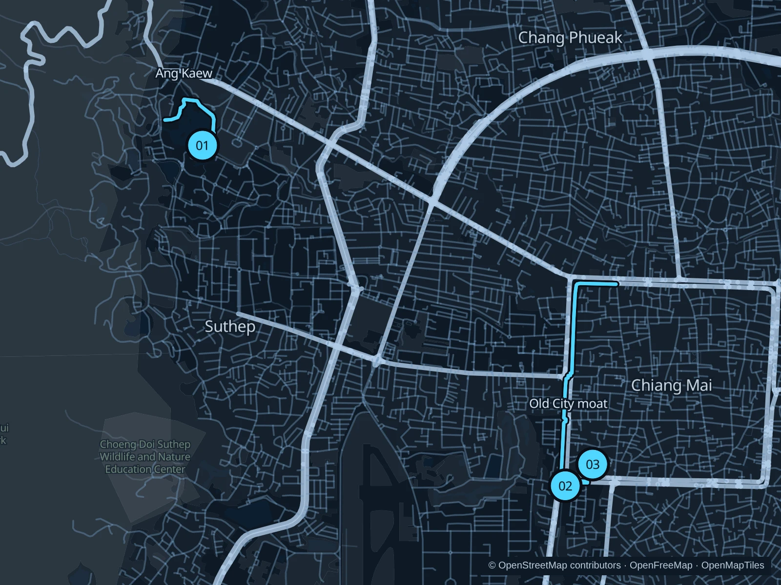
The numbers mark each start. Distances exclude the journey from your accommodation.

Map data: © OpenStreetMap contributors · OpenFreeMap · OpenMapTiles

Where to run in Chiang Mai

Ang Kaew · reservoir paths

A reservoir-side out-and-back on the saved east, north and west-side paths, with mountain views.
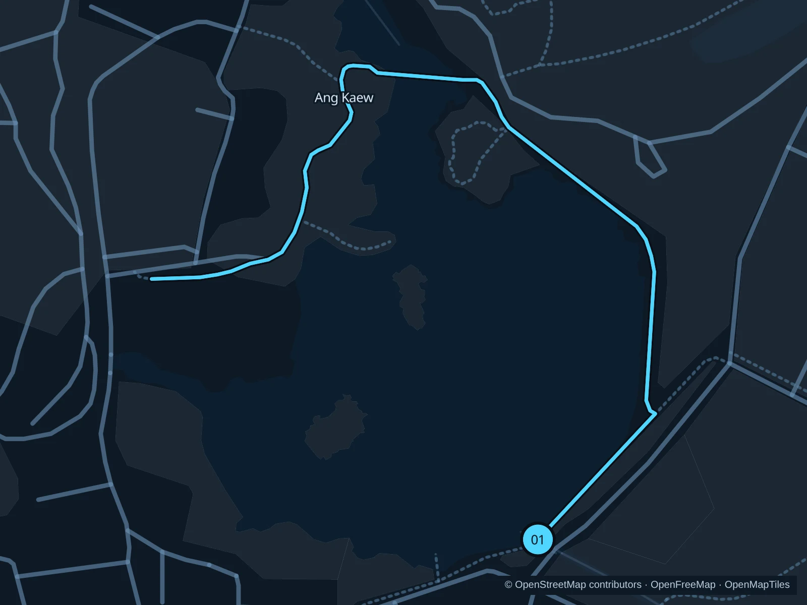
Map of the 1.6 km Ang Kaew · reservoir paths run, with start and finish marked 01.
01 Out & backOpen full-size map
Approx. distance1.6 km
Underfoot

Park footpaths with varying surfaces

01

Start here

On the public southeastern reservoir path inside Chiang Mai University.

Follow the saved path north along the eastern shore and around the northern end toward the western shore, then retrace it.

Getting there

Take a taxi or songthaew to Chiang Mai University’s Huay Kaew Road entrance and follow the permitted visitor access toward Ang Kaew.

Before you go

This is a working campus. Respect current university access rules and events, stay on the exercise paths and keep away from teaching buildings and private grounds.

Park / route information

Get running directions on your phone
Old City · western moat paths

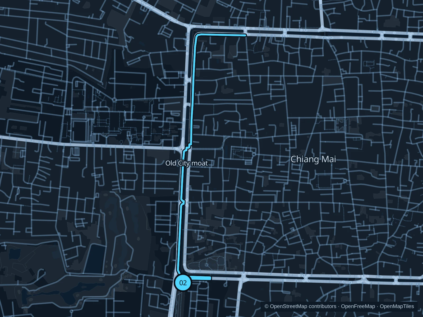
The longer city option follows public footways around the southwestern and western moat, continuing onto its northern side.

Map of the 4.7 km Old City · western moat paths run, with start and finish marked 02.
02 Out & backOpen full-size map
Approx. distance4.7 km
Underfoot

Paved sidewalks, moat paths and street crossings

02

Start here

On the public footpath south of Nong Buak Haad, beside the southwestern moat.

Follow the saved footways west around the southwest corner, north beside the western moat and east along its northern side; return by the same route.

Getting there

Walk from southwestern Old City hotels toward Nong Buak Haad and use marked crossings to reach the moat-side path.

Before you go

The moat is surrounded by active roads. Stop at crossings, follow the saved sidewalk changes and do not run in traffic or climb historic walls to bypass a blocked section.

Park / route information

Get running directions on your phone

Nong Buak Haad · garden laps

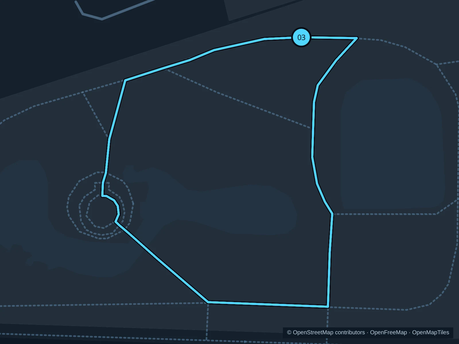
Four short laps on the small connected garden circuit near the public entrance.

Map of the 1.2 km Nong Buak Haad · garden laps run, with start and finish marked 03.
03 LoopOpen full-size map
Approx. distance1.2 km
Underfoot

Paved park paths and entrance links

03

Start here

At the public park path near the northern entrance of Nong Buak Haad.

Complete the saved garden circuit and return to the entrance path; run it four times for the saved total.

Getting there

Walk from the Old City to the park and enter through an open public gate.

Before you go

The full distance includes all four laps. Flower festivals can occupy the gardens; use only open paths, watch access crossings and slow down for families and exercise groups.

Park / route information

Get running directions on your phone

Get running directions on your phone

Choose a distance and start at your hotel. RunFromHere plans a loop back to your door and guides you along it. Download the area’s map before you leave to use it offline.

The app generates its own routes from your chosen start; it doesn’t open the routes in this guide.

More places to run

Huay Kaew Arboretum

A separate wooded public exercise area near the university. Use its signed visitor paths and current gates; do not assume a direct link through every campus or forest boundary.

Park / route information

Huay Tung Tao Reservoir

A separate reservoir excursion north of the city, within a managed visitor area on military land. Check current admission, permitted exercise paths and return transport; stay out of restricted military and forest sections.

Park / route information

Sources & route notes

Researched using the official visitor and park sources below; not checked on foot. Maps and GPX files use the same saved OpenStreetMap pedestrian paths. Distances are approximate. Check local notices for access, gate hours and detours.

Researched