Skip to routes
RunFromHere
Get the app
English
Illustrated panorama of Buenos Aires in white linework.

Buenos Aires

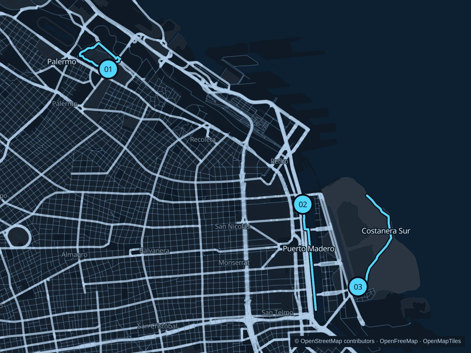
Palermo’s lakes give you park paths near many hotels in the city’s northern neighborhoods. Puerto Madero offers a straighter dockside run close to the business district; beyond it, Costanera Sur trades towers for lagoons, birds and unpaved trails behind gates.

Get running directions on your phone

Find a route near your hotel

The numbers mark each start. Distances exclude the journey from your accommodation.

Map data: © OpenStreetMap contributors · OpenFreeMap · OpenMapTiles

Where to run in Buenos Aires

Palermo · lakes beside El Rosedal

Lakeside paths and broad parkland around the Rosedal area, with the planetarium nearby. This run uses the public park rather than the rose beds.
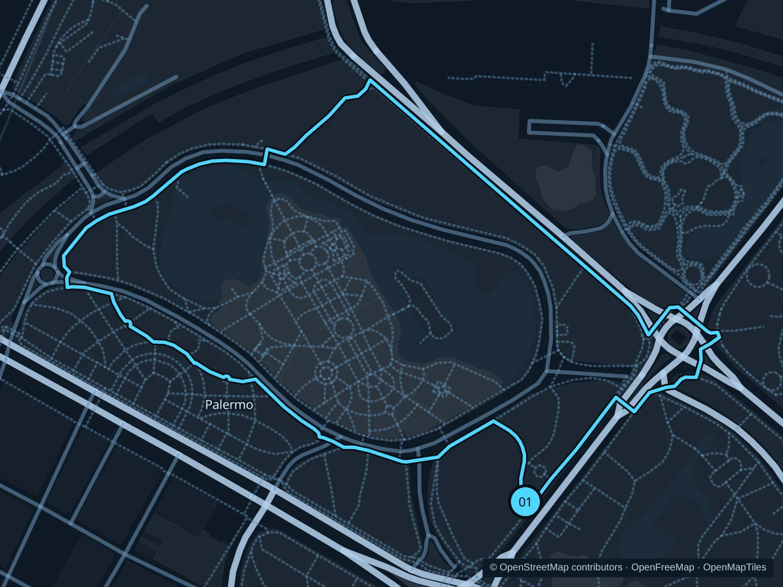
Map of the 2.4 km Palermo · lakes beside El Rosedal run, with start and finish marked 01.
01 LoopOpen full-size map
Approx. distance2.4 km
Underfoot

Paved and compacted park paths

01

Start here

At the public lakeside path beside the Avenida Iraola approach to El Rosedal.

Circle the public paths around the Rosedal lake area and adjacent parkland, returning to the Iraola-side junction.

Getting there

Walk from Plaza Italia or Palermo stations along the public streets into Parque Tres de Febrero.

Before you go

Keep outside the gated rose garden and watch crossings on park roads. Shared paths attract bikes and skaters, especially on weekends.

Park / route information

Get running directions on your phone
Puerto Madero · dockside promenades

Former dock warehouses, moored museum ships and modern towers make a practical waterfront setting near the offices of Microcentro.

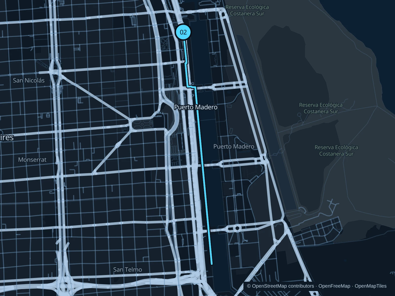
Map of the 4.8 km Puerto Madero · dockside promenades run, with start and finish marked 02.
02 Out & backOpen full-size map
Approx. distance4.8 km
Underfoot

Paved quays and street crossings

02

Start here

On the public western quay of Dique 4 near Cecilia Grierson Street.

Follow the western dockside paths south past Puente de la Mujer toward the southern docks, then return.

Getting there

Walk east from the Catalinas area or nearby bus stops to the public dockside promenade.

Before you go

Stay on the public quays rather than restaurant terraces or vessel gangways. Pause at road crossings between docks and allow space near office-hour crowds.

Park / route information

Get running directions on your phone

Reserva Ecológica Costanera Sur

The nature reserve replaces dockside paving with broad trails, wetland vegetation and views toward the Río de la Plata.

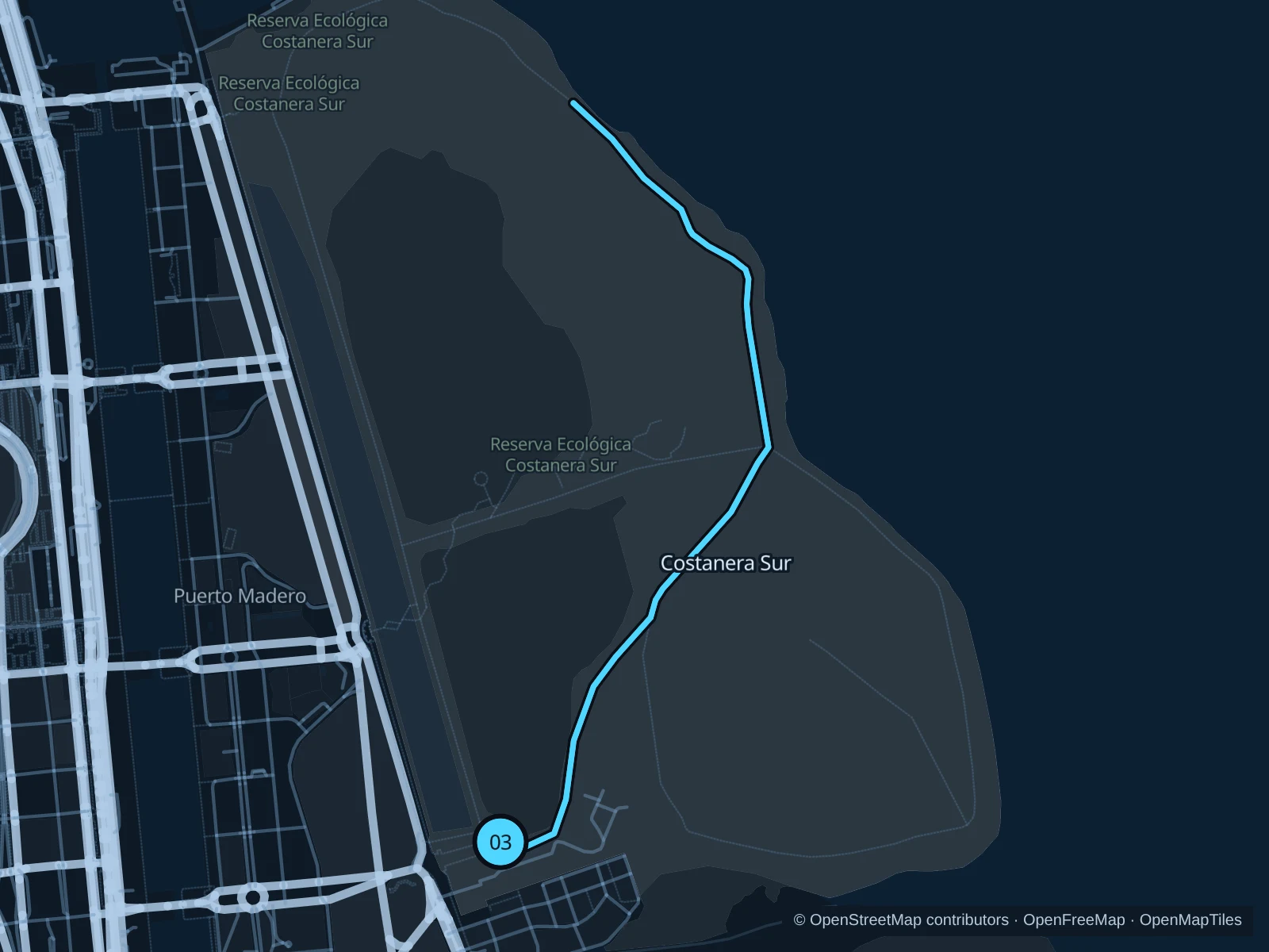
Map of the 5.0 km Reserva Ecológica Costanera Sur run, with start and finish marked 03.
03 Out & backOpen full-size map
Approx. distance5.1 km
Underfoot

Unpaved reserve trails

03

Start here

At the Camino de los Plumerillos junction inside the reserve, reached through the public Brasil entrance.

Follow Camino de los Plumerillos toward the river, continue northwest on Camino de los Alisos and return to the same interior junction.

Getting there

Walk from southern Puerto Madero toward Fuente de las Nereidas and the signed Brasil gate.

Before you go

The reserve is normally open Tuesday through Sunday and closes for strong rain or wind. Check today’s gate status, carry water and stay on marked trails.

Park / route information

Get running directions on your phone

Get running directions on your phone

Choose a distance and start at your hotel. RunFromHere plans a loop back to your door and guides you along it. Download the area’s map before you leave to use it offline.

The app generates its own routes from your chosen start; it doesn’t open the routes in this guide.

More places to run

Lago de Regatas

Farther north in the Palermo park system, the larger lake offers another waterside outing. Road crossings separate it from the Rosedal area.

Park / route information

Parque Centenario

A neighborhood alternative in Caballito, with a lake and a circular park setting. Check gate hours and expect busy paths around fairs.

Park / route information

Sources & route notes

Researched using the official visitor and park sources below; not checked on foot. Maps and GPX files use the same saved OpenStreetMap pedestrian paths. Distances are approximate. Check local notices for access, gate hours and diversions.

Researched