Skip to routes
RunFromHere
Get the app
English
Illustrated panorama of Brisbane in white linework.

Brisbane

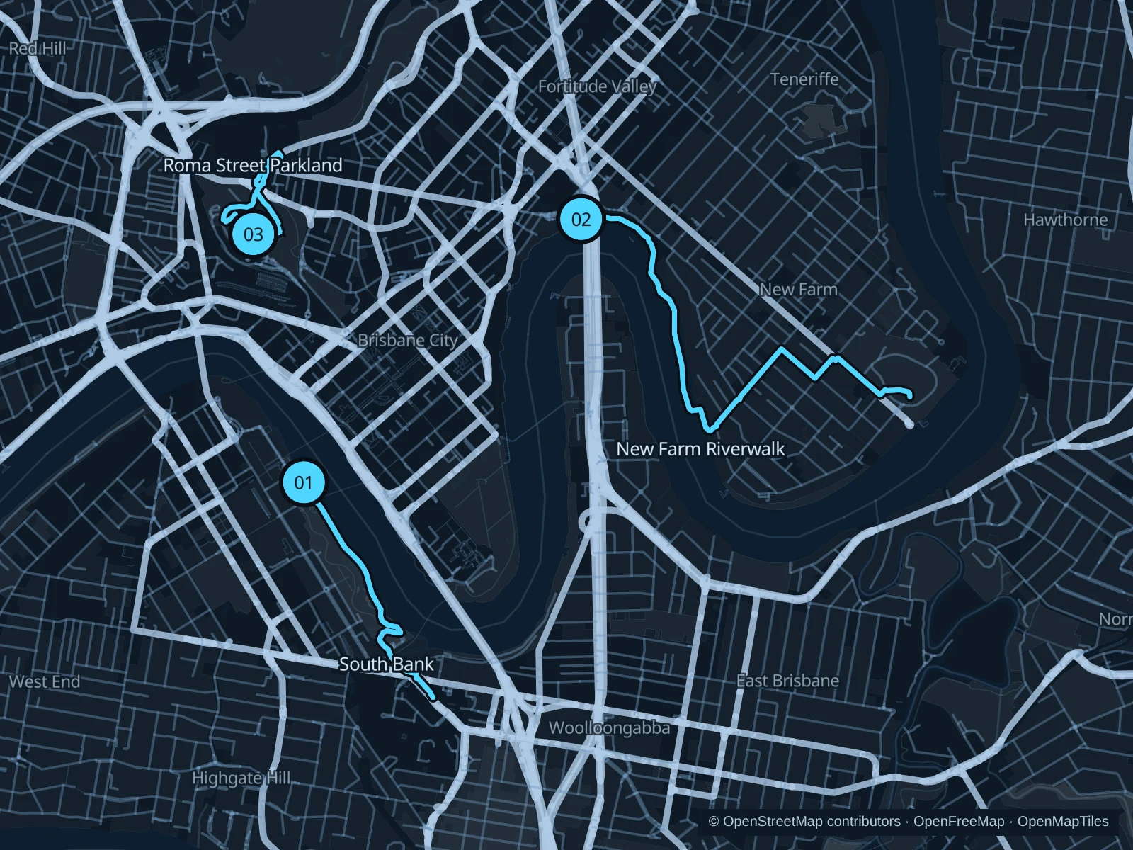
Brisbane’s river bends put the skyline on a different side at every turn. South Bank suits a short run near the cultural precinct, New Farm Riverwalk gives you a longer waterside outing, and Roma Street Parkland adds gardens and slopes beside the station.

Get running directions on your phone

Find a route near your hotel

The numbers mark each start. Distances exclude the journey from your accommodation.

Map data: © OpenStreetMap contributors · OpenFreeMap · OpenMapTiles

Where to run in Brisbane

South Bank · Clem Jones Promenade

A short waterfront run past South Bank’s gardens and swimming lagoon, with the business district directly across the river.
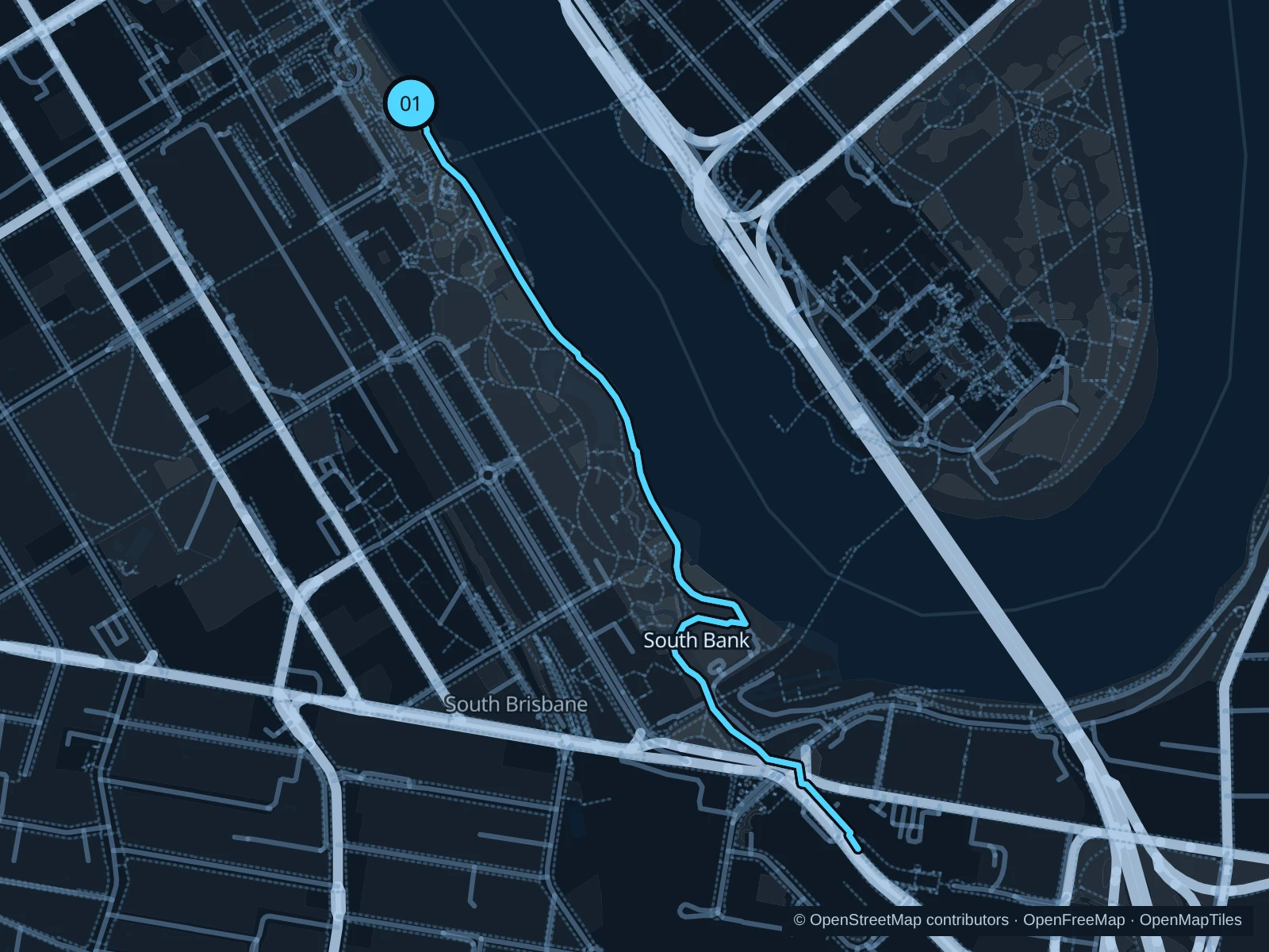
Map of the 3.0 km South Bank · Clem Jones Promenade run, with start and finish marked 01.
01 Out & backOpen full-size map
Approx. distance3.0 km
Underfoot

Paved promenade and shared paths

01

Start here

On the riverside promenade at the Cultural Forecourt, by the Brisbane sign.

Follow Clem Jones Promenade southeast past Streets Beach and the Goodwill Bridge approach to the public path beside the Queensland Maritime Museum, then return.

Getting there

Walk from South Brisbane station towards the river beside QPAC.

Before you go

The promenade is busy around the lagoon and restaurants. Slow down at crossings and run early to avoid the strongest heat.

Park / route information

Get running directions on your phone
Howard Smith Wharves · New Farm Riverwalk

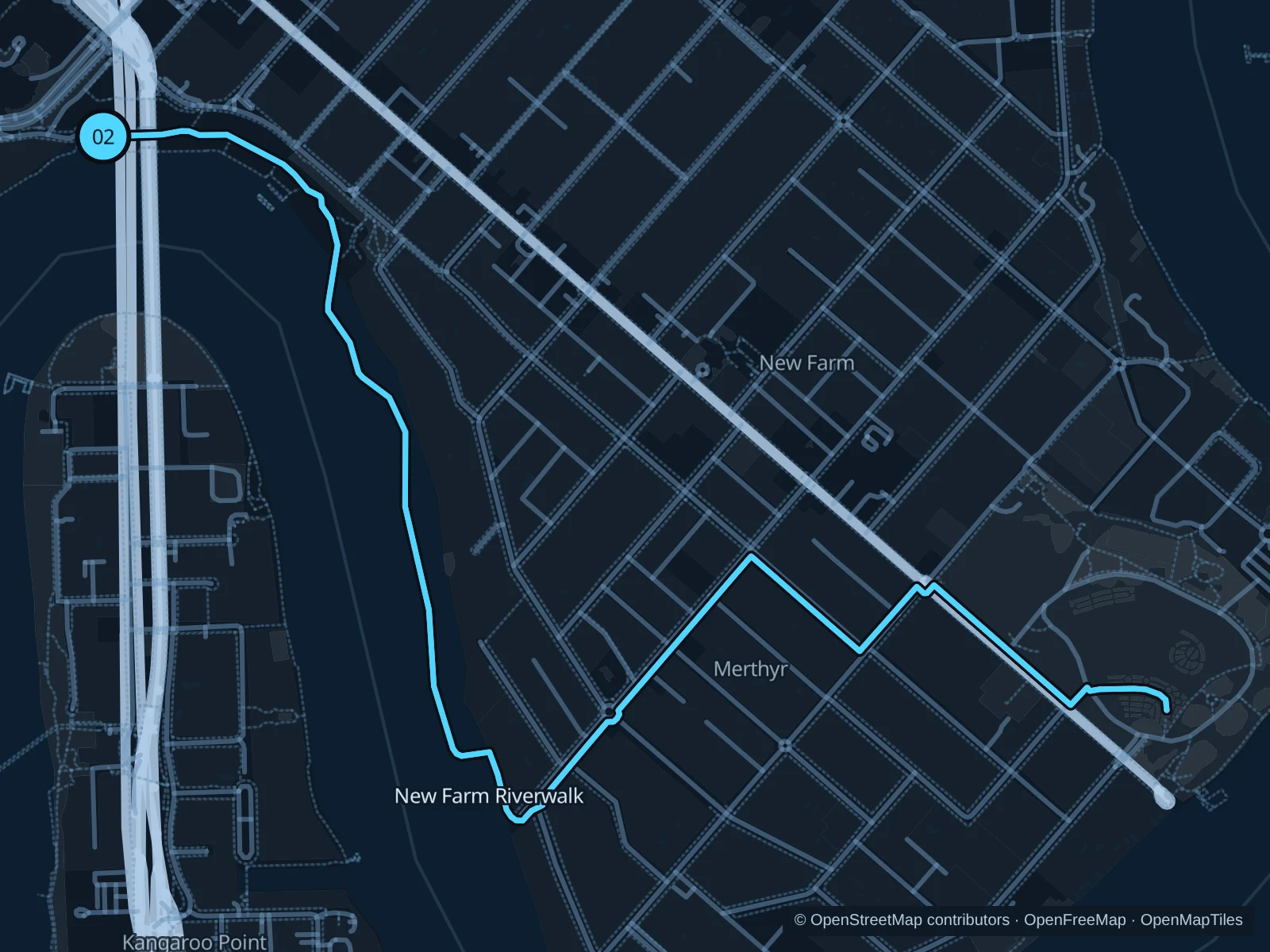
The raised Riverwalk takes you out over the water below New Farm’s houses. This is the longer choice, with broad river views rather than garden laps.

Map of the 5.8 km Howard Smith Wharves · New Farm Riverwalk run, with start and finish marked 02.
02 Out & backOpen full-size map
Approx. distance5.8 km
Underfoot

Paved river paths, boardwalk and street footpaths

02

Start here

At the public river path below Story Bridge at Howard Smith Wharves.

Follow the north-bank Riverwalk around the bend to Riverview Court, then use the public street footpaths to New Farm Park and retrace the saved path.

Getting there

Walk down from Fortitude Valley or approach along the river from the CBD.

Before you go

Keep to the pedestrian side where lanes are marked. Stay off the ferry pontoons; temporary river closures and maintenance signs take priority.

Park / route information

Get running directions on your phone

Roma Street Parkland

A compact garden run with changing levels, lawns and planted paths, useful if your hotel is near Roma Street station.

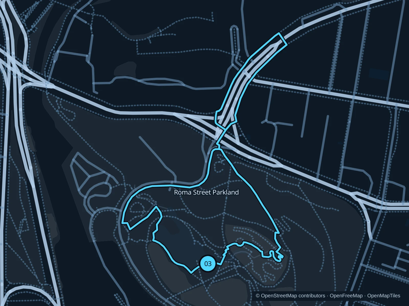
Map of the 1.5 km Roma Street Parkland run, with start and finish marked 03.
03 LoopOpen full-size map
Approx. distance1.5 km
Underfoot

Paved garden paths, ramps and some steps

03

Start here

At the park path above Roma Street station near Parkland Boulevard.

Use the garden paths around the lake and northern lawns, then return through the eastern paths.

Getting there

Follow the signed pedestrian access from Roma Street station into the parkland.

Before you go

The park is hilly and some paths have steps. Keep this an easy outing, follow current garden access signs and avoid event enclosures.

Park / route information

Get running directions on your phone

Get running directions on your phone

Choose a distance and start at your hotel. RunFromHere plans a loop back to your door and guides you along it. Download the area’s map before you leave to use it offline.

The app generates its own routes from your chosen start; it doesn’t open the routes in this guide.

More places to run

City Botanic Gardens

A central riverside option beside QUT, with shaded garden paths and public approaches from Goodwill Bridge.

Park / route information

Kangaroo Point parks

Choose the lower riverside paths for flatter running; the cliff-top level adds city views and steep access between levels.

Park / route information

Sources & route notes

Researched using the official visitor and park sources below; not checked on foot. Maps and GPX files use the same saved OpenStreetMap pedestrian paths. Distances are approximate. Check local notices for access, gate hours and diversions.

Researched