Skip to routes
RunFromHere
Get the app
English
Illustrated panorama of Bilbao in white linework.

Bilbao

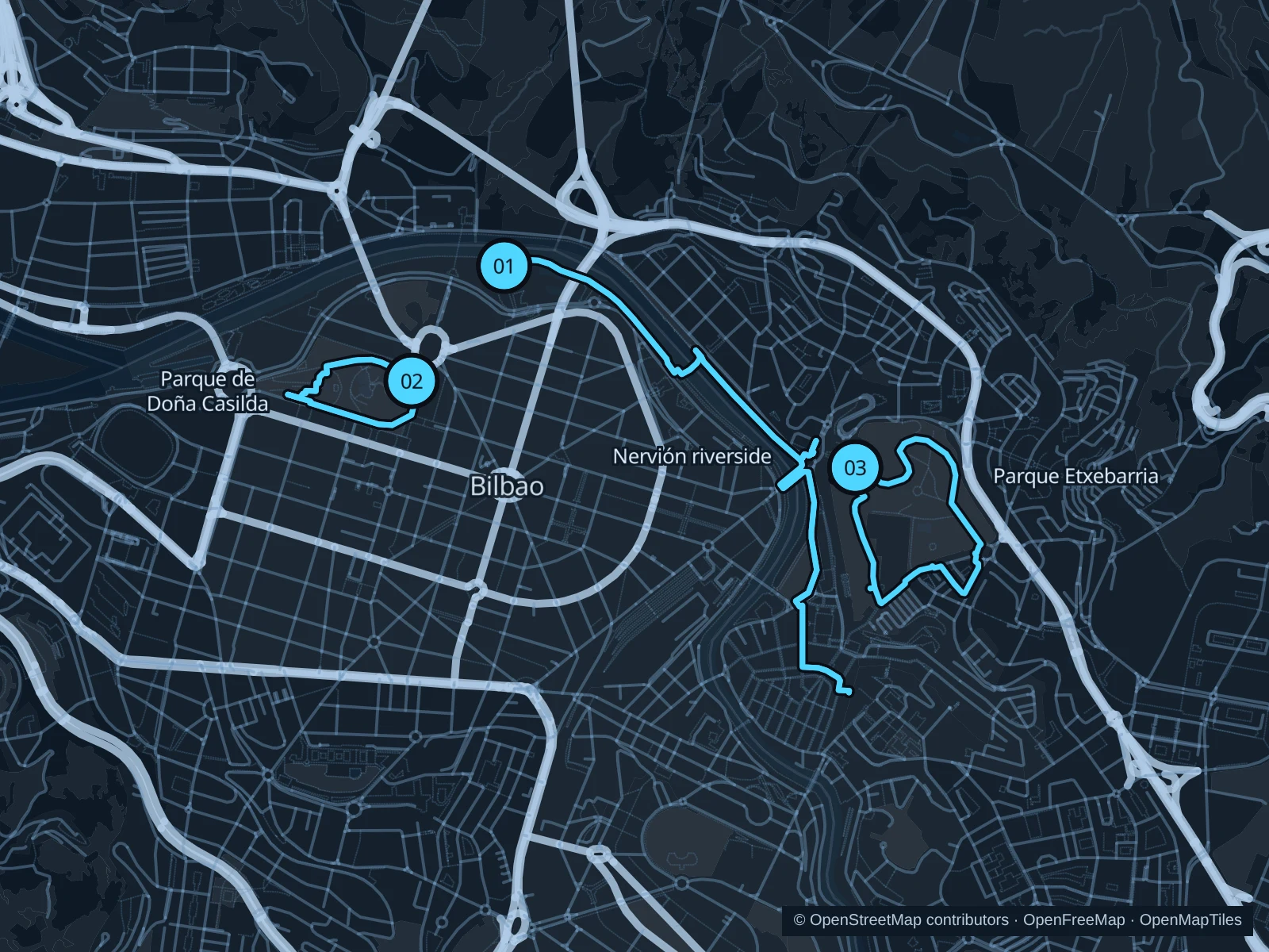
The Nervión gives Bilbao a central running corridor beside the museums and former docks. Doña Casilda offers a shorter green circuit; Etxebarria adds slopes and views above the old town.

Get running directions on your phone

Find a route near your hotel

The numbers mark each start. Distances exclude the journey from your accommodation.

Map data: © OpenStreetMap contributors · OpenFreeMap · OpenMapTiles

Where to run in Bilbao

Nervión · Guggenheim to Old Town

An urban riverside run from the museum district toward the old town.
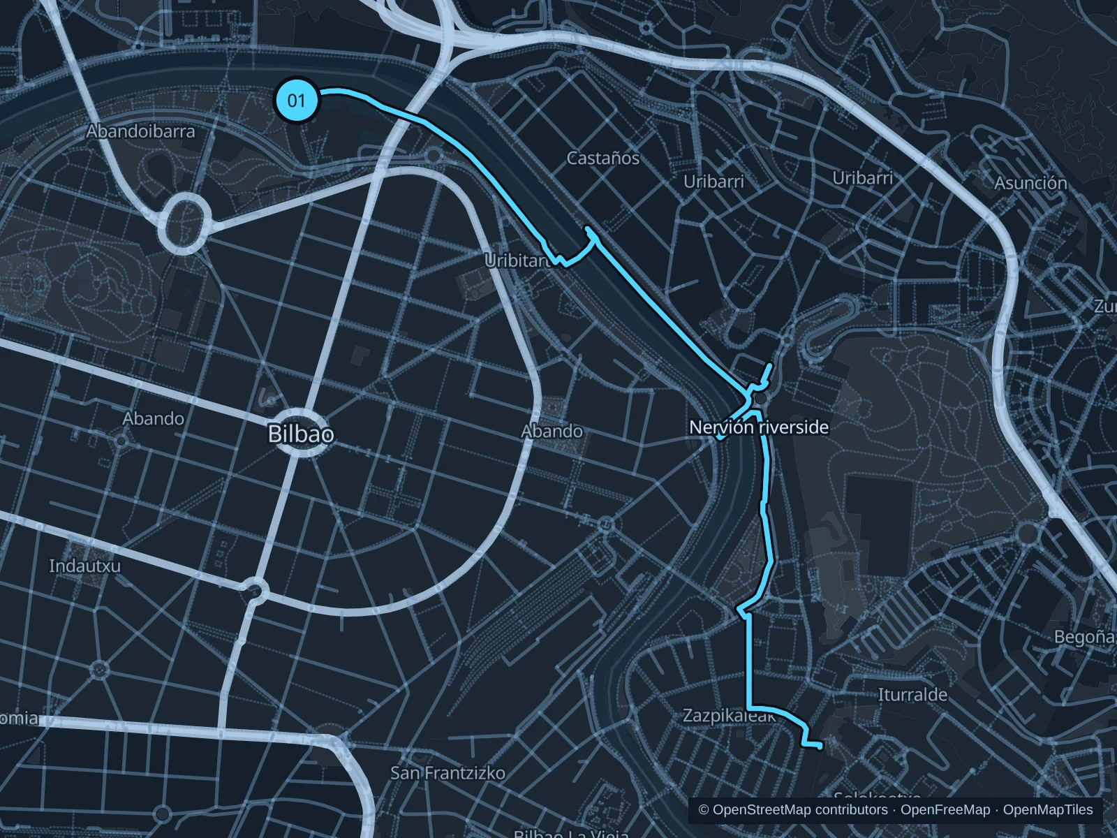
Map of the 5.2 km Nervión · Guggenheim to Old Town run, with start and finish marked 01.
01 Out & backOpen full-size map
Approx. distance5.2 km
Underfoot

Paved paths

01

Start here

Public riverside promenade alongside Guggenheim Park, outside the museum.

Follow the mapped riverside paths east and south toward San Antón by the old town, then return the same way.

Getting there

Walk from the Moyua area or the Guggenheim tram stop to the riverside promenade.

Before you go

Allow for street crossings, bridge approaches and busy pedestrian sections. Slow down near museum lines and stay out of admission areas. The route includes steps; walk these sections.

Park / route information

Get running directions on your phone
Doña Casilda · two laps

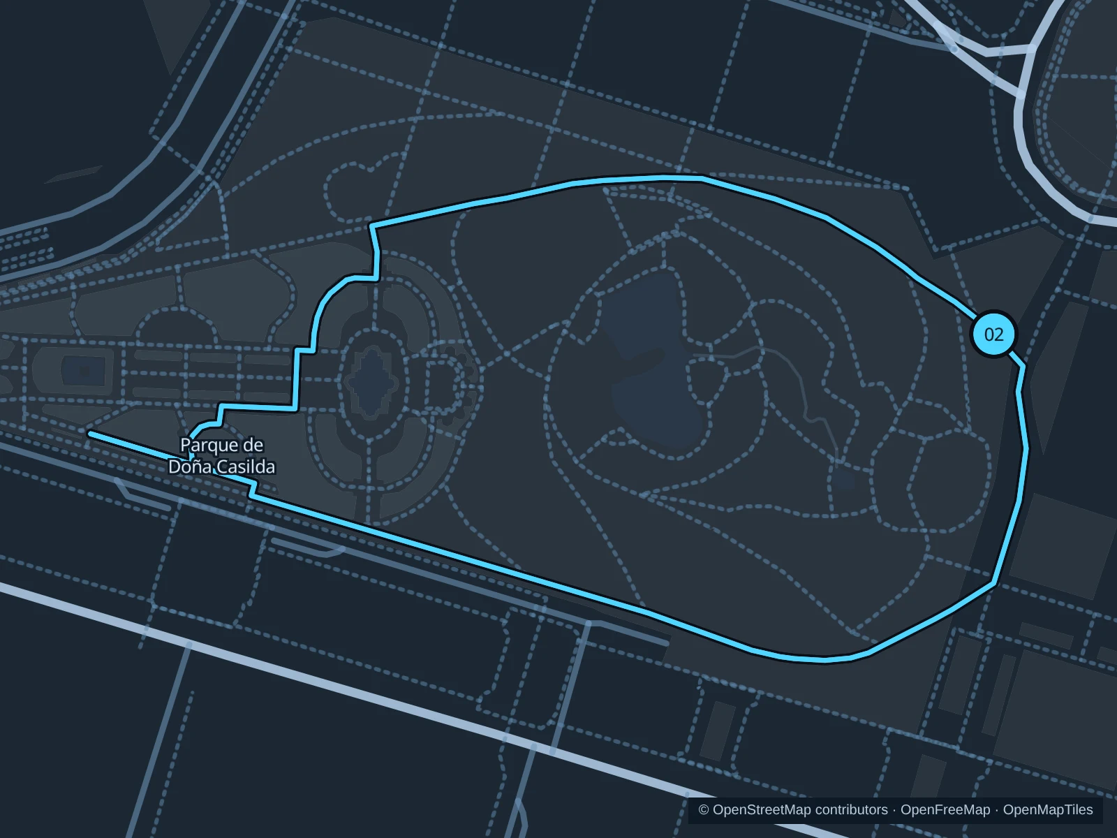
A compact park loop along tree-lined paths, past lawns and the duck pond.

Map of the 2.1 km Doña Casilda · two laps run, with start and finish marked 02.
02 LoopOpen full-size map
Approx. distance2.1 km
Underfoot

Park paths, paved and unpaved

02

Start here

Public park path on the Museo de Bellas Artes side.

Run two laps on the public park paths around the lawns and pond, returning each time to the museum-side start.

Getting there

Walk from the Moyua area or Indautxu toward the Museo de Bellas Artes and the park.

Before you go

Keep the pace easy around the pond and playgrounds. Wet paving and fallen leaves can be slippery.

Park / route information

Get running directions on your phone

Parque Etxebarria

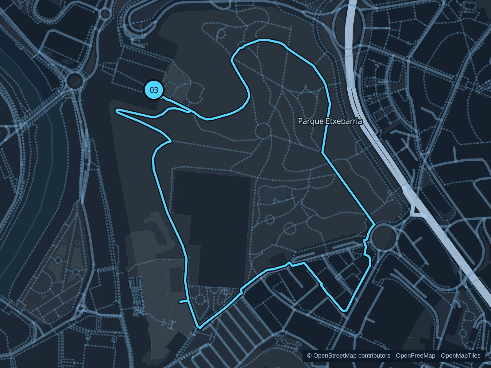
A hilltop park circuit above the old town, with open views and slopes.

Map of the 2.0 km Parque Etxebarria run, with start and finish marked 03.
03 LoopOpen full-size map
Approx. distance2.0 km
Underfoot

Park paths, paved and unpaved

03

Start here

Public northwestern park entrance above Plaza del Gas.

Circle the public paths around the park’s open lawns, returning to the northwestern entrance.

Getting there

Walk uphill from the old town toward Plaza del Gas and the public park paths.

Before you go

Expect slopes and wind. Festivals can occupy the central grounds; follow signs around temporary fencing. The route includes steps; walk these sections.

Park / route information

Get running directions on your phone

Get running directions on your phone

Choose a distance and start at your hotel. RunFromHere plans a loop back to your door and guides you along it. Download the area’s map before you leave to use it offline.

The app generates its own routes from your chosen start; it doesn’t open the routes in this guide.

More places to run

Artxanda

Take the funicular for hilltop paths and viewpoints. Expect climbs and check signs before continuing onto forest paths.

Park / route information

Sources & route notes

Researched using the official visitor and park sources below; not checked on foot. Maps and GPX files use the same saved OpenStreetMap pedestrian paths. Distances are approximate. Check local notices for access, gate hours and diversions.

Researched