Skip to routes
RunFromHere
Get the app
English
Illustrated panorama of Berlin in white linework.

Berlin

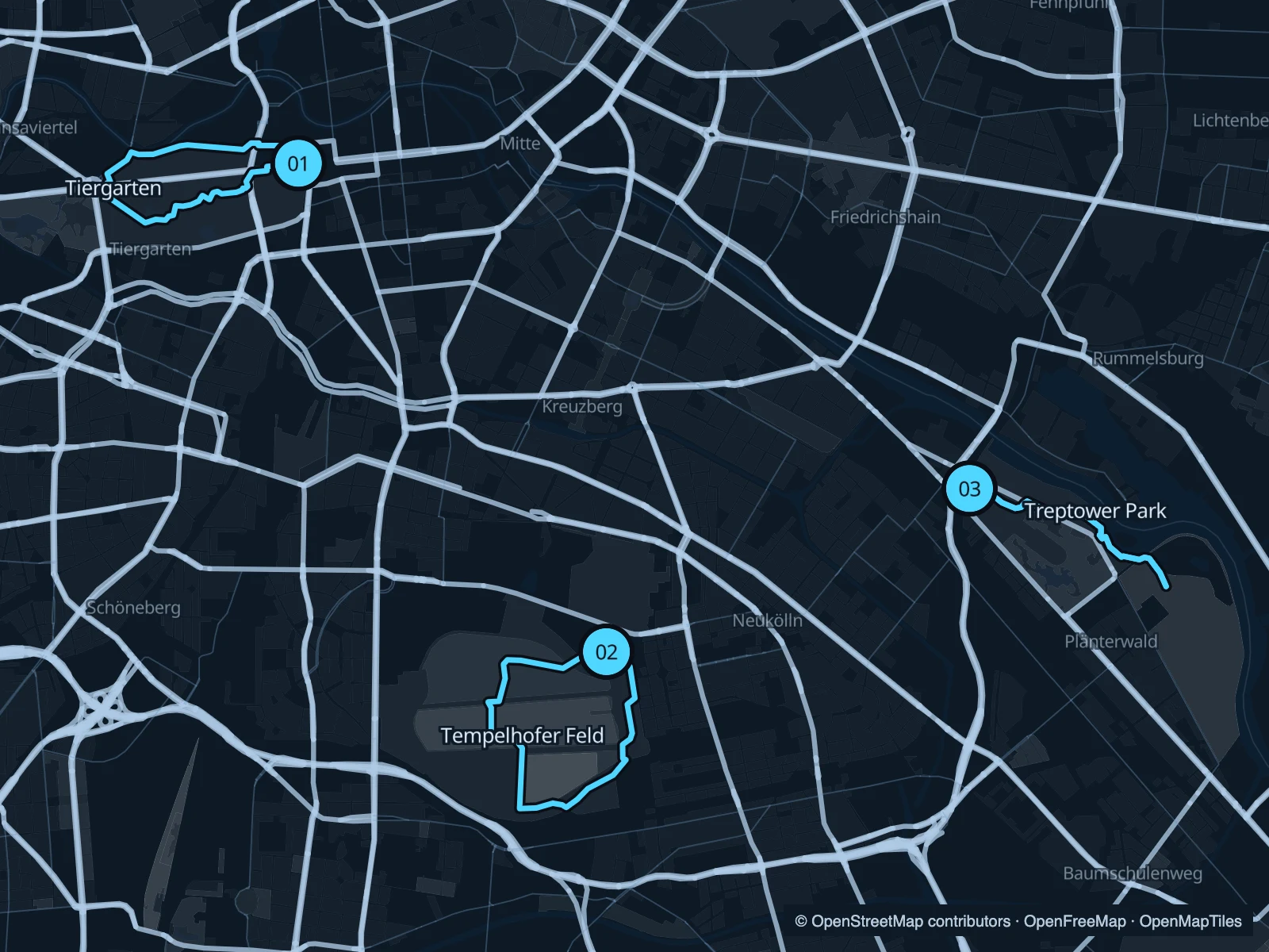
The Tiergarten puts a park run next to the Brandenburg Gate. Tempelhofer Feld trades trees for open sky and former runways; Treptower Park follows the Spree southeast. Berlin is spread out, so choose the side of town that fits your stay.

Get running directions on your phone

Find a route near your hotel

The numbers mark each start. Distances exclude the journey from your accommodation.

Map data: © OpenStreetMap contributors · OpenFreeMap · OpenMapTiles

Where to run in Berlin

Tiergarten

Wooded paths and a circuit through the eastern Tiergarten. It is close to major sights without following the busy shopping streets.
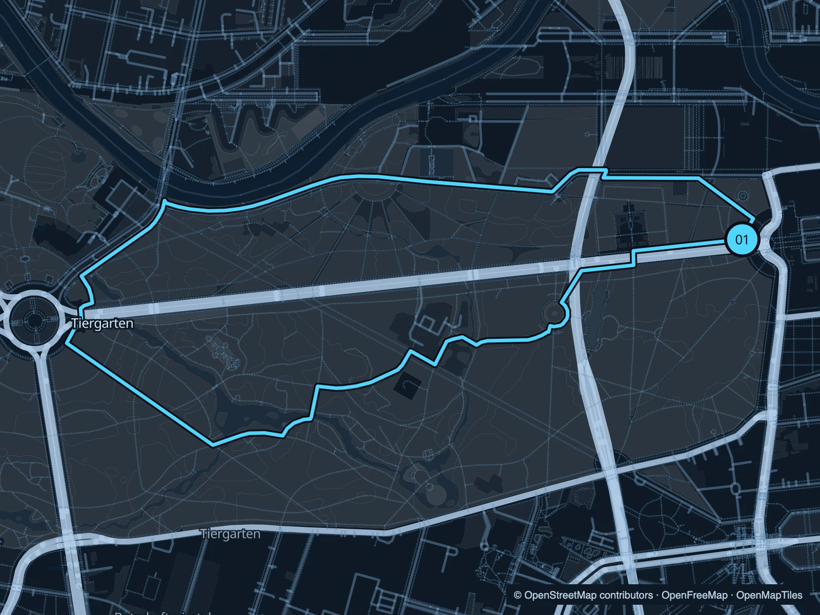
Map of the 4.2 km Tiergarten run, with start and finish marked 01.
01 LoopOpen full-size map
Approx. distance4.2 km
Underfoot

Mixed park paths; road crossings

01

Start here

At the park edge immediately west of the Brandenburg Gate.

Head west through the park, loop around the central paths and return along the northern side.

Getting there

Walk from Brandenburger Tor station through the gate.

Before you go

The park is crossed by roads. Pause at crossings and follow event diversions around the gate.

Park / route information

Get running directions on your phone
Tempelhofer Feld

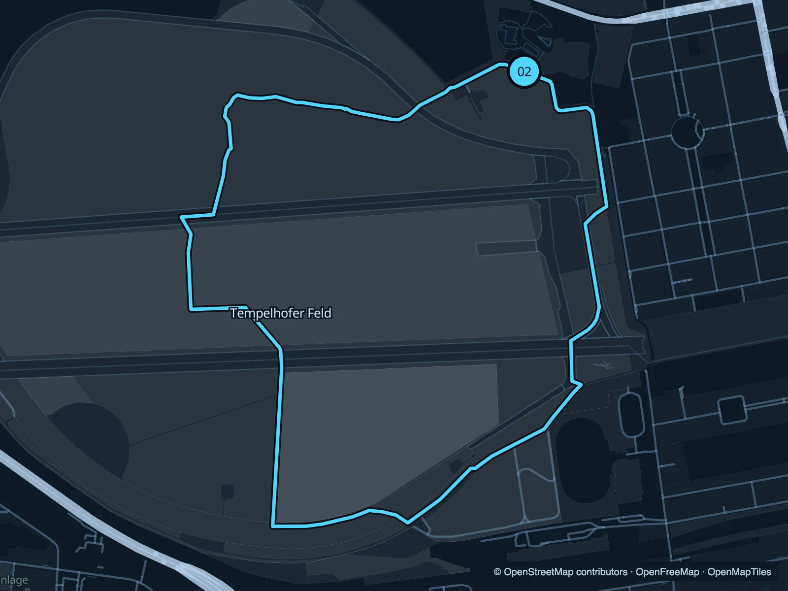
Wide views and long stretches across a former airfield. This circuit uses the public field paths rather than the streets outside the fence.

Map of the 4.8 km Tempelhofer Feld run, with start and finish marked 02.
02 LoopOpen full-size map
Approx. distance4.8 km
Underfoot

Paved airfield paths

02

Start here

Inside the northeastern field access from the Oderstraße side.

Loop south through the field, turn west and return across its northern paths.

Getting there

Approach through Schillerkiez from the Boddinstraße side.

Before you go

There is little shelter from sun or wind. The gates close; check today’s opening times.

Park / route information

Get running directions on your phone

Treptower Park · Spree

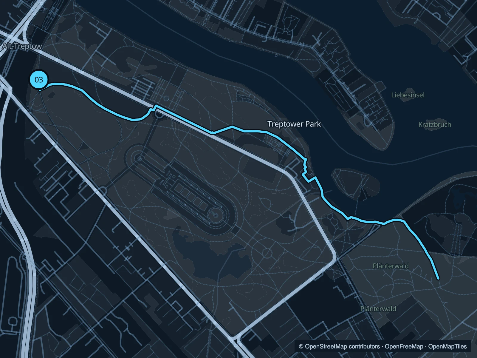
A riverside run past lawns and landing stages, heading towards the green spaces beyond the main park.

Map of the 4.5 km Treptower Park · Spree run, with start and finish marked 03.
03 Out & backOpen full-size map
Approx. distance4.5 km
Underfoot

Paved and mixed riverside paths

03

Start here

On the Spree path by the northwestern end of Treptower Park.

Follow the Spree southeast through the park and return from the mapped turnaround.

Getting there

Walk from Treptower Park S-Bahn station towards the river.

Before you go

Slow down by boat landings and waterside cafés. Keep to the public bank when paths branch.

Park / route information

Get running directions on your phone

Get running directions on your phone

Choose a distance and start at your hotel. RunFromHere plans a loop back to your door and guides you along it. Download the area’s map before you leave to use it offline.

The app generates its own routes from your chosen start; it doesn’t open the routes in this guide.

More places to run

Grunewald

Save more time for the woodland paths west of the city; this is a different outing from a short central run.

Park / route information

Sources & route notes

Researched using the official visitor and park sources below; not checked on foot. Maps and GPX files use the same saved OpenStreetMap pedestrian paths. Distances are approximate. Check local notices for access, gate hours and diversions.

Researched