Skip to routes
RunFromHere
Get the app
English
Illustrated panorama of Belfast in white linework.

Belfast

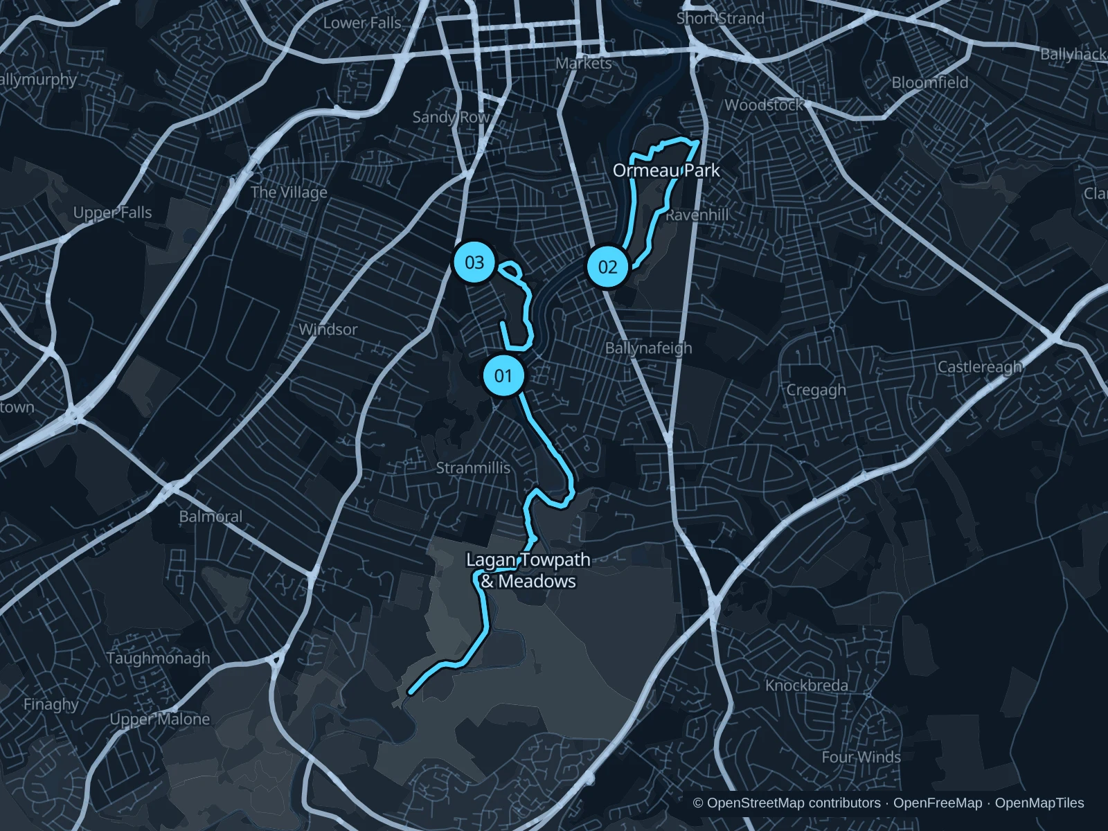
The Lagan Towpath gives you room for a longer run south of the center. Ormeau Park offers a leafy circuit on the other side of the river, while Botanic Gardens works for a short outing near Queen’s University. Plan park runs around seasonal gate closing times.

Get running directions on your phone

Find a route near your hotel

The numbers mark each start. Distances exclude the journey from your accommodation.

Map data: © OpenStreetMap contributors · OpenFreeMap · OpenMapTiles

Where to run in Belfast

Lagan Towpath & Meadows

A longer out-and-back on public Lagan Valley paths from Stranmillis, with riverside and meadow sections.
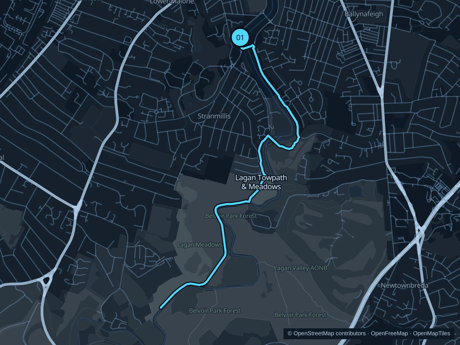
Map of the 6.8 km Lagan Towpath & Meadows run, with start and finish marked 01.
01 Out & backOpen full-size map
Approx. distance6.8 km
Underfoot

Paved and compacted towpath

01

Start here

Public Lagan Towpath beside Lockview Road in Stranmillis.

Follow the mapped public towpath and Lagan Meadows connections south to the marked turnaround, then return the same way.

Getting there

Travel towards Stranmillis and walk along Lockview Road to the public towpath entrance.

Before you go

Share the narrow towpath with walkers and cyclists. Mud, flooding and low winter light can change conditions; respect closure signs and keep away from the river edge.

Park / route information

Get running directions on your phone
Ormeau Park

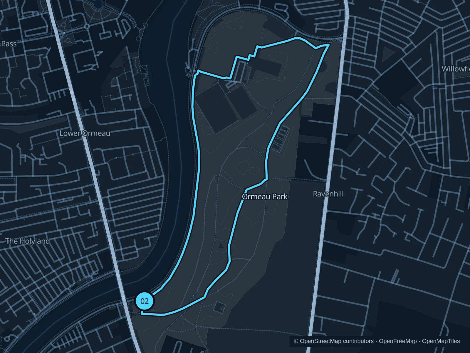
A park circuit on public avenues among trees and open lawns, outside the golf course.

Map of the 2.6 km Ormeau Park run, with start and finish marked 02.
02 LoopOpen full-size map
Approx. distance2.6 km
Underfoot

Park paths, paved and unpaved

02

Start here

Public southwestern park path from the Ormeau Road entrance.

Follow the mapped circuit north on the public wooded park paths, then return to the western entrance on Ormeau Road.

Getting there

Use public transport along Ormeau Road and walk through the signed public park entrance.

Before you go

Check gate hours and event access. Stay outside the golf course, BMX track and enclosed sports courts; give organized runs and dog walkers room. Slow to a walk at gates and barriers.

Park / route information

Get running directions on your phone

Botanic Gardens

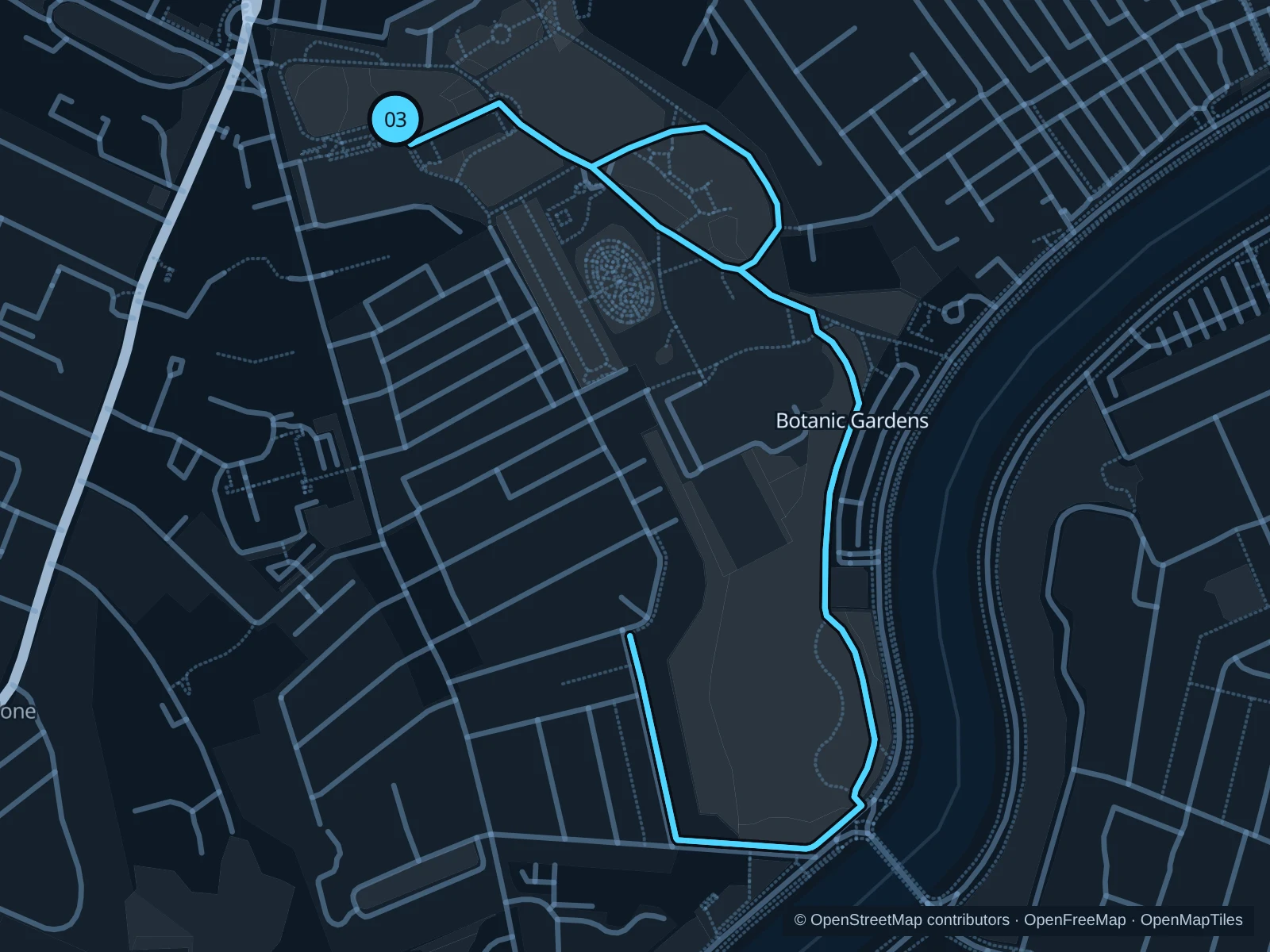
An easy outdoor garden circuit near the university, the museum and hotels south of the center.

Map of the 2.5 km Botanic Gardens run, with start and finish marked 03.
03 LoopOpen full-size map
Approx. distance2.5 km
Underfoot

Paved paths

03

Start here

Public northern garden path near the Botanic Avenue entrance.

Run one lap on the outdoor public garden paths, outside the Palm House and Tropical Ravine buildings.

Getting there

Walk from Queen’s University or Botanic Avenue to the public garden gate.

Before you go

Closing times move earlier as winter approaches. Give visitors room near the glasshouses, keep out of flower beds and check concert or festival enclosures. Slow to a walk at gates and barriers.

Park / route information

Get running directions on your phone

Get running directions on your phone

Choose a distance and start at your hotel. RunFromHere plans a loop back to your door and guides you along it. Download the area’s map before you leave to use it offline.

The app generates its own routes from your chosen start; it doesn’t open the routes in this guide.

More places to run

Victoria Park

A compact eastern park with public paths around the lake, useful for a separate outing near the airport side of the city. Follow current access signs and give birds space.

Park / route information

Waterworks

A northern park alternative with reservoir-side paths and a different neighborhood setting. Use the public park paths and check gate hours.

Park / route information

Sources & route notes

Researched using the official visitor and park sources below; not checked on foot. Maps and GPX files use the same saved OpenStreetMap pedestrian paths. Distances are approximate. Check local notices for access, gate hours and diversions.

Researched