Skip to routes
RunFromHere
Get the app
English
Illustrated panorama of Barcelona in white linework.

Barcelona

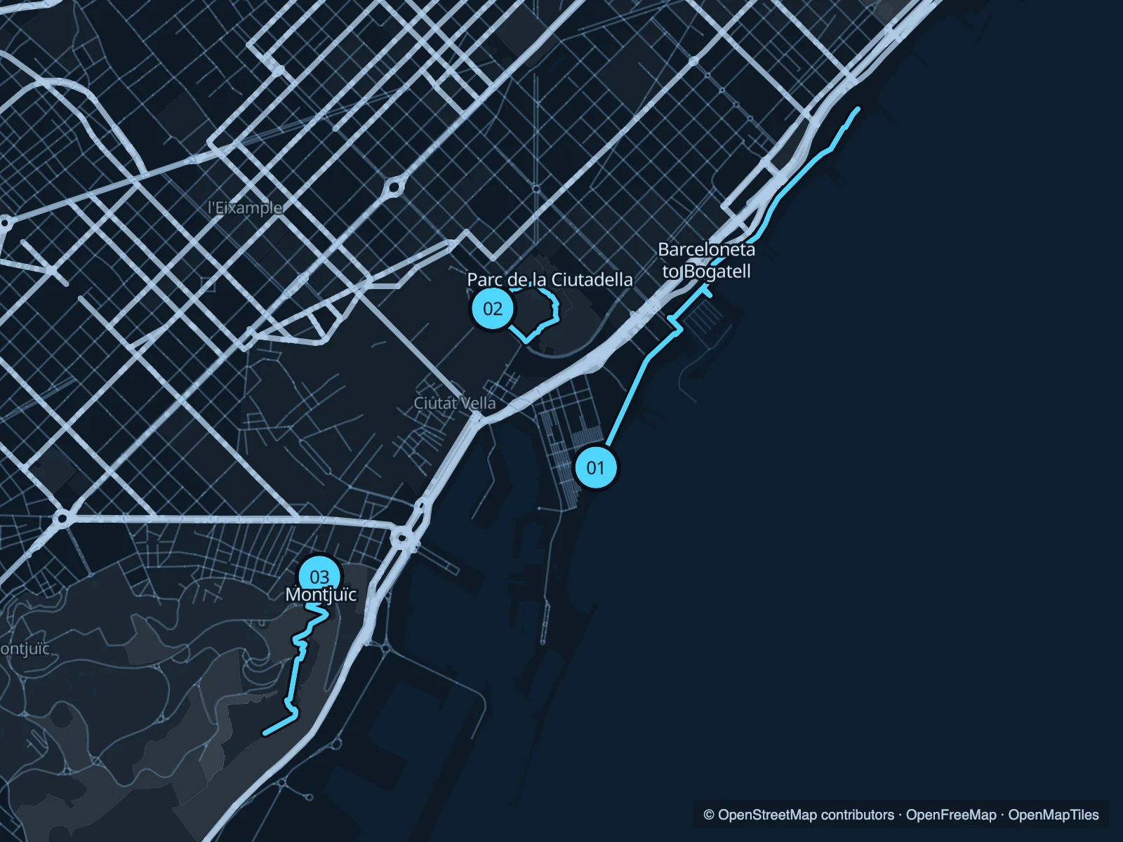
Barcelona’s beach promenade is the obvious place for a longer, mostly level run. Ciutadella offers a shorter park circuit near El Born. Montjuïc is the choice for a climb, with harbour views on the way up towards the castle.

Get running directions on your phone

Find a route near your hotel

The numbers mark each start. Distances exclude the journey from your accommodation.

Map data: © OpenStreetMap contributors · OpenFreeMap · OpenMapTiles

Where to run in Barcelona

Barceloneta to Bogatell

Follow the beaches northeast, with the sea beside you and plenty of places to turn back early.
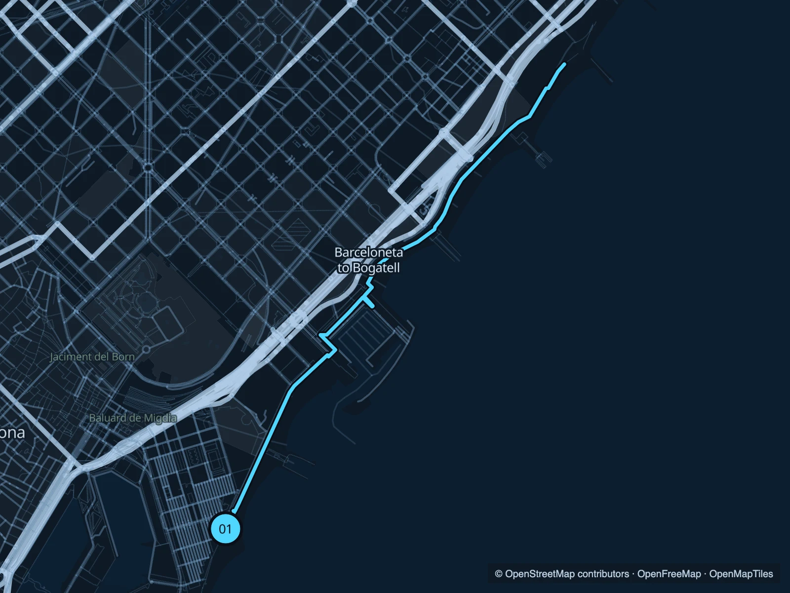
Map of the 6.6 km Barceloneta to Bogatell run, with start and finish marked 01.
01 Out & backOpen full-size map
Approx. distance6.6 km
Underfoot

Paved seafront promenade

01

Start here

On Passeig Marítim, beside the southern Barceloneta beach.

Follow the pedestrian promenade past Port Olímpic towards Bogatell, then return.

Getting there

Walk through Barceloneta from the metro to the beachfront.

Before you go

Expect walkers, bikes and beach traffic. Use pedestrian space and slow down at marina crossings.

Park / route information

Get running directions on your phone
Parc de la Ciutadella

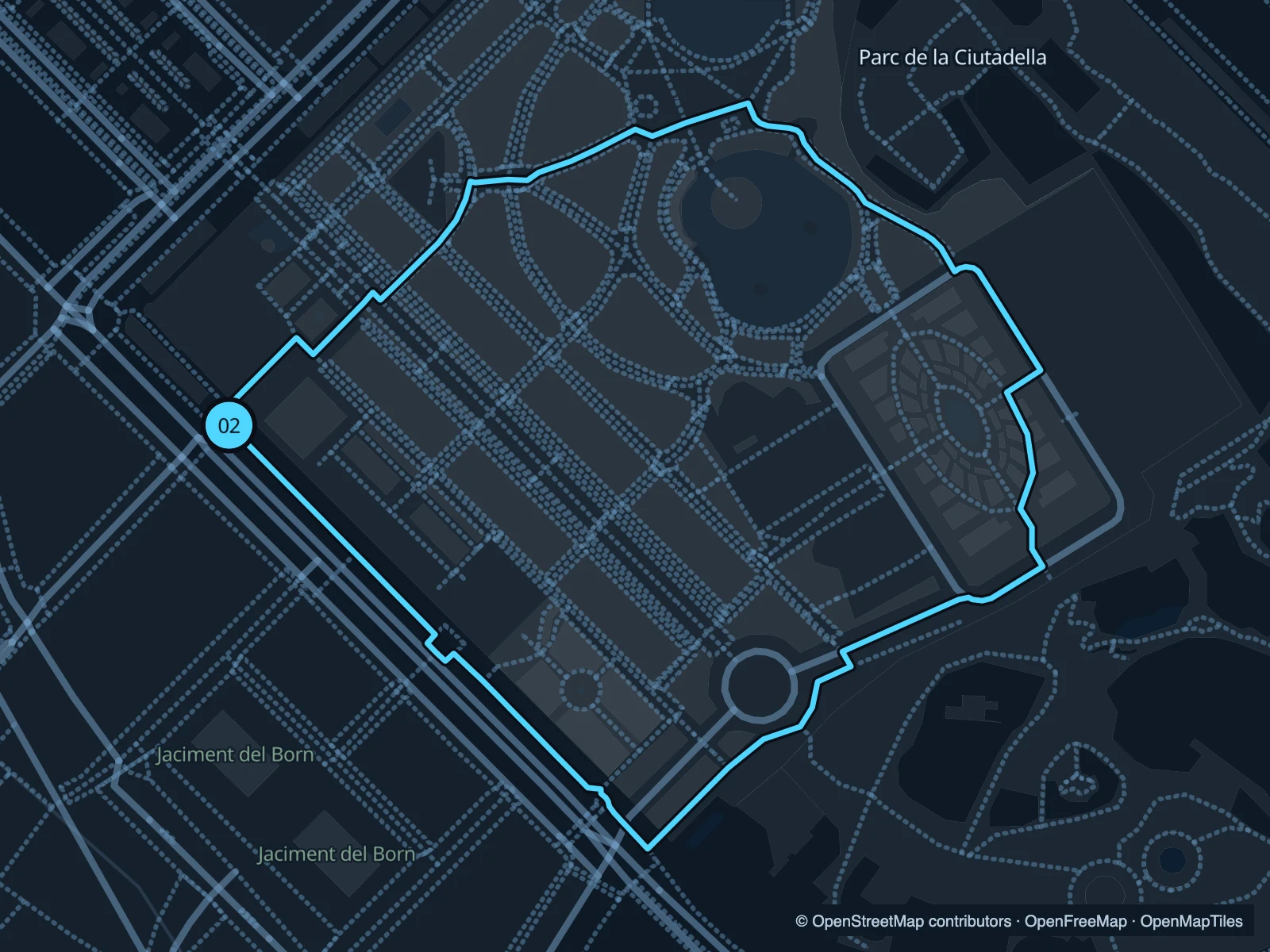
Garden paths and a short loop close to the old town. Repeat it if you want more distance without leaving the park.

Map of the 1.3 km Parc de la Ciutadella run, with start and finish marked 02.
02 LoopOpen full-size map
Approx. distance1.3 km
Underfoot

Paved and gravel park paths

02

Start here

Inside the park on the Passeig de Pujades side.

Loop through the garden paths around the central park, returning to the northern side.

Getting there

Approach from Arc de Triomf via Passeig de Lluís Companys.

Before you go

Keep the run within the public gardens. The zoo is a separate attraction. Check gate notices.

Park / route information

Get running directions on your phone

Montjuïc · Miramar to the castle

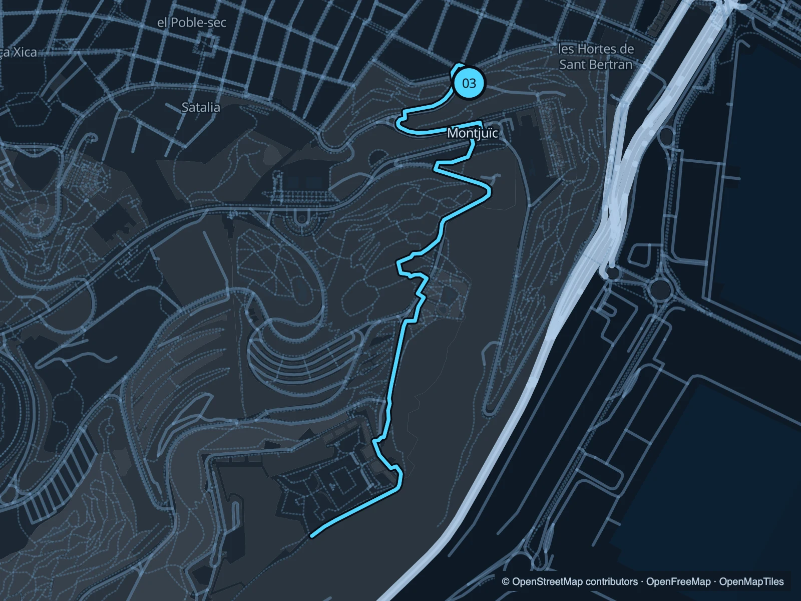
A run with a climb, using garden paths on the harbour side of Montjuïc. The turnaround is outside the castle grounds.

Map of the 4.0 km Montjuïc · Miramar to the castle run, with start and finish marked 03.
03 Out & backOpen full-size map
Approx. distance4.0 km
Underfoot

Mixed paths; slopes and possible steps

03

Start here

At the public Miramar viewpoint approach.

Climb through the garden paths towards the castle’s exterior, then descend along the same route.

Getting there

Walk uphill from Poble-sec or approach via the Montjuïc transport connections.

Before you go

Allow time for the descent and watch your footing. Castle admission is not part of this run.

Park / route information

Get running directions on your phone

Get running directions on your phone

Choose a distance and start at your hotel. RunFromHere plans a loop back to your door and guides you along it. Download the area’s map before you leave to use it offline.

The app generates its own routes from your chosen start; it doesn’t open the routes in this guide.

More places to run

Sources & route notes

Researched using the official visitor and park sources below; not checked on foot. Maps and GPX files use the same saved OpenStreetMap pedestrian paths. Distances are approximate. Check local notices for access, gate hours and diversions.

Researched