
Skip to routes
RunFromHere
Get the app
English
Illustrated panorama of Antalya in white linework.

Antalya

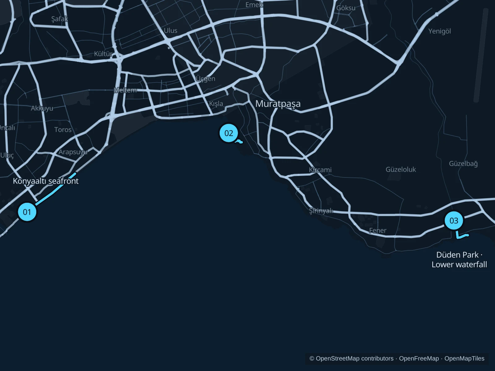
Antalya’s useful running areas are spread across the coast. Konyaaltı gives you a longer beach-side run, Karaalioğlu Park suits a short outing from Kaleiçi, and Lower Düden combines river paths and clifftop views near Lara. Choose the area closest to your accommodation rather than joining them along busy roads.

Get running directions on your phone

Find a route near your hotel

The numbers mark each start. Distances exclude the journey from your accommodation.

Map data: © OpenStreetMap contributors · OpenFreeMap · OpenMapTiles

Where to run in Antalya

Konyaaltı seafront

The longest option stays beside Konyaaltı’s pebble beach, away from the traffic on Akdeniz Bulvarı.
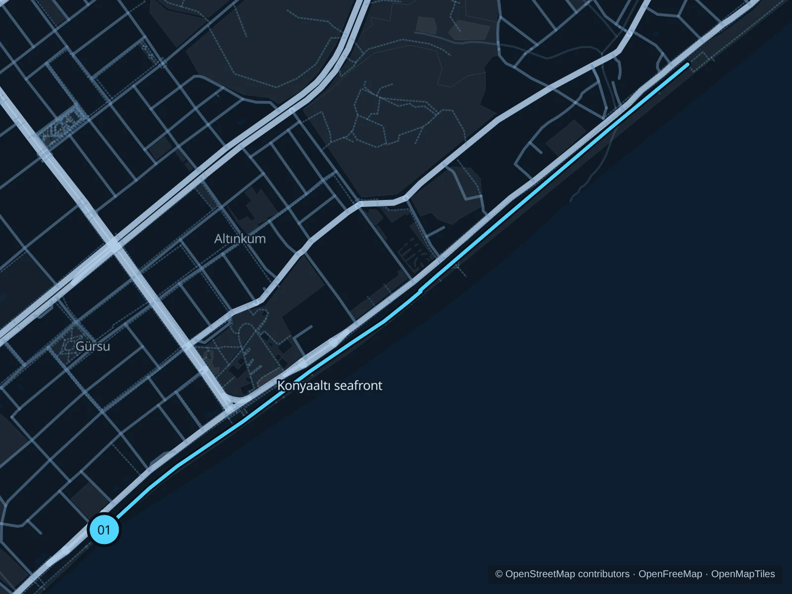
Map of the 3.8 km Konyaaltı seafront run, with start and finish marked 01.
01 Out & backOpen full-size map
Approx. distance3.8 km
Underfoot

Wooden pedestrian boardwalk

01

Start here

On the seafront boardwalk at Konyaaltı Kent Meydanı, below Belediye Caddesi.

Follow the wooden pedestrian boardwalk northeast, with the sea on your right, to the beach access below the Konyaaltı Akdeniz BLV-9 stop. Turn around at the boardwalk junction and return the same way.

Getting there

Use a city bus to the Akdeniz Bulvarı or Belediye Caddesi area, then cross at a marked crossing to the seafront.

Before you go

Keep off the separate cycle lane and give way at beach accesses. Wet boards can be slippery; this is an exposed coast run, so choose the cooler part of the day.

Park / route information

Get running directions on your phone
Karaalioğlu Park

A short garden run above the sea, close to the old town, with viewing terraces rather than a long beach promenade.

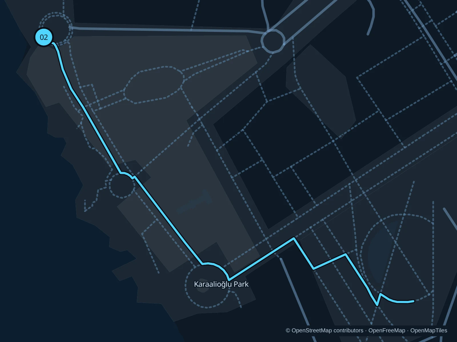
Map of the 1.3 km Karaalioğlu Park run, with start and finish marked 02.
02 Out & backOpen full-size map
Approx. distance1.3 km
Underfoot

Paved park paths and paving stones

02

Start here

At the public park terrace immediately southeast of Hıdırlık Tower; the route does not enter the tower.

Take the park paths southeast through the viewing terraces, then follow the 1308 Sokak pedestrian path into the eastern garden paths. Turn back at the eastern garden junction and return the same way.

Getting there

Walk from Kaleiçi or Işıklar Caddesi and enter through a public park entrance.

Before you go

Keep to the formed paths above the cliffs. Slow down at the viewpoints; event barriers or garden maintenance can shorten the run.

Park / route information

Get running directions on your phone

Düden Park · Lower waterfall

Riverside paths, a pedestrian bridge and clifftop viewpoints make this a compact park outing in the Lara area.

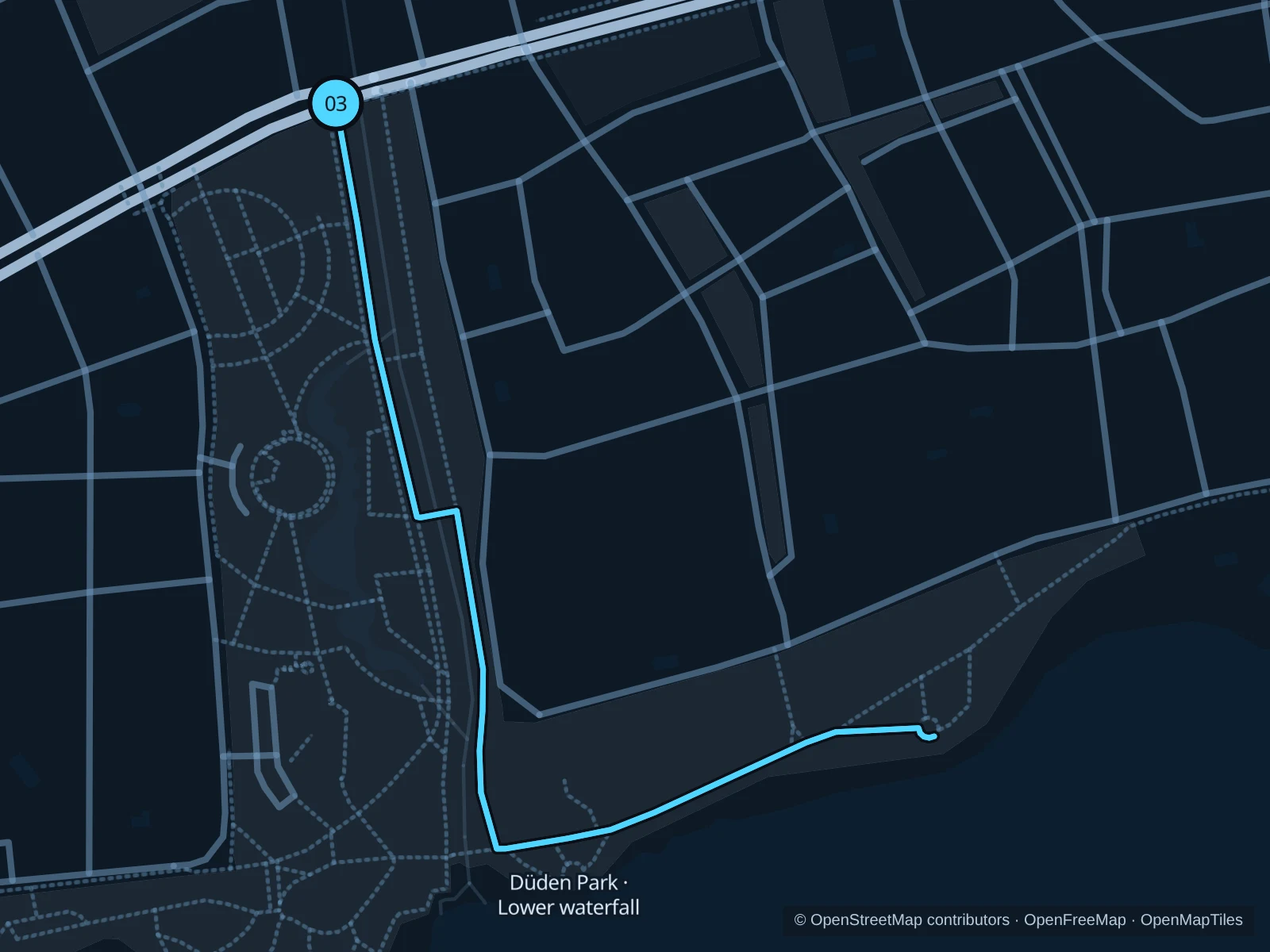
Map of the 1.8 km Düden Park · Lower waterfall run, with start and finish marked 03.
03 Out & backOpen full-size map
Approx. distance1.8 km
Underfoot

Paved park paths and a pedestrian bridge

03

Start here

At the western riverside entrance to Düden Park on Lara Caddesi, near the DÜDEN PARKI bus stops.

Follow the west-bank path downstream to the pedestrian bridge in the middle of the park. Cross to the east bank, follow the park paths down towards the waterfall and then east to the broad clifftop viewing area. Return by the same paths and bridge to the entrance.

Getting there

Take a city bus towards Düden Park in Çağlayan or arrange a taxi. Specify Aşağı Düden Şelalesi (Lower Düden) in Lara, not Yukarı Düden (Upper Düden) in Kepez.

Before you go

Stay behind barriers at the waterfall and cliffs; spray can wet the paving. Do not continue onto the rocks or treat this as a connection to Upper Düden.

Park / route information

Get running directions on your phone

Get running directions on your phone

Choose a distance and start at your hotel. RunFromHere plans a loop back to your door and guides you along it. Download the area’s map before you leave to use it offline.

The app generates its own routes from your chosen start; it doesn’t open the routes in this guide.

More places to run

Hayat Park

An inland alternative in Konyaaltı with designated running and walking paths. Check current opening hours if you plan an early start.

Park / route information

Atatürk Park

A separate clifftop park west of the old town, useful for a shorter outing near central hotels. Stay on upper park paths rather than taking stairs towards the sea.

Park / route information

Sources & route notes

Researched using the official visitor and park sources below; not checked on foot. Maps and GPX files use the same saved OpenStreetMap pedestrian paths. Distances are approximate. Check local notices for access, gate hours and diversions.

Researched