Skip to routes
RunFromHere
Get the app
English
Illustrated panorama of Abu Dhabi in white linework.

Abu Dhabi

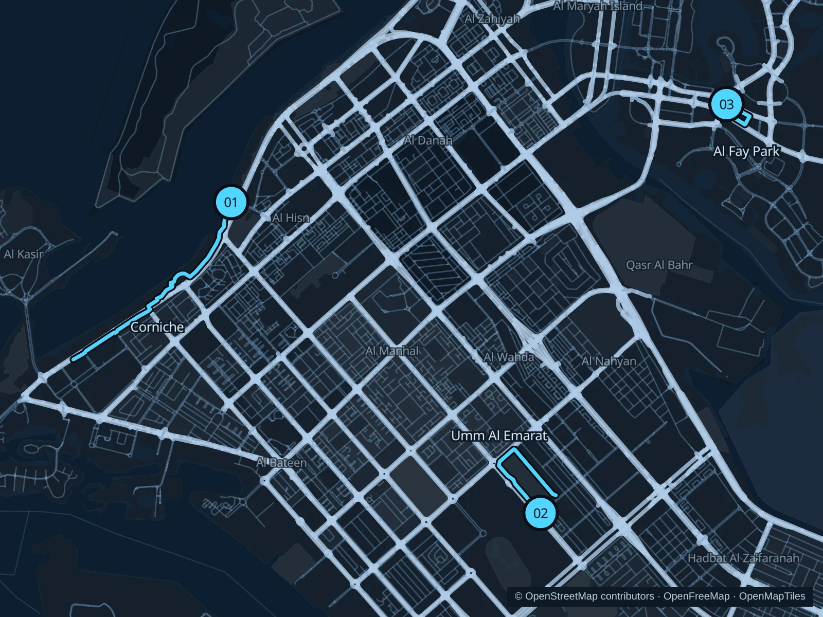
The Corniche is the longest run here, on waterfront pedestrian paths beside the Gulf. The external track at Umm Al Emarat Park is a separate neighborhood option, while Al Fay Park gives Reem Island a short, leafy loop. Plan around the heat: early mornings and the cooler months are more comfortable.

Get running directions on your phone

Find a route near your hotel

The numbers mark each start. Distances exclude the journey from your accommodation.

Map data: © OpenStreetMap contributors · OpenFreeMap · OpenMapTiles

Where to run in Abu Dhabi

Abu Dhabi Corniche

The longest run here, following public pedestrian paths along the Gulf past waterfront parks and beach areas, with the city behind you.
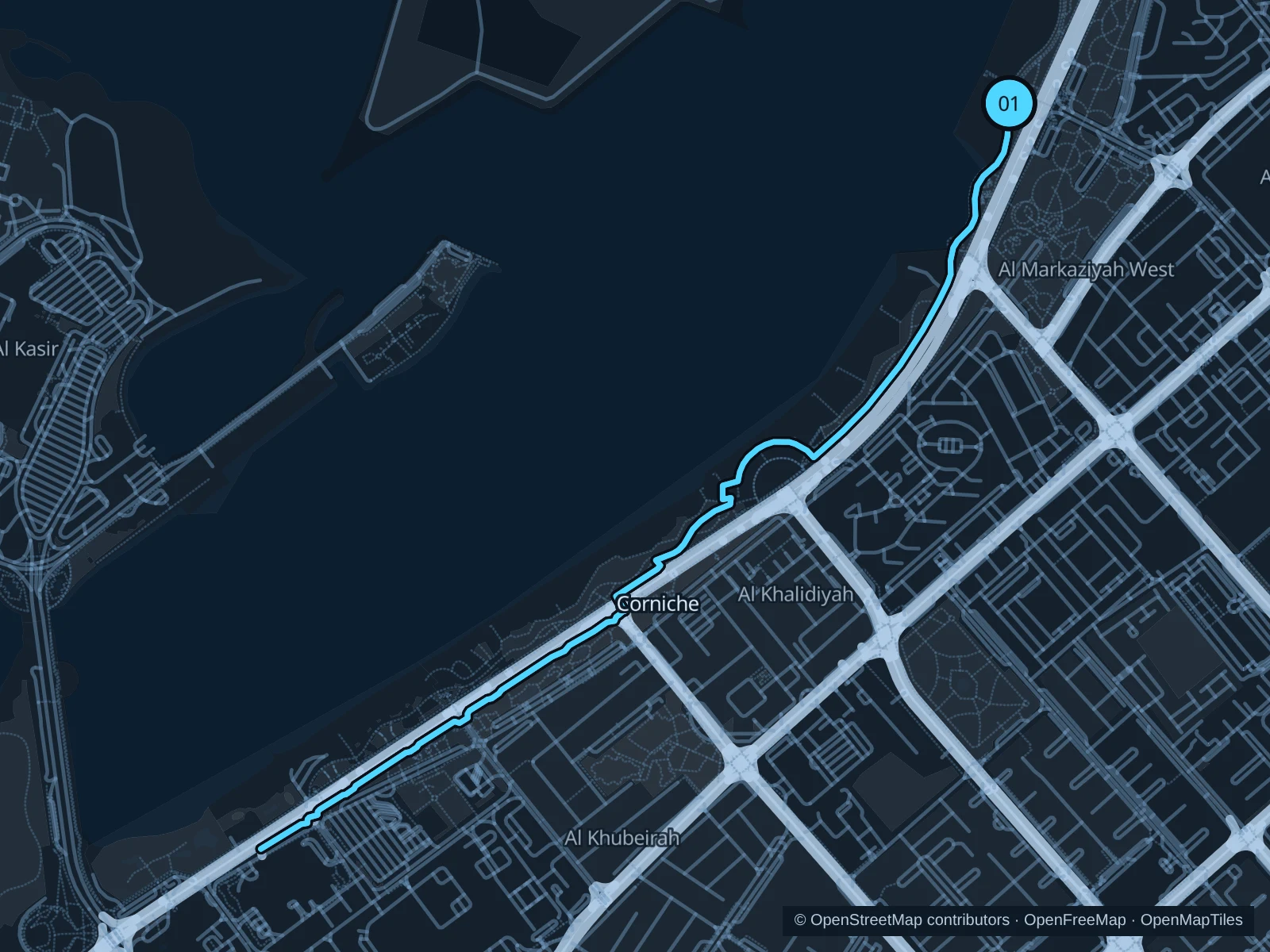
Map of the 6.0 km Abu Dhabi Corniche run, with start and finish marked 01.
01 Out & backOpen full-size map
Approx. distance6.0 km
Underfoot

Paved pedestrian promenade and connecting park paths

01

Start here

On the public Corniche path opposite Family Park, on the waterfront side of Corniche Road.

Follow the public pedestrian path southwest along the Corniche toward the western hotel area, then return along the same saved route.

Getting there

Use a city bus along Corniche Road, then reach the waterfront through a marked crossing or pedestrian underpass.

Before you go

Use the pedestrian side where bikes have a separate track. Beach clubs and gated beach sections have their own entry rules; stay on the public promenade and carry water.

Park / route information

Get running directions on your phone
Umm Al Emarat · external running track

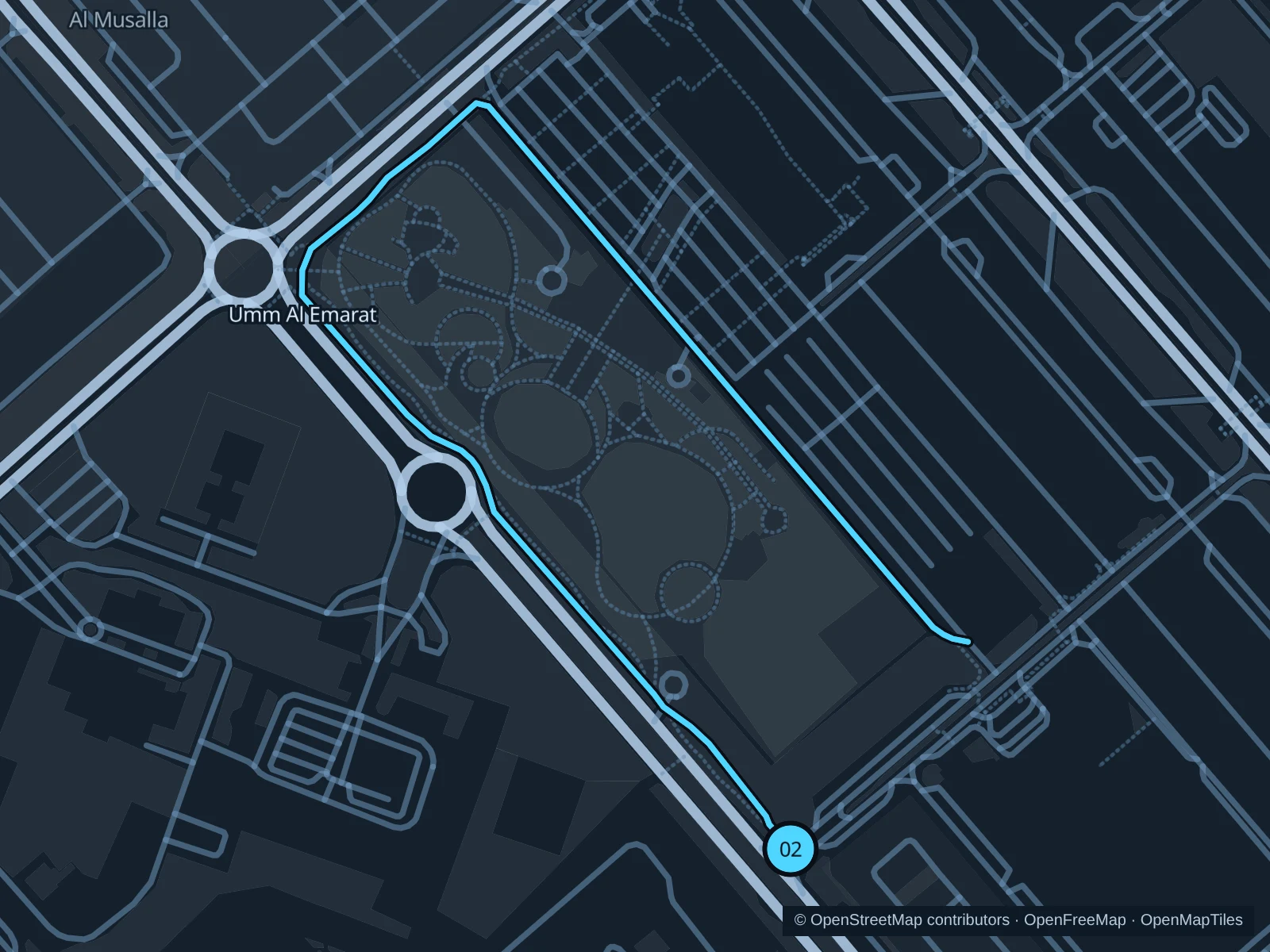
The external running track offers a neighborhood run along much of the park boundary, without entering the garden attractions.

Map of the 3.6 km Umm Al Emarat · external running track run, with start and finish marked 02.
02 Out & backOpen full-size map
Approx. distance3.6 km
Underfoot

Paved external running track

02

Start here

At the southeastern end of the external track beside Umm Al Emarat Park.

Follow the external running track around the western and northern park edges, then retrace it to the southeastern starting point.

Getting there

Take a bus or taxi to Umm Al Emarat Park in Al Mushrif and walk to the external track along the park’s southern side.

Before you go

The saved route is out and back. The gardens have ticketed entry and their own hours; stay on the external track, watch driveways and leave room for other runners.

Park / route information

Get running directions on your phone

Al Fay Park · two short laps

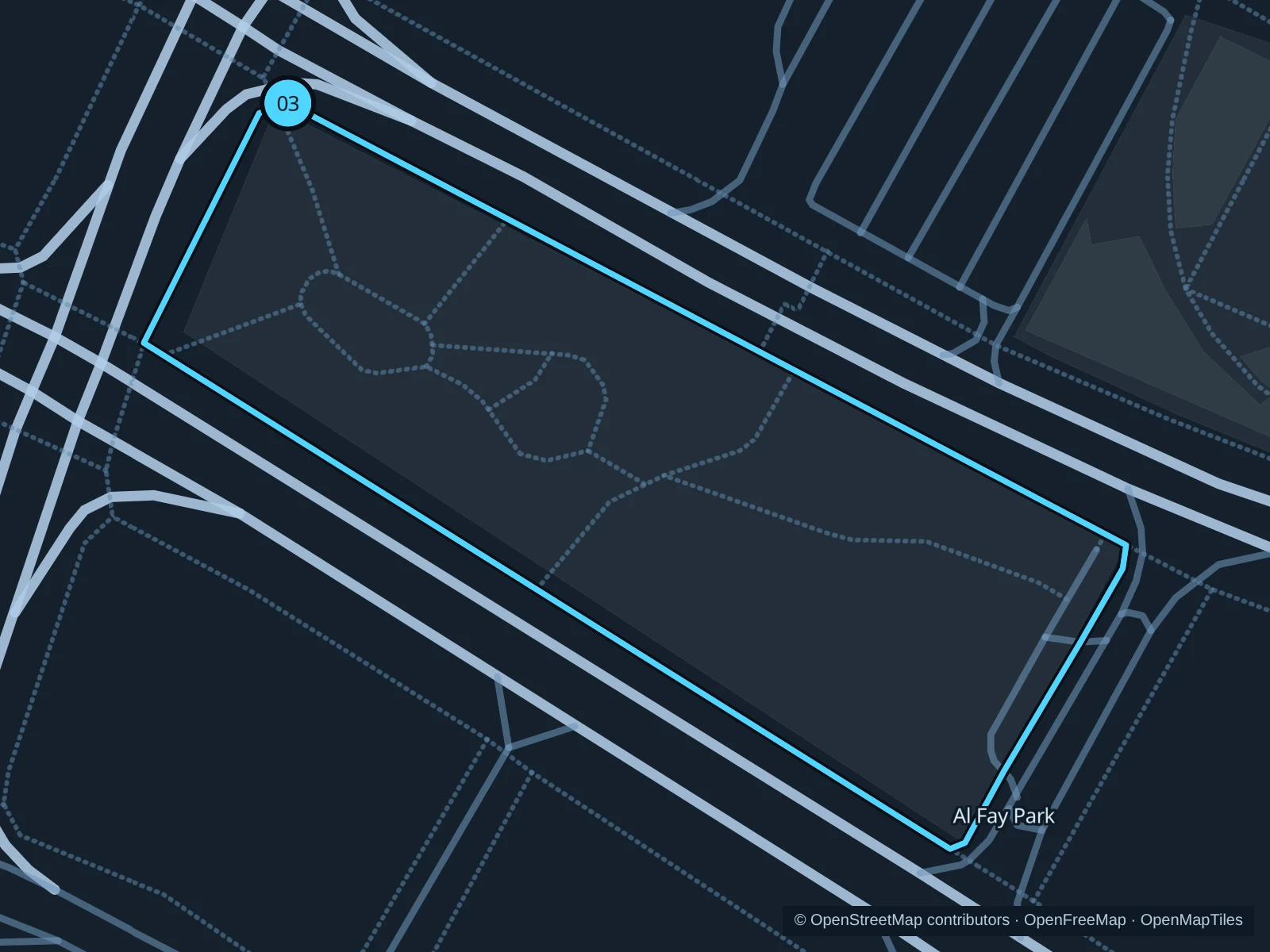
Two short perimeter laps around a densely planted neighborhood park. The saved distance includes both laps, making this the shortest route here.

Map of the 1.7 km Al Fay Park · two short laps run, with start and finish marked 03.
03 LoopOpen full-size map
Approx. distance1.7 km
Underfoot

Paved perimeter footpath

03

Start here

At the northern end of Al Fay Park’s public perimeter path.

Circle the park on the public perimeter path and repeat once, returning to the northern starting point.

Getting there

Take a bus or taxi to Al Fay Park on Reem Island and use the public park approach.

Before you go

This route stays outside the play and sports areas. Keep off the planted beds and follow posted gate signs; shade helps, but humid weather still calls for an easy pace.

Park / route information

Get running directions on your phone

Get running directions on your phone

Choose a distance and start at your hotel. RunFromHere plans a loop back to your door and guides you along it. Download the area’s map before you leave to use it offline.

The app generates its own routes from your chosen start; it doesn’t open the routes in this guide.

More places to run

Reem Central Park

Farther north on Reem Island, public running paths look toward the mangroves. Start at a signed park entrance and use the public waterfront rather than private residential decks.

Park / route information

Al Gurm Corniche

This separate promenade along the mangroves offers a change of scenery from the central Corniche. Plan your trip to a public entrance and follow pedestrian signs on the shared path.

Park / route information

Sources & route notes

Researched using the official visitor and park sources below; not checked on foot. Maps and GPX files use the same saved OpenStreetMap pedestrian paths. Distances are approximate. Check local notices for access, gate hours and diversions.

Researched